

- Usage in publication:
-
- Gene Autry shale
- Modifications:
-
- Original reference
- Dominant lithology:
-
- Shale
- AAPG geologic province:
-
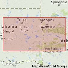
- South Oklahoma folded belt
Summary:
Pg. 70 (table 2), 99-101. Gene Autry shale. Uniformly soft clayey shale, gray to light gray, easily disintegrated in water; yellow-brown to red and maroon ferruginous concretions along bedding planes; contains one fossiliferous concretionary lentil, 2 or 3 feet thick, about 105 feet below what is considered top of formation. Thickness at type locality about 700 feet; dip almost vertical. Overlies Primrose sandstone; top is taken as base of concretionary fossiliferous lentil which is correlated with Jolliff formation. Fossiliferous (cephalopods, mollusks, pelecypods); includes pelecypod GIRTYANA HONESSI at top. Age is Pennsylvanian (Morrow).
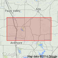
Type section: north and west of center of NW/4 sec. 34, T. 3 S., R. 4 E., Carter Co., south-central OK. Exposed in a series of ravines on both sides of Santa Fe RR track, about 2 mi north of town of Gene Autry (formerly Berwyn), in southern Arbuckle Mountains.
Source: US geologic names lexicon (USGS Bull. 1200, p. 1489); supplemental information from GNU records (USGS DDS-6; Denver GNULEX).
- Usage in publication:
-
- Gene Autry Member*
- Modifications:
-
- Revised
- Adopted
Summary:
Pg. A14-A15, A54, A56-A57 (fig. 5). Gene Autry Member of Golf Course Formation of Dornick Hills Group. Gene Autry Shale of Elias (1956) adopted as Gene Autry Member (reduced in rank) and assigned to Golf Course Formation of Dornick Hills Group. Overlies Primrose Sandstone Member of Golf Course; underlies Jolliff Member of Golf Course. Present in southern Arbuckle Mountains, south-central Oklahoma. Age is Early and Middle Pennsylvanian (Morrowan; late Namurian C and early Westphalian A of Europe); foram zone 20 and ammonoid zones BRANNEROCERAS BRANNERI and AXINOLOBUS MODULUS. [See also Mackenzie Gordon, Jr., and G.C. Stone, 1976, Arkansas Geol. Commission Symposium on the geology of the Ouachita Mountains, v. 1.]
Source: Publication.
For more information, please contact Nancy Stamm, Geologic Names Committee Secretary.
Asterisk (*) indicates published by U.S. Geological Survey authors.
"No current usage" (†) implies that a name has been abandoned or has fallen into disuse. Former usage and, if known, replacement name given in parentheses ( ).
Slash (/) indicates name conflicts with nomenclatural guidelines (CSN, 1933; ACSN, 1961, 1970; NACSN, 1983, 2005, 2021). May be explained within brackets ([ ]).