

- Usage in publication:
-
- Gaillard Formation
- Modifications:
-
- Named
- Dominant lithology:
-
- Sand
- Clay
- AAPG geologic province:
-
- South Georgia sedimentary province
Summary:
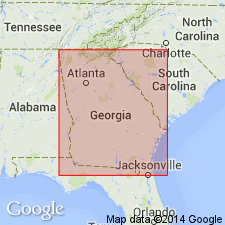
Gaillard Formation, introduced as an informal name by Hetrick (1990: Georgia Geologic Survey Geologic Atlas 7), is here formally proposed as part of the Oconee Group (new). The Oconee encompasses all pre-late Eocene kaolin and kaolinitic sands of fluvial origin in the Fort Valley plateau and Fall Line Hills districts of the GA Coastal Plain. The deposits assigned to the Gaillard were formerly included in the Lower Cretaceous of Veatch and Stephenson (1911), the Middendorf Formation of Smith (1929), and the Tuscaloosa Formation of Cooke (1936), among other units. The Buffalo Creek formation of Pickering and Hurst (1989) is revised as the Buffalo Creek Kaolin Member and is assigned to the upper part of the Gaillard. In addition to the type section in the Atlanta Sand and Supply Company pit at Gaillard, a reference section is designated in the railroad cut of the Central of Georgia RR in the western valley wall of the Ocmulgee River on the south side of Macon in Bibb Co., GA, 0.25 mi northeast of the Mead Road overpass. Occurs in outcrop from Butler, Taylor Co. to Washington Co, GA. It is traceable across western SC to Lexington Co. Unit consists of easily erodable sand and kaolin. The sand component, volumetrically the largest, ranges from fine to very coarse, with quartz of granule- to pebble-size. Bedding is prominent and cross-bedding is especially characteristic. Maximum known thickness is 93 m in the Georgia Geologic Survey core Houston 9 (GGS-3629). Only 18 m of the upper part of the formation are exposed at the type section. Disconformably underlies the lower Paleocene Marshallville Formation (new) or the Huber Formation and disconformably overlies the Pio Nono Formation (new), all of Oconee Group. Grades laterally westward into the Blufftown Formation and/or the Cusseta Sand in eastern Marion Co. Grades laterally eastward into the Middendorf Formation of SC. Stratigraphic position indicates that the Gaillard is correlative with the Mooreville and Demopolis Chalks of the Selma Group of AL and therefore the age is interpreted as late Santonian to Campanian (late Austinian to Tayloran).
Source: GNU records (USGS DDS-6; Reston GNULEX).
For more information, please contact Nancy Stamm, Geologic Names Committee Secretary.
Asterisk (*) indicates published by U.S. Geological Survey authors.
"No current usage" (†) implies that a name has been abandoned or has fallen into disuse. Former usage and, if known, replacement name given in parentheses ( ).
Slash (/) indicates name conflicts with nomenclatural guidelines (CSN, 1933; ACSN, 1961, 1970; NACSN, 1983, 2005, 2021). May be explained within brackets ([ ]).