- Usage in publication:
-
- Fryingpan Member*
- Modifications:
-
- Named
- Reference
- Dominant lithology:
-
- Sandstone
- Siltstone
- Breccia
- AAPG geologic province:
-
- Eagle basin
Summary:
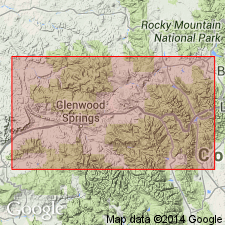
Named upper member of Maroon Formation for Fryingpan River, Eagle, Pitkin Cos, CO, Eagle basin. Type section composite: 1) lower part (84 m thick), north of Fryingpan River, 1350-1800 m west of Ruedi Reservoir, SW1/4 sec 12, NW1/4 sec 13, T8S, R85W; 2) upper part (39 m thick) in small quarry north of river, SE1/4 sec 11, T8S, R85W. Formerly called sandstone of Fryingpan River, basal unit overlying State Bridge Formation. Reference section 1360 cm thick in Dry Woody Creek, NE1/4 sec 34, T8S, R85W. Occurs over 80 sq km area adjacent to north flank, Sawatch uplift, north part Aspen sub-basin, Central Colorado trough. Consists resistant, cliff-forming, reddish-orange, well-sorted, round to well rounded, very fine to fine grained quartz (85 percent) sandstone, lesser amount siltstone, medium- to coarse-grained sandstone, breccia. Cross-bedded part eolian. Planar-laminated to massive part interdune. As eolian deposit, more closely related to Maroon than State Bridge; hence reassignment. Lower contact with Maroon concordant, abrupt, characterized by gentle low-angle, undulating relief; placed at change to massive to flatbedded siltstone, massive to very fine grained sandstone. Upper contact with State Bridge disconformable; local angularity of up to 60 deg; may represent significant hiatus. Derived from older parts Maroon or Schoolhouse Tongue of Weber Sandstone. Correlation chart. Early Permian age; may be as old as Pennsylvanian.
Source: GNU records (USGS DDS-6; Denver GNULEX).
For more information, please contact Nancy Stamm, Geologic Names Committee Secretary.
Asterisk (*) indicates published by U.S. Geological Survey authors.
"No current usage" (†) implies that a name has been abandoned or has fallen into disuse. Former usage and, if known, replacement name given in parentheses ( ).
Slash (/) indicates name conflicts with nomenclatural guidelines (CSN, 1933; ACSN, 1961, 1970; NACSN, 1983, 2005, 2021). May be explained within brackets ([ ]).

