- Usage in publication:
-
- Frolona Formation*
- Modifications:
-
- Named
- Dominant lithology:
-
- Schist
- Conglomerate
- Quartzite
- AAPG geologic province:
-
- Piedmont-Blue Ridge province
Summary:
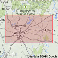
Pg. 127, pl. 1. Frolona Formation. The informal Frolona unit of Crawford and Medlin, 1974 (Georgia Geol. Survey Gdbk., no. 12), the oldest unit in the Austell-Frolona anticlinorium in the Bill Arp thrust sheet in Georgia, is here formally named the Frolona Formation, as defined by Crawford and Medlin, and is assigned to the Great Smoky Group of the Ocoee Supergroup in Georgia. Delineated on geologic map, in northeast-southwest trending belt, across parts of Heard and Carroll Counties, Georgia, into Randolph County, Alabama. Consists of the following rock types, interlayered (citing Crawford and Medlin, 1974, p. 9): graphitic staurolite-kyanite-garnet-feldspar-quartz-muscovite schist, nongraphitic mica schist, feldspathic micaceous quartzite, clean quartzite, and quartz-pebble metaconglomerate. The quartzites are fine- to coarse-grained, commonly feldspathic and micaceous. Layers of quartz-pebble metaconglomerate contain elongate pebbles as large as 8 x 20 mm in a quartz-feldspar-mica matrix. Overlies Grenville basement rocks; underlies Bill Arp Formation. Thickness approximately 5,000 feet (1,525 m). A composite type section is designated. Age is Late Proterozoic. Report includes generalized geologic tectonic map.
Composite type section: characteristic exposures along secondary roads south and southwest of the community of Frolona, and along Hillabahatchee Creek northeast of Frolona, Frolona 7.5-min quadrangle, Heard County, GA. Named from community of Frolona, Heard Co., GA (Crawford and Medlin, 1974).
Source: Publication; supplemental information from GNU records (USGS DDS-6; Reston GNULEX).

- Usage in publication:
-
- Frolona Formation*
- Modifications:
-
- Revised
- Age modified
- AAPG geologic province:
-
- Piedmont-Blue Ridge province
Summary:
Frolona Formation removed from Great Smoky Group and from Ocoee Supergroup. Frolona consists of graphitic to very graphitic schist with small kyanite crystals and fairly abundant, discontinuous clean quartzite lenses; less common, but important because they link Frolona to Corbin Metagranite (Allatoona Complex) basement and to Nantahala Formation, are discontinuous lenses of metaconglomerate that contain blue quartz granules/pebbles and microcline feldspar granules/pebbles and chips of dark graphitic schist. Frolona is part of the cover sequence and probably a higher metamorphic grade equivalent of Nantahala. Frolona also includes a new unnamed nongraphitic schist member consisting of nongraphitic schists with kyanite, scattered garnets, and lenses of metagraywacke. This unit can be separately mapped from rest of Frolona and future mapping may better define the unit. Age of Frolona is tentatively changed, in accordance with new age for Nantahala Formation, to Late Proterozoic to Middle Ordovician; age of Nantahala is based on containment of detritus from Middle(?) to Late Proterozoic Corbin Metagranite and fact that it is thrust over Middle Ordovician Rockmart Slate. Report includes geologic map and correlation chart.
Source: GNU records (USGS DDS-6; Reston GNULEX).
For more information, please contact Nancy Stamm, Geologic Names Committee Secretary.
Asterisk (*) indicates published by U.S. Geological Survey authors.
"No current usage" (†) implies that a name has been abandoned or has fallen into disuse. Former usage and, if known, replacement name given in parentheses ( ).
Slash (/) indicates name conflicts with nomenclatural guidelines (CSN, 1933; ACSN, 1961, 1970; NACSN, 1983, 2005, 2021). May be explained within brackets ([ ]).

