

- Usage in publication:
-
- Friendsville black shale
- Modifications:
-
- First used
- Dominant lithology:
-
- Shale
- AAPG geologic province:
-
- Appalachian basin
Summary:
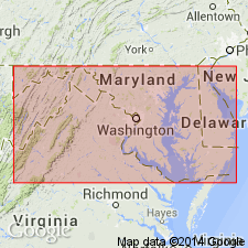
Pg. 574. Friendsville black shale in Conemaugh formation. Recognized in Garrett County, Maryland. Marine fauna (Cambridge?). Underlies Albright limestone and overlies Thomas coal; all included in Conemaugh formation.
Source: US geologic names lexicon (USGS Bull. 896, p. 781); supplemental information from GNU records (USGS DDS-6; Reston GNULEX).
- Usage in publication:
-
- Friendsville shale
- Modifications:
-
- Areal extent
- AAPG geologic province:
-
- Appalachian basin
Summary:
Pg. 60, pl. 7. Friendsville shale in Conemaugh formation. Present in western Maryland (Allegany and Garrett Counties). Thomas sandstone is found above Thomas coal at places in Upper Potomac basin, replacing Friendsville shale. [On pp. 95, 98, 100 he says Friendsville shale is same as Cambridge black shale.]
Source: US geologic names lexicon (USGS Bull. 896, p. 781).

- Usage in publication:
-
- Friendsville shale
- Modifications:
-
- Overview
- AAPG geologic province:
-
- Appalachian basin
Summary:
Unit is unranked marine shale in the middle of Conemaugh Formation. Equivalent to Woods Run limestone in PA and MD and Portersville limestone in OH. Occurs in western MD and adjacent PA.
Source: GNU records (USGS DDS-6; Reston GNULEX).
For more information, please contact Nancy Stamm, Geologic Names Committee Secretary.
Asterisk (*) indicates published by U.S. Geological Survey authors.
"No current usage" (†) implies that a name has been abandoned or has fallen into disuse. Former usage and, if known, replacement name given in parentheses ( ).
Slash (/) indicates name conflicts with nomenclatural guidelines (CSN, 1933; ACSN, 1961, 1970; NACSN, 1983, 2005, 2021). May be explained within brackets ([ ]).