

- Usage in publication:
-
- Fremont Canyon Sandstone*
- Modifications:
-
- Named
- Dominant lithology:
-
- Sandstone
- AAPG geologic province:
-
- Wind River basin
- Denver basin
- Powder River basin
Summary:
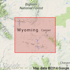
Named for Fremont Canyon, Natrona Co, WY in the Wind River basin. Type section measured from foot of south-facing nose in NE1/4 sec 21, T29N, R83W, on Fremont Canyon power plant road 2 mi west of intersection with Kortes Road. Intersection is 6.2 mi south of Alcova on WY Hwy 220. Identified also in measured sections in Converse Co in the Powder River basin and in Platte Co in the Denver basin. These rocks previously assigned to the Guernsey, Deadwood and Bighorn Formations. Composed of friable to indurated quartz-arenite that weathers white, gray, tan, orange, red, and pink. Current ripples and cross-bedding characterize most of the bedding. Cement is predominantly silica, but hematite and limonite are common as cementing materials. Basal beds are subarkosic quartz sandstone and sandy conglomerate. The conglomerate includes Precambrian granite in Laramie Range and Precambrian (Late Archean) granite or metamorphic rocks (including dolomite) of Whalen group in Hartville uplift. Ranges in thickness from 6 ft (1.8 m) in Hartville Canyon to 186 ft (56.7 m) at type. Unconformably overlies Precambrian granite or metamorphic rocks; underlies red siltstone of Englewood Formation. Assigned to the Late Devonian. Correlated with Parting Formation of central CO. Deposited in a marginal-marine and peritidal environment. Only fossils are linear ichnofossils on bedding planes.
Source: GNU records (USGS DDS-6; Denver GNULEX).
- Usage in publication:
-
- Fremont Canyon? Quartzite*
- Modifications:
-
- Areal extent
- AAPG geologic province:
-
- Green River basin
Summary:
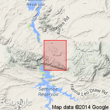
Is provisionally extended into the Seminoe Dam Northeast quad, north and south of the Seminoe Mountains in north-central Carbon Co, WY in Greater Green River basin. Is mapped undivided with Flathead? Quartzite (Middle Cambrian). Map unit consists of pale-red, grayish-red, and grayish-orange-pink, medium- to coarse-grained quartzite; basal part is commonly cross-bedded conglomerate, containing clasts as much as 3 cm long of quartz, quartzite, and dark-gray phyllite; about 85 m thick. [Although the lithic description is changed from sandstone (original definition of Fremont Canyon at type section) to quartzite in this map area, the change is not considered a formal redefinition due to questionable identification of the map unit. Probably the same unit mapped by R. W. Bayley (1968) as the Middle Cambrian Flathead Sandstone in the Bradley Peak quad, seven mi to west.] Age is Late Devonian.
Source: GNU records (USGS DDS-6; Denver GNULEX).
- Usage in publication:
-
- Fremont Canyon Sandstone
- Modifications:
-
- Not used
Summary:
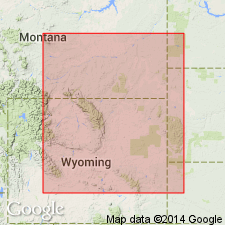
The basal sandstone unit that Sando, Sandberg (1987) named Fremont Canyon Sandstone can be traced southwest from its type section at Fremont Canyon, Natrona Co, WY, Wind River basin to Rawlins Hills, Carbon Co, WY, Greater Green River basin where the sandstone unit is the Flathead Sandstone. As the basal sandstone at the type Fremont Canyon is actually Flathead, name Fremont Canyon is not used. Also, the basal sandstone assigned by Sando, Sandberg to their Fremont Canyon in the northern Laramie Range, Natrona and Converse Cos and in the Hartville uplift area, Platte and Goshen Cos, WY is not the same basal sandstone unit that is present at Fremont Canyon; the basal sandstone unit in northern Laramie Range-Hartville uplift area is here assigned to the Mississippian basal clastic unit of author's stratigraphic sequence 5 (upper Meramecian and Chesterian).
Source: GNU records (USGS DDS-6; Denver GNULEX).
For more information, please contact Nancy Stamm, Geologic Names Committee Secretary.
Asterisk (*) indicates published by U.S. Geological Survey authors.
"No current usage" (†) implies that a name has been abandoned or has fallen into disuse. Former usage and, if known, replacement name given in parentheses ( ).
Slash (/) indicates name conflicts with nomenclatural guidelines (CSN, 1933; ACSN, 1961, 1970; NACSN, 1983, 2005, 2021). May be explained within brackets ([ ]).