

- Usage in publication:
-
- Freeport sandstone, limestone
- Modifications:
-
- Named
- Dominant lithology:
-
- Sandstone
- Limestone
- AAPG geologic province:
-
- Appalachian basin
Summary:
Freeport or contorted sandstone consists of massive sandstone, 15 to 60 ft thick, that underlies Lower Freeport coal and is separated from Kittanning coal by 75 ft of shale and sandstone. Freeport limestone is 4 to 7 ft thick; separated from overlying Upper Freeport coal by 1 to 10 ft of fire clay and shale and from underlying Lower Freeport coal by 30 to 40 ft of slate and slaty sandstone.
Source: GNU records (USGS DDS-6; Reston GNULEX).
- Usage in publication:
-
- Freeport limestone
- Modifications:
-
- Revised
- AAPG geologic province:
-
- Appalachian basin
Summary:
Freeport limestone lies between Middle Freeport coal and Lower Freeport coal.
Source: GNU records (USGS DDS-6; Reston GNULEX).
- Usage in publication:
-
- Freeport limestone
- Modifications:
-
- Revised
- AAPG geologic province:
-
- Appalachian basin
Summary:
The name Freeport limestone is applied to 0 to 4 ft of limestone lying 5 to 15 ft below Upper Freeport coal and 55 to 60 ft above Lower Freeport coal.
Source: GNU records (USGS DDS-6; Reston GNULEX).
- Usage in publication:
-
- Freeport limestone*
- Modifications:
-
- Revised
- AAPG geologic province:
-
- Appalachian basin
Summary:
Freeport limestone is 2 to 4 ft thick; separated from overlying Upper Freeport coal by 3 to 15 ft of fire clay and shale and from underlying Lower Freeport coal by 45 to 82 ft of beds including one unnamed coal.
Source: GNU records (USGS DDS-6; Reston GNULEX).
- Usage in publication:
-
- Freeport limestone
- Modifications:
-
- Revised
- AAPG geologic province:
-
- Appalachian basin
Summary:
In Cambria Co., the name Freeport limestone is applied to a limestone between Upper and Middle Freeport coals and the name Middle Freeport limestone is applied to a limestone between Lower and Middle Freeport coals. Author states that so-called Middle Freeport coal would probably in the future be called Lower Freeport coal, that so-called Middle Freeport limestone would be called Lower Freeport limestone, and that so-called Lower Freeport coal would be called Kittanning coal.
Source: GNU records (USGS DDS-6; Reston GNULEX).
- Usage in publication:
-
- Freeport limestone
- Modifications:
-
- Revised
- AAPG geologic province:
-
- Appalachian basin
Summary:
Changed Freeport limestone of previous reports to Upper Freeport limestone, Middle Freeport limestone to Lower Freeport limestone, Middle Freeport coal to Lower Freeport coal, and Lower Freeport coal to Upper Kittanning coal. These are names that have been in common use for many years.
Source: GNU records (USGS DDS-6; Reston GNULEX).
- Usage in publication:
-
- Freeport sandstone*
- Modifications:
-
- Revised
- AAPG geologic province:
-
- Appalachian basin
Summary:
Freeport sandstone is the same as Lower Freeport sandstone of earlier reports.
Source: GNU records (USGS DDS-6; Reston GNULEX).
- Usage in publication:
-
- Lower Freeport sandstone*
- Modifications:
-
- Revised
- AAPG geologic province:
-
- Appalachian basin
Summary:
Lower Freeport sandstone is same as Freeport sandstone of earlier reports. Present at Freeport, PA.
Source: GNU records (USGS DDS-6; Reston GNULEX).

- Usage in publication:
-
- Freeport formation
- Modifications:
-
- Revised
- AAPG geologic province:
-
- Appalachian basin
Summary:
Allegheny group of Pittsburgh series includes (ascending) Clarion, Kittanning, and Freeport formations. Freeport includes (ascending) Freeport sandstone, Freeport lower limestone, Freeport lower clay, Freeport lower or D coal, Butler sandstone, Bolivar flint clay, Freeport upper limestone, Freeport upper clay, Freeport Upper or E coal. Freeport underlies Mahoning formation.
Source: GNU records (USGS DDS-6; Reston GNULEX).
- Usage in publication:
-
- Freeport formation
- Modifications:
-
- Revised
- AAPG geologic province:
-
- Appalachian basin
Summary:
Freeport formation of Allegheny group used in Fayette Co. Lies below Lower Freeport coal and fire clay and above Upper Kittanning coal. Consists of brown, medium-grained, thin- to medium-bedded, locally cross-bedded, micaceous sandstone. Thickness is as much as 15 ft, exposed in roadcut 1 mi south of Indian Head. Two miles southwest of Markleysburg along State line, a massive sandstone bed crops out which appears to be about 80 to 100 ft below Upper Freeport coal.
Source: GNU records (USGS DDS-6; Reston GNULEX).
- Usage in publication:
-
- Freeport formation
- Modifications:
-
- Revised
- AAPG geologic province:
-
- Appalachian basin
Summary:
Allegheny group includes (ascending) Clarion, Kittanning, and Freeport formations. Freeport formation includes all rocks between top of Upper Freeport coal and top of Upper Kittanning coal. Includes (ascending) Freeport and Kittanning sandstones, Lower Freeport clay and limestone, Lower Freeport coal, Butler sandstone, Bolivar fire clay, Upper Freeport limestone, and Upper Freeport coal and clay.
Source: GNU records (USGS DDS-6; Reston GNULEX).
- Usage in publication:
-
- Freeport limestone
- Modifications:
-
- Overview
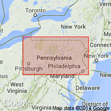
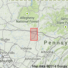
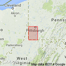
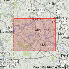
- Areal extent
- AAPG geologic province:
-
- Appalachian basin
Summary:
In Ohio, from 3 to 12 ft below base of Upper Freeport coal, there is an irregular bed of limestone which Rogers (1858) referred to as Freeport limestone in northwestern PA and which Newberry (1878) apparently described as White limestone in Mahoning Co., OH. In report on Lawrence Co., PA, White (1879) changed the name of the Butler limestone (which underlies Lower Freeport coal and which was not recognized by Rogers) to Lower Freeport limestone and changed the Freeport limestone of Rogers to Upper Freeport limestone. This terminology has been accepted in reports dealing with geology of coal measures in PA, WV, and OH.
Source: GNU records (USGS DDS-6; Reston GNULEX).
- Usage in publication:
-
- Freeport formation
- Modifications:
-
- Revised
- AAPG geologic province:
-
- Appalachian basin
Summary:
Freeport formation of Allegheny group includes (ascending) Lower Freeport sandstone, Lower Freeport coal, Butler sandstone, and Upper Freeport coal. Overlies Kittanning formation which contains Upper Kittanning coal at its top.
Source: GNU records (USGS DDS-6; Reston GNULEX).
- Usage in publication:
-
- Freeport Formation
- Modifications:
-
- Revised
- AAPG geologic province:
-
- Appalachian basin
Summary:
Freeport Formation in PA now includes strata from base of lower Freeport underclay to top of upper Freeport coal.
Source: GNU records (USGS DDS-6; Reston GNULEX).
- Usage in publication:
-
- Freeport Sandstone Member*
- Modifications:
-
- Revised
- AAPG geologic province:
-
- Appalachian basin
Summary:
In OH, Freeport Sandstone Member of Allegheny Formation is found in subsurface of OH [revised in subsurface of OH].
Source: GNU records (USGS DDS-6; Reston GNULEX).

- Usage in publication:
-
- Freeport Formation*
- Modifications:
-
- Revised
- Areal extent
- AAPG geologic province:
-
- Appalachian basin
Summary:
Freeport Formation is uppermost of three formations composing Allegheny group in PA. Extends from top of lower bench of Upper Kittaning coal group to top of Upper Freeport coal. [Use of the name Freeport is formal only in PA. Use as Freeport Sandstone Member is discontinued.]
Source: GNU records (USGS DDS-6; Reston GNULEX).
For more information, please contact Nancy Stamm, Geologic Names Committee Secretary.
Asterisk (*) indicates published by U.S. Geological Survey authors.
"No current usage" (†) implies that a name has been abandoned or has fallen into disuse. Former usage and, if known, replacement name given in parentheses ( ).
Slash (/) indicates name conflicts with nomenclatural guidelines (CSN, 1933; ACSN, 1961, 1970; NACSN, 1983, 2005, 2021). May be explained within brackets ([ ]).