


- Usage in publication:
-
- Fraileys shale
- Modifications:
-
- Named
- Dominant lithology:
-
- Shale
- AAPG geologic province:
-
- Illinois basin
Summary:
New name is needed for the "Golconda" as recognized east of Todd Co., KY, and north into IN. Fraileys shale is proposed for the middle "Golconda," that is, the interval between Haney limestone (new) and Beech Creek limestone, wherever [Big Clifty] sandstone is insignificant or absent. Unit consists largely of shale with minor amounts of limestone and mudstone. It is typically 70 to 90 ft thick in IL with extremes of about 45 to 140 ft. 94 ft thick at type locality.
Source: GNU records (USGS DDS-6; Reston GNULEX).
- Usage in publication:
-
- Fraileys Shale Member
- Modifications:
-
- Areal extent
- AAPG geologic province:
-
- Ozark uplift
Summary:
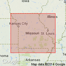
Unit has not been formerly recognized in MO. Constitutes middle portion of Golconda Formation, corresponding to Fraileys Shale of Golconda Group in IL. In MO, Golconda does not include sandstone interval called Big Clifty in IL. Underlies Haney Limestone Member and overlies Beech Creek Limestone Member.
Source: GNU records (USGS DDS-6; Reston GNULEX).
- Usage in publication:
-
- Fraileys Shale Member
- Modifications:
-
- Revised
- AAPG geologic province:
-
- Illinois basin
Summary:
Pg. 7; also Weibel and others, 1991, Illinois Geol. Survey Geol. Quad. Ser. IGQ-8. Fraileys Shale Member, middle member of Golconda Formation of Pope Group (all revised). Golconda, reduced to formation rank in this report, includes (ascending) Beech Creek Limestone Member, Fraileys Shale Member, and Haney Limestone Member (all reduced in rank). Beech Creek and Fraileys not exposed in Waltersburg quadrangle, Pope County, southeastern Illinois; only the Haney is exposed. Age is Late Mississippian (Chesterian).
Source: Publication.
For more information, please contact Nancy Stamm, Geologic Names Committee Secretary.
Asterisk (*) indicates published by U.S. Geological Survey authors.
"No current usage" (†) implies that a name has been abandoned or has fallen into disuse. Former usage and, if known, replacement name given in parentheses ( ).
Slash (/) indicates name conflicts with nomenclatural guidelines (CSN, 1933; ACSN, 1961, 1970; NACSN, 1983, 2005, 2021). May be explained within brackets ([ ]).