- Usage in publication:
-
- Four Corners Stage
- Modifications:
-
- Named
- AAPG geologic province:
-
- Paradox basin
- Black Mesa basin
- San Juan basin
Summary:
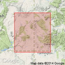
Named as a stage within Desmoinesian Series in Four Corners area (for which unit was probably named) of southeast UT, southwest CO, northwest NM, and northeast AZ, within Paradox, San Juan, and Black Mesa basins. Stage defined in Shell No. 1 Hovenweep well, sec 5, T40S, R26E, San Juan Co, UT within interval of approximately 5700-6950 ft (fig. 1). Barker Creek, Akah, and Desert Creek are in the upper part of the Paradox Formation of the Hermosa. Ismay lies at the base of Honaker Trail Formation of the Hermosa. Consists of four substages which are, in descending order, Ismay, Desert Creek, Akah, and Barker Creek Substages (all revised from informal subsurface pay zones to formal time-stratigraphic units). Stage is to be used locally in Four Corners area and replaces Cherokee and Marmaton "series" which are often used as subdivisions of Desmoinesian Series but are really rock-stratigraphic units. Substages are bounded by shales and are nearly time-equivalent across broad areas of Colorado Plateau. Within No. 1 Hovenweep well, Four Corners Stage includes parts of Paradox and overlying Honaker Trail Formations of Hermosa Group, however, rock-stratigraphic units within various substages varies across Colorado Plateau. No defined overlying or underlying stages. Fusulinids (listed) useful in identifying substages. Desmoinesian (Pennsylvanian) age.
Source: GNU records (USGS DDS-6; Denver GNULEX).
For more information, please contact Nancy Stamm, Geologic Names Committee Secretary.
Asterisk (*) indicates published by U.S. Geological Survey authors.
"No current usage" (†) implies that a name has been abandoned or has fallen into disuse. Former usage and, if known, replacement name given in parentheses ( ).
Slash (/) indicates name conflicts with nomenclatural guidelines (CSN, 1933; ACSN, 1961, 1970; NACSN, 1983, 2005, 2021). May be explained within brackets ([ ]).

