- Usage in publication:
-
- Fort Valley Group
- Modifications:
-
- Named
- Dominant lithology:
-
- Sand
- Clay
- AAPG geologic province:
-
- South Georgia sedimentary province
- South GA-North FL sedimentary province
Summary:
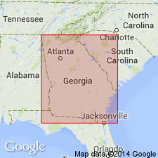
Name Fort Valley Group is introduced here for a group of kaolinitic, sandy formations of coastal marine origin that are concentrated in the Fort Valley plateau region of the updip central Coastal Plain of GA. Formations include (ascending) Nakomis Formation (new), Providence Sand, Marshallville Formation (new), Mossy Creek Sand (new) and Perry Sand (new). The Fort Valley Group is the coastal marine facies of the landward, fluvial Oconee Group (new). Offshore correlatives include the Ripley, Clayton, and Lisbon Formations. Consists mainly of sand and subordinate kaolin. Sand ranges in size from coarse and pebbly through fine to very fine and is prominently and intricately stratified. Bioturbation and burrows are characteristic. Thickness at the type locality is 25 m, but exposure includes only the Marshallville Formation and Mossy Creek Sand. Except for the Perry Sand, the Fort Valley is known to extend from eastern Taylor Co. in the west at least as far east as the Ocmulgee River. In the Chattahoochee River area and in AL, the Nakomis, Marshallville, and Perry Sand are absent. The Fort Valley disconformably overlies the Pio Nono Formation near the Fall Line, but southward overlies the Gaillard Formation, both of the Oconee Group. In Twiggs Co., the Mossy Creek Sand disconformably overlies the Marion Member of the Huber Formation. Farther west in GA, the Perry Sand disconformably overlies the Tuscahoma or Baker Hill Formations. For the most part, the Fort Valley occurs at the top of the stratigraphic section, but it is overlain locally by outliers of Barnwell Group. The age is interpreted by stratigraphic position and correlation of its formations with the Late Cretaceous Ripley Formation, the early Paleocene Clayton Formation, and the late middle Eocene Lisbon Formation.
Source: GNU records (USGS DDS-6; Reston GNULEX).
For more information, please contact Nancy Stamm, Geologic Names Committee Secretary.
Asterisk (*) indicates published by U.S. Geological Survey authors.
"No current usage" (†) implies that a name has been abandoned or has fallen into disuse. Former usage and, if known, replacement name given in parentheses ( ).
Slash (/) indicates name conflicts with nomenclatural guidelines (CSN, 1933; ACSN, 1961, 1970; NACSN, 1983, 2005, 2021). May be explained within brackets ([ ]).

