The National Geologic Map Database is migrating to a new infrastructure. We apologize for any service disruptions during this process.
|
|---|


- Usage in publication:
-
- Fort Union group*
- Modifications:
-
- Areal extent
- AAPG geologic province:
-
- Williston basin
Summary:
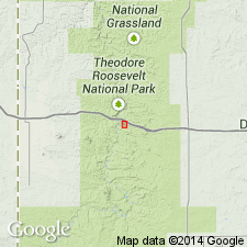
Occupies country near Fort Union near mouth of Yellowstone River near present town of Buford, Williams Co, ND in the Williston basin. [Buford was originally called Fort Union and later called Fort Buford.] Extends north into Canada, south to the Missouri River, and probably along east flank of mountains to Denver and perhaps farther in the Denver basin. Is part of the great lignite group. Assigned to the Tertiary.
Source: GNU records (USGS DDS-6; Denver GNULEX).
- Usage in publication:
-
- Fort Union formation
- Modifications:
-
- Contact revised
- AAPG geologic province:
-
- Williston basin
Summary:
Lower contact revised in that the lignite beds of the Fort Union? overlie newly named Hell Creek beds in the Missouri River area of Garfield Co, MT in Williston basin. The lignite beds are 100 ft thick and they increase in thickness to south. These beds are questionably assigned to the Fort Union; they include lignite, cross-bedded sandstone, layers of flattened chert pebbles which were probably formed on the floor of a shallow pond or in a bog; they are fossiliferous (shells, dinosaur bone fragment, crocodile, turtle--listed). The Fort Union proper above the lignite is: a buff, very fine grained sandstone, impure limestone, and micaceous shale unit. Leaf impressions (listed) identified in main part of Fort Union. Tertiary age. Graphic section.
Source: GNU records (USGS DDS-6; Denver GNULEX).
- Usage in publication:
-
- Fort Union formation*
- Modifications:
-
- Revised
- AAPG geologic province:
-
- Central Montana uplift
Summary:
Pg. 551-557, 652-659, 741-764 [See also M.G. Wilmarth, 1938, Geologic Names Committee remark]. Fort Union formation. In Crazy Mountains region, Montana, consists of massive sandstone and shales, with Lebo andesitic member (new) at base, the latter 450 to 2,200 feet thick and containing Fort Union (Eocene) fossils. Total thickness 4,000+ feet. Overlies Lance formation (new). Age is Tertiary. Report includes cross section.
Source: US geologic names lexicon (USGS Bull. 896, p. 762); supplemental information from GNU records (USGS DDS-6; Denver GNULEX).
- Usage in publication:
-
- Fort Union group
- Modifications:
-
- Revised
- AAPG geologic province:
-
- Central Montana uplift
Summary:
Fort Union group. In Crazy Mountain field, Montana, comprises Lebo formation below and Melville formation (new) above. Thickness about 6,350 feet. Overlies Bear formation (new). Age is Paleocene. Mammalian faunas described.
Source: US geologic names lexicon (USGS Bull. 1200, p. 1403-1405).
- Usage in publication:
-
- Fort Union formation*
- Modifications:
-
- Revised
- AAPG geologic province:
-
- Powder River basin
Summary:
Revised in that unit divided into (ascending) Tullock, Lebo shale, and Tongue River members in Weston Co, WY, Powder River basin. Thicknesses for members are: Tullock, 800 ft; Lebo, 500 ft; and Tongue River, 450 ft. Deep wells drilled in 1947 and 1948 provided for first time accurate thicknesses of Tullock and Lance formation (1650 ft). Overlies Lance; Fort Union is youngest unit exposed in study area. Columnar section. Paleocene age.
Source: GNU records (USGS DDS-6; Denver GNULEX).
- Usage in publication:
-
- Fort Union Formation*
- Modifications:
-
- Revised
- AAPG geologic province:
-
- Wind River basin
Summary:
Divides upper part of Fort Union Formation into Waltman Shale Member (new) and overlying Shotgun Member (new) in Fremont and Natrona Counties, Wyoming, Wind River basin. At Shotgun Butte section (secs. 21, and 26-28, T. 6 N., R. 1 E.) unit conformably overlies Lance Formation and conformably underlies Indian Meadows Formation. Age is Paleocene.
Source: GNU records (USGS DDS-6; Denver GNULEX).
- Usage in publication:
-
- Fort Union Formation*
- Modifications:
-
- Revised
- Age modified
- Reference
- Dominant lithology:
-
- Sandstone
- Siltstone
- AAPG geologic province:
-
- Central Montana uplift
Summary:
Pg. C37-C39 (table 4), C42-C43 (table 6), C44 (fig. 15), C51-C55, C97-C109, pls. 1, 2. Fort Union Formation. Nonmarine sequence of sandstone and conglomerate alternating with siltstone and mudstone, 6,615 feet thick (top of formation is eroded). Overlies Hoppers Formation of Livingston Group with apparent conformity; the conglomerates in the Livingston are composed almost entirely of Cretaceous volcanic rock, whereas the conglomerates in the Fort Union contain mostly igneous, metamorphic, and sedimentary rock fragments derived from rocks of Precambrian, Paleozoic, and Mesozoic age. In Livingston area [see pl. 2], the Fort Union is subdivided into: (1) lower conglomeratic sandstone member, 975 feet; (2) middle sandstone and mudstone member, 3,840 feet; and (3) upper conglomeratic sandstone member, 1,800 feet. [Fossils listed.] Age is Late Cretaceous ("Maestrichtian") to early Tertiary (Paleocene; Dragonian-Puercan to Clarkforkian NALMA). The lower member is assigned a Late Cretaceous age, based on plant microfossils (identified by E.B. Leopold and R.H. Tschudy, USGS), stratigraphic position. Reference section designated.
Reference section: measured north of Hoppers Station near abandoned townsite of Cokedale, [in area between Grassy and Canyon Mountains, Gallatin National Forest, Park County, Montana], in secs. 7, 16, 17, 21, 28, 32, and 33, T. 1 S., R. 8 E.; secs. 2, 3, 11, 12, 13, and 23, T. 2 S., R. 8 E.; and secs. 7, 18, 19, and 20, T. 2 S., R. 9 E., [from about Lat. 45 deg. 45 min. 49 sec. N., Long. 110 deg. 47 min. 11 sec. W. to Lat. 45 deg. 38 min. 50 sec. W., Long. 110 deg. 38 min. 32 sec. W., Grassy Mountain and Hoppers 7.5-min quadrangles, Gallatin National Forest], Park Co., MT.
Source: Publication.
- Usage in publication:
-
- Fort Union Formation*
- Modifications:
-
- Biostratigraphic dating
- AAPG geologic province:
-
- Piceance basin
Summary:
Biostratigraphic dating based on fossil pollen from USGS paleobotany locality D4629--about 350 ft above base of lower member of formation--indicates an early to middle Paleocene age. Locality D4633--about 320 ft below top of lower member--indicates a middle to late Paleocene age. Fossil localities are in Rio Blanco Co, CO in Piceance basin.
Source: GNU records (USGS DDS-6; Denver GNULEX).
- Usage in publication:
-
- Fort Union Group
- Modifications:
-
- Revised
- AAPG geologic province:
-
- Williston basin
Summary:
Tongue River Formation of Fort Union Group revised to include newly named Medora Member. Medora is a tabular sand body, 15 to 25 feet thick, lying 80 feet below top of Tongue River Formation at Medora, North Dakota. Area of report is in Billings, Slope, and Adams Counties, North Dakota, Willison basin.
Source: Modified from GNU records (USGS DDS-6; Denver GNULEX).
- Usage in publication:
-
- Fort Union Group
- Modifications:
-
- Revised
- AAPG geologic province:
-
- Williston basin
Summary:
Fort Union Group. In western North Dakota, divided into (descending): Sentinel Butte Formation; newly named Bullion Creek Formation [replaces Tongue River Formation of some geologists]; newly named Slope Formation, rocks previously included in upper part of Ludlow Formation; Cannonball Formation, generally absent in western North Dakota; and Ludlow Formation, restricted. Underlies Paleocene to Eocene Golden Valley Formation and overlies Cretaceous Hell Creek Formation. Age is Paleocene.
[See also entries under Bullion Creek, Slope, Ludlow, and Tongue River.]
Source: GNU records (USGS DDS-6; Denver GNULEX).
- Usage in publication:
-
- Fort Union Formation
- Modifications:
-
- Revised
- AAPG geologic province:
-
- Williston basin
Summary:
In western North Dakota (Williston basin), upper contact of the Paleocene Sentinel Butte Member of the Fort Union Formation is revised. Unconformably underlies the newly named Bear Den Member of Golden Valley Formation (called "lower member" in previous reports). Fort Union Formation distinguished from the Bear Den Member by its darker colors (dark gray, brown), abundance of lignite, rarity of kaolinite, abundant petrified wood, numerous siderite concretion zones, predominance of illite and montmorillonite, and in the northwest part of the area, the presence of extensive blue-gray bentonite beds. Age is Paleocene (early Clarkforkian, early Thanetian). On accompanying geologic map, Fort Union Formation (mapped undivided) is about 500 m thick. Report includes correlation chart, cross section, geologic map.
Source: Modified from GNU records (USGS DDS-6; Denver GNULEX).
- Usage in publication:
-
- Fort Union Formation*
- Modifications:
-
- Overview
- AAPG geologic province:
-
- Powder River basin
Summary:
Is formation in the Reno Junction-Antelope Creek area--Campbell, Converse, Niobrara, and Weston Cos, WY in the southern Powder River basin. The Fort Union comprises the Tullock and overlying Lebo Members. Tongue River Member is not used in this area. Lebo Member of study area is said to be equivalent to the Lebo and Tongue River Members of Fort Union in northern part of Powder River basin. Fort Union-Wasatch contact (tentatively interpreted as an unconformity) is shown on fence diagram and geologic map. Samples taken randomly across the unconformity proposed to mark the Fort Union-Wasatch contact have two distinct heavy mineral assemblages. Heavy minerals from rocks mapped as Fort Union contain abundant zircon and tourmaline; rocks assigned to Wasatch are rich in garnet, epidote, and biotite. Mapping shows that the contact between these two groups of rocks, each with its own diagnostic heavy mineral signature, changes stratigraphic position across the area more abruptly than can be explained readily by assumed facies changes. Contact lies on or close to top of Wyodak coal bed in most of the study area, but climbs to at least 200 ft above the Wyodak and Anderson coal beds in southeastern part of area. Age is Paleocene.
Source: GNU records (USGS DDS-6; Denver GNULEX).
- Usage in publication:
-
- Fort Union Formation*
- Modifications:
-
- Revised
- AAPG geologic province:
-
- Bighorn basin
Summary:
Fort Union Formation of the northern Bighorn basin, Montana, is a complex sequence of interbedded fluvial, lacustrine, and palustrine deposits. A probable lacustrine facies, well developed in center of basin, is here designated the Belfry Member. [Relationship of Belfry to overlying(?) and underlying(?) parts of Fort Union Formation not stated.] Age of Fort Union is Paleocene. Report includes petrologic and mineralogic descriptions of Belfry. Two sections (Cody Road and Silvertip) studied in detail.
Source: Modified from GNU records (USGS DDS-6; Denver GNULEX).
- Usage in publication:
-
- Fort Union Formation*
- Modifications:
-
- Areal extent
- AAPG geologic province:
-
- Williston basin
Summary:
In descending order, consists of Tongue River Member, Lebo Member and Tullock Member, in eastern Custer Co, MT in the Williston basin. In southern half of quadrangle (except for small area west of divide that separates Powder River from Mizpah Creek) Lebo and Tullock Members are undifferentiated and the name Ludlow Member is used. Gradational contact with underlying Hell Creek Formation and unconformably overlain by Quaternary surficial deposits. Is assigned to the Paleocene Epoch.
Source: GNU records (USGS DDS-6; Denver GNULEX).
- Usage in publication:
-
- Fort Union Formation*
- Modifications:
-
- Areal extent
- AAPG geologic province:
-
- Williston basin
Summary:
In descending order consists of Tongue River Member?, Lebo Member and Tullock Member, in eastern Custer Co, MT in the Williston basin. Throughout most of quadrangle (except for small area in northwest corner) Lebo and Tullock Members are undifferentiated and the name Ludlow member is used. Gradational contact with underlying Upper Cretaceous Hell Creek Formation and unconformably overlain by Quaternary surficial deposits. Is assigned to the Paleocene Epoch.
Source: GNU records (USGS DDS-6; Denver GNULEX).
- Usage in publication:
-
- Fort Union Formation*
- Modifications:
-
- Biostratigraphic dating
- AAPG geologic province:
-
- Powder River basin
Summary:
In northwestern Powder River basin, Big Horn County, Montana, the Fort Union Formation is divided into (ascending): Tullock, Lebo Shale, and Tongue River Members. Overlies Upper Cretaceous Hell Creek Formation. Underlies Eocene Wasatch Formation. Fossils collected from about 50 m above base of Tongue River Member, at Newell's Nook (USGS fossil locality D-2003), 48 km east of Hardin, Montana, indicate a late Paleocene (Tiffanian) age. This fossil-bearing horizon is at about same stratigraphic position as lowest coal bed in Tongue River; thus dating (faunally) initiation of major Paleocene coal accumulation in northwestern Powder River basin.
Source: Modified from GNU records (USGS DDS-6; Denver GNULEX).
- Usage in publication:
-
- Fort Union Formation*
- Modifications:
-
- Overview
- AAPG geologic province:
-
- Green River basin
Summary:
Contains Paleocene P3 to P5 palynomorph zones in Rock Springs uplift area, WY, Greater Green River basin. The lower Paleocene P1 and P2 zones are missing. Maestrichtian and part of Campanian also absent beneath Fort Union and underlying unit, the Campanian Almond Formation, suggesting a significant period of erosion prior to Fort Union time. No lithologic break observed between Fort Union and overlying Wasatch Formation. Both formations deposited in an alluvial environment. Fort Union more organic-rich with coal, carbonaceous shale and clastics that are usually gray to brown. The Wasatch is organic-poor with less coal and mostly green mudstone and clastics. Deposited on low-relief topography.
Source: GNU records (USGS DDS-6; Denver GNULEX).
- Usage in publication:
-
- Fort Union Formation*
- Modifications:
-
- Revised
- AAPG geologic province:
-
- Green River basin
Summary:
Lower boundary is placed at top of upper zone of underlying unnamed Cretaceous and Tertiary sandstone unit in area along eastern flank of Washakie basin and southeastern flank of Great Divide basin, Carbon and Sweetwater Cos, WY in Greater Green River basin. North of Dad arch, sandstones of upper zone of unnamed Cretaceous and Tertiary sandstone unit split into thinner sandstone bodies with interbedded shale and coal lithologies equivalent to basal part of Fort Union. An unconformity at base of upper zone of unnamed sandstone unit marks Cretaceous-Tertiary boundary. Palynological samples indicate latest Maastrichtian and earliest Paleocene are missing, rocks below unconformity are Late Cretaceous (Maastrichtian) age, and rocks above unconformity are early Paleocene age. Previous surface and subsurface studies by other workers have placed Cretaceous-Tertiary boundary and contact between Lance and Fort Union at various stratigraphic positions as defined in this report. Upper boundary of Fort Union placed at base of basal sandstone zone of the overlying unnamed upper Paleocene unit. Previous surface studies by other workers have placed unnamed Paleocene unit in upper part of Fort Union. Geologic map. Measured sections. Correlation diagram. Fossil list. Early Paleocene age based on palynomorphs.
Source: GNU records (USGS DDS-6; Denver GNULEX).
- Usage in publication:
-
- Fort Union Formation*
- Modifications:
-
- Revised
- AAPG geologic province:
-
- Powder River basin
Summary:
Is formation mapped in Johnson, Sheridan, and Campbell Cos, WY and Big Horn and Powder River Cos, MT in Powder River basin. Tullock, Lebo, and Tongue River Members mapped together in southwestern part of quadrangle. Disconformably overlies Upper Cretaceous Lance Formation; unconformably underlies Wasatch Formation (revised). Fort Union is distinguished from the Wasatch on basis of 1) sandstone is finer grained and better sorted than that of Wasatch, 2) varies from light gray to somber shades of gray, while Wasatch characteristically weathers buff to tan, 3) brown-weathering, calcareous, iron-rich, cauliflower shaped concretions (less than an inch to as large as 4 ft) are most common in the Fort Union, and are generally absent from the Wasatch, 4) dominant heavy minerals in the Fort Union (Lebo and Tongue River) are tourmaline and a pinkish-violet variety of zircon in contrast to sphene, epidote, and garnet in the Wasatch, and 5) minor accessory minerals in the Fort Union are chloritoid, staurolite, and rutile compared to apatite, epidote, and biotite in the Wasatch. For purposes of this map (and others in same series) the upper contact of the Fort Union is revised downward 200-300 ft from that of most previous workers in the basin. Strata below the top of Baker's (1929) Roland coal bed are referred to as lower part of Wasatch instead of upper part of Fort Union. Thickness ranges 2,700-6,100 ft in quadrangle. Paleocene age given.
Source: GNU records (USGS DDS-6; Denver GNULEX).
- Usage in publication:
-
- Fort Union Formation*
- Modifications:
-
- Biostratigraphic dating
- AAPG geologic province:
-
- Piceance basin
Summary:
Biostratigraphic dating based on fossil palynomorphs from USGS paleobotany locality D4631--65 ft above base of upper member of formation--indicates a late Paleocene age. Fossil palynomorphs from locality D4632--50 ft below top of upper member--indicate a late Paleocene age. Fossil pollen and spores from locality D4637--about 150 ft below top of upper member--indicate a late Paleocene age. Fossil list. Fossil localities are in Rio Blanco Co, CO in Piceance basin. Same author in previous studies (GQ-1131, 1973 and GQ-1195, 1974) assigned same age as above to upper member; however, fossils not listed.
Source: GNU records (USGS DDS-6; Denver GNULEX).
- Usage in publication:
-
- Fort Union Formation*
- Modifications:
-
- Overview
- Areal extent
- AAPG geologic province:
-
- Powder River basin
Summary:
Is formation in Piney Canyon SE quad, Campbell Co, WY in southeastern Powder River basin. Consists of (ascending) Tullock Member, Lebo Shale Member, and Tongue River Member. Denson and others (1980) recognized only the Tullock and Lebo Shale Members in this area. Sandy, coal-bearing upper part of Fort Union in this area is here considered correlative with the Tongue River of adjacent areas. Detailed lithologic descriptions and columnar sections presented for 298-646 ft of Tongue River present below the clinker bed of the upper Wyodak coal bed in this area. Age is Paleocene.
Source: GNU records (USGS DDS-6; Denver GNULEX).
- Usage in publication:
-
- Fort Union Formation*
- Modifications:
-
- Age modified
- AAPG geologic province:
-
- Williston basin
Summary:
Locally in the Williston basin, the lowest part of the Fort Union Formation is of Late Cretaceous age. At Pyramid Butte near Marmarth, Slope County, North Dakota, palynology and the iridium anomaly data indicate the Cretaceous-Tertiary (Maastrichtian-Paleocene) boundary is near the base of the the Fort Union Formation, just above the top of the basal coal. Dinosaur bones occur in the underlying Hell Creek Formation 1 m below the coal. In the Hell Creek area, Garfield County, Montana, the Cretaceous-Tertiary boundary occurs at the bottom of the basal coal. At other localities the boundary is 11 m below the coal, in the underlying Hell Creek Formation.
Source: Modified from GNU records (USGS DDS-6; Denver GNULEX).
- Usage in publication:
-
- Fort Union Formation*
- Modifications:
-
- Biostratigraphic dating
- AAPG geologic province:
-
- Bighorn basin
Summary:
Lower part of Fort Union in area of Grass Creek coal mine and on Red Ridge, Hot Springs Co, WY, Bighorn basin, are within biozones P2 (upper lower Paleocene) and P3 (lower middle Paleocene) (D.J. Nichols, personal commun., 1994). Stratigraphic column. Overlies Lance Formation overlies; underlies Willwood Formation.
Source: GNU records (USGS DDS-6; Denver GNULEX).
- Usage in publication:
-
- Fort Union Formation*
- Modifications:
-
- Revised
- Dominant lithology:
-
- Sandstone
- Siltstone
- Mudstone
- AAPG geologic province:
-
- Green River basin
Summary:
Pg. 3-7, sheet 1 (figs. 1-3, geol. map), sheet 2. Fort Union Formation. Present in Washakie, Sand Wash, and Great Divide basins, Carbon County, southernmost Wyoming, and Moffat County, northwesternmost Colorado. Divided into (ascending) China Butte, Blue Gap, and Overland Members (all new). Unconformably overlies Red Rim Member (new) of Lance Formation; conglomerate at base of Chine Butte marks regional unconformity separating Tertiary from Cretaceous age rocks. Unconformably underlies Wasatch Formation. Age is Paleocene. Report includes geologic map, measured sections, correlation chart, cross sections.
Source: Publication.
For more information, please contact Nancy Stamm, Geologic Names Committee Secretary.
Asterisk (*) indicates published by U.S. Geological Survey authors.
"No current usage" (†) implies that a name has been abandoned or has fallen into disuse. Former usage and, if known, replacement name given in parentheses ( ).
Slash (/) indicates name conflicts with nomenclatural guidelines (CSN, 1933; ACSN, 1961, 1970; NACSN, 1983, 2005, 2021). May be explained within brackets ([ ]).