The National Geologic Map Database is migrating to a new infrastructure. We apologize for any service disruptions during this process.
|
|---|


- Usage in publication:
-
- Fort Riley limestone
- Modifications:
-
- Original reference
- AAPG geologic province:
-
- Nemaha anticline
Summary:
Pg. 14. Fort Riley limestone. Thick-bedded buff porous magnesium limestone, 8 to 10 feet thick, forming bed No. 52 of geologic section of eastern Kansas. Fossiliferous. Included in Lower Permian. Locality near Fort Riley, Cottonwood and Fancy Creek.
Named from Fort Riley, Geary Co., eastern KS.
Source: Publication; US geologic names lexicon (USGS Bull. 896, p. 758).
- Usage in publication:
-
- Fort Riley limestone*
- Modifications:
-
- Overview
- AAPG geologic province:
-
- Nemaha anticline
Summary:
Pg. 771-786, 798. Florence limestone (or Fort Riley limestone). [See 1st entry under †Florence limestone.]
Named from Fort Riley, Geary Co., KS.
Source: US geologic names lexicon (USGS Bull. 896, p. 758); GNC KS-NE Permian Corr. Chart, Oct. 1936).
- Usage in publication:
-
- Fort Riley limestone
- Modifications:
-
- Revised
- AAPG geologic province:
-
- Nemaha anticline
Summary:
Redefined Fort Riley limestone as explained in 1902 entry under †Florence limestone. [See also GNC remark under †Florence limestone.]
Source: US geologic names lexicon (USGS Bull. 896, p. 758); GNC KS-NE Permian Corr. Chart, Oct. 1936).

- Usage in publication:
-
- Fort Riley limestone member
- Modifications:
-
- Revised
- AAPG geologic province:
-
- Nemaha anticline
Summary:
Pg. 41. Fort Riley limestone. Top member of Barneston formation (new) of Chase group. Thickness 27 feet. Overlies Florence flint member of Barneston; underlies Doyle formation of Chase group. Recognized in southeastern Nebraska and eastern Kansas. Age is Permian (Big Blue).
Source: US geologic names lexicon (USGS Bull. 1200, p. 1399); GNC KS-NE Permian Corr. Chart, Oct. 1936.
- Usage in publication:
-
- Fort Riley limestone member
- Modifications:
-
- Revised
- AAPG geologic province:
-
- Nemaha anticline
Summary:
Pg. 12 (fig. 4), 69 (45). Fort Riley limestone member restricted of Barneston limestone of Chase group. Restricted Fort Riley limestone. Overlies Oketo shale member (new). [See also GNC remark under †Florence limestone.]
This resticted definition as not been considered by the USGS for its publications [ca. 1938].
Source: US geologic names lexicons (USGS Bull. 896, p. 758; USGS Bull. 1200, p. 1399); GNC KS-NE Permian Corr. Chart, Oct. 1936).

- Usage in publication:
-
- Fort Riley limestone*
- Modifications:
-
- Overview
Summary:
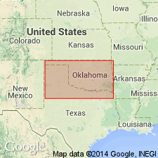
Fort Riley limestone of Chase group adopted by the USGS [ca. 1938]. Recognized in eastern Kansas, central northern Oklahoma, and southeastern Nebraska. Age is Permian.
Source: US geologic names lexicon (USGS Bull. 896, p. 758); GNC KS-NE Permian Corr. Chart, Oct. 1936).

- Usage in publication:
-
- Fort Riley limestone
- Modifications:
-
- Overview
Summary:
Pg. 44-45. Fort Riley limestone member of Barneston limestone of Chase group. Limestone, light-gray and tan, massive and thin-bedded, with minor amount of gray shale. Basal part contains thin, more or less shaly beds that are overlain by massive "rim rock," which contains fossil algae; thin shaly beds and locally clay shale deposits occur in middle part; upper strata rather massive but less so than the "rim rock." Thickness 30 to 45 feet. Underlies Holmesville shale member of Doyle shale. Age is Early Permian (Wolfcamp).
Source: US geologic names lexicons (USGS Bull. 896, p. 758; USGS Bull. 1200, p. 1399).
- Usage in publication:
-
- Fort Riley limestone*
- Modifications:
-
- Mapped 1:500k
Summary:
Mapped as Fort Riley limestone in Chase group. Age is Permian.
Source: US geologic names lexicons (USGS Bull. 896, p. 758; USGS Bull. 1200, p. 1399).
- Usage in publication:
-
- Fort Riley limestone member*
- Modifications:
-
- Areal extent
- AAPG geologic province:
-
- Chautauqua platform
Summary:
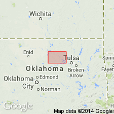
Pg. 111-114. Fort Riley limestone of Chase group. In Kay County, central northern Oklahoma, consists of about 31 feet of soft light-gray to buff limestone with massive algal bed more than 10 feet thick occurring locally in lower part. Overlies Matfield shale; underlies Doyle shale. Age is Early Permian (Wolfcampian).
Source: Modified from US geologic names lexicons (USGS Bull. 896, p. 758; USGS Bull. 1200, p. 1399).
- Usage in publication:
-
- Fort Riley Limestone
- Modifications:
-
- Areal extent
- Age modified
- AAPG geologic province:
-
- Chautauqua platform
Summary:
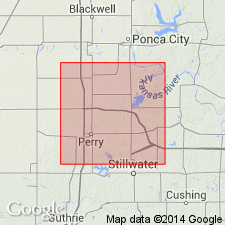
Pg. 6 (fig. 3), 8 (fig. 4), 10, App. Fort Riley Limestone of Oscar Group. Described from Noble County, central northern Oklahoma. Overlies Matfield shale and underlies Doyle Shale; all included in Oscar Group. Age is latest Pennsylvanian (Gearyan), based on fossil data (see Branson, 1962; Wilson and Rashid [abs.], 1971; Clendening [abs.], 1971); previously considered earliest Permian.
Source: Publication.
For more information, please contact Nancy Stamm, Geologic Names Committee Secretary.
Asterisk (*) indicates published by U.S. Geological Survey authors.
"No current usage" (†) implies that a name has been abandoned or has fallen into disuse. Former usage and, if known, replacement name given in parentheses ( ).
Slash (/) indicates name conflicts with nomenclatural guidelines (CSN, 1933; ACSN, 1961, 1970; NACSN, 1983, 2005, 2021). May be explained within brackets ([ ]).