The National Geologic Map Database is migrating to a new infrastructure. We apologize for any service disruptions during this process.
|
|---|


- Usage in publication:
-
- Fort Payne chert*
- Modifications:
-
- Original reference
- Dominant lithology:
-
- Chert
- AAPG geologic province:
-
- Appalachian basin
Summary:
Pg. 155-156, section opp. p. 162, and map. Fort Payne chert. The siliceous member of the Sub-Carboniferous, consisting of a great series of cherty limestones somewhat analagous to Knox dolomite; lower part more cherty than upper part in Tennessee Valley, but south of the Tennesse the entire member shows, at least on surface, little else than chert. Usually very fossiliferous. Thickness not great. Probably represents both subdivisions of Siliceous group. Overlies Devonian black shale and underlies Bangor limestone in some areas and Oxmoor sandstone and shales in other areas. [Age is Mississippian.]
Source: US geologic names lexicon (USGS Bull. 896, p. 757).

- Usage in publication:
-
- Fort Payne Formation
- Modifications:
-
- Areal extent
- AAPG geologic province:
-
- Appalachian basin
Summary:
The Fort Payne Formation is only recognized in the southwestern part of the study area, where it occurs above the Chattanooga Shale and below the Salem-Warsaw Formations. Thickness ranges from 0 to 75 m. It pinches out to the north and east, and is replaced laterally by the Borden Formation. In this study, the coeval dolomitic siltstones of the Muldraugh Member of the Borden Formation are considered to be a part of the Fort Payne Formation. The Fort Payne consists of limestones that are commonly cherty, biostromal, crinoidal, or siliceous. It also contains cherty dolostones and calcareous, cherty siltstones. Age is Early Mississippian.
Source: GNU records (USGS DDS-6; Reston GNULEX).

- Usage in publication:
-
- Fort Payne Formation
- Modifications:
-
- Overview
- AAPG geologic province:
-
- Appalachian basin
Summary:
Fort Payne Formation mapped in Roane Co., eastern TN. Consists of yellowish-gray, dolomitic, siliceous siltstone. Weathers to medium-bedded layers of chert. Thin green shale with phosphatic nodules at base assigned to Maury Shale [Member]. Thickness about 150 ft. Overlies Chattanooga Shale and underlies Newman Limestone. Age is Early Mississippian.
Source: GNU records (USGS DDS-6; Reston GNULEX).
- Usage in publication:
-
- Fort Payne Formation
- Modifications:
-
- Areal extent
- Biostratigraphic dating
- AAPG geologic province:
-
- Illinois basin
Summary:
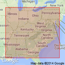
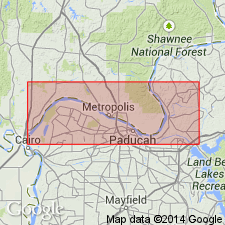
Fort Payne Formation is widespread over the south-central United States. Its northwesternmost occurrence is in southeastern IL, where it is more than 600 ft in Pope Co. The formation thins to the west and north. In western KY, the Fort Payne reaches thicknesses of more than 600 ft. In Reed quarry, the contact with the overlying Ullin Limestone (previously mapped as Warsaw) is lowered 70 ft, so that the mound facies is now included in the Ullin. The general age of the Ullin Limestone and the underlying and interfingering Fort Payne in the Illinois basin is middle Valmeyeran (late Osagean through early Meramecian) based on stratigraphic position and paleontologic evidence. A Keokuk-age assignment is indicated by conodont information from the upper part of the Fort Payne at Reed quarry, KY, a core in White Co., IL, and an isolated outcrop just west of Jonesboro. Conodont data on the type Fort Payne in northwestern AL indicate a latest Osagean (Keokuk) age. A middle Osagean age has been suggested for the unit in northwestern GA by Ausich and Meyer (1990: GSA Bull, v. 102, p. 129-146). No biostratigraphic information is available from the lower Fort Payne of IL.
Source: GNU records (USGS DDS-6; Reston GNULEX).

- Usage in publication:
-
- Fort Payne Chert*
- Modifications:
-
- Age modified
- AAPG geologic province:
-
- Piedmont-Blue Ridge province
Summary:
Fort Payne Chert is Early Mississippian (Osagean) based on warm, shallow-water fauna composed of crinoid stem plates, horn corals, brachiopods, pelecypods, and bryozoans.
Source: GNU records (USGS DDS-6; Reston GNULEX).
For more information, please contact Nancy Stamm, Geologic Names Committee Secretary.
Asterisk (*) indicates published by U.S. Geological Survey authors.
"No current usage" (†) implies that a name has been abandoned or has fallen into disuse. Former usage and, if known, replacement name given in parentheses ( ).
Slash (/) indicates name conflicts with nomenclatural guidelines (CSN, 1933; ACSN, 1961, 1970; NACSN, 1983, 2005, 2021). May be explained within brackets ([ ]).