The National Geologic Map Database is migrating to a new infrastructure. We apologize for any service disruptions during this process.
|
|---|


- Usage in publication:
-
- Fort Hays beds
- Modifications:
-
- Original reference
- AAPG geologic province:
-
- Central Kansas uplift
- Anadarko basin
- Salina basin
Summary:
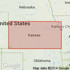
Pg. 108-109. Fort Hays beds. The very characteristic heavy stratified chalk, or soft white limestone, at base of this [Niobrara] formation, about 80 feet thick, extends across the State [Kansas], from near Mankato, Jewell County, on north, to north of Coolidge, in Hamilton or Greeley County on west. Its character and thickness, wherever seen, are so unmistakable that it is at once recognized. [Further on he speaks of "the stratified, or Fort Hays beds, as I will call them in Ness and Trego Counties," and states: "The divisional line between Benton and Niobrara I take at top of the stratified beds already mentioned, following Mudge, but I am not at all certain that it should not be placed below this, or even below the subjacent dark-blue shale."]
Source: US geologic names lexicon (USGS Bull. 896, p. 756).

- Usage in publication:
-
- Fort Hays limestone member*
- Modifications:
-
- Overview
Summary:
As above defined [Williston, 1893] Fort Hays limestone was tentatively included in the Benton. In 1896, however, Cragin, also Williston, included it in the Niobrara, as its basal member, underlying Smoky Hill chalk member. This is commonly accepted definition. The limestone is top member of Fort Hays division or group of Mudge.
In 1933 the USGS and Kansas Geol. Survey agreed to change the name to Hays limestone, "the name of the town having been changed from Fort Hays to Hays, and geologists working in Kansas having become accustomed to calling the limestone Hays limestone." (See AAPG Bull., v. 18, 1934, p. 1494.) Later the Kansas Geol. Soc. reported that the beds were named from old Fort Hays, a well-known landmark in western Kansas, and Fort Hays limestone member was therefore restored.
Source: US geologic names lexicon (USGS Bull. 896, p. 756).
- Usage in publication:
-
- Fort Hays limestone member*
- Modifications:
-
- Areal extent
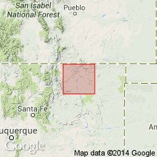
- AAPG geologic province:
-
- Las Vegas-Raton basin
Summary:
Pg. 30-31. Fort Hays limestone member of Niobrara formation. Described in Colfax County, New Mexico, where it underlies Smoky Hill marl member and overlies Carlile shale. Consists of seven or eight limestone beds that are separated by beds of calcareous shale. Thickness 15 to 20 feet. Believed to be equivalent to part of Timpas limestone of previous usage. Age is Late Cretaceous.
Source: US geologic names lexicon (USGS Bull. 1200, p. 1394-1395).
- Usage in publication:
-
- Fort Hays member
- Modifications:
-
- Areal extent
- AAPG geologic province:
-
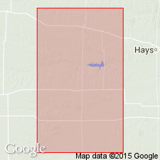
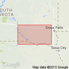
- Sioux uplift
- Salina basin
Summary:
Fort Hays member of Niobrara formation. Geographically extended into southeastern South Dakota. It is difficult to distinguish Fort Hays and Smoky Hill members on lithologic basis, but, this investigation demonstrated that they could be distinguished on basis of microfossils (benthic foraminifers EOUVIGERINA ACULEATA and E. PLUMMERAE). Thickness of Fort Hays varies from 50 to 80 feet. Age is Late Cretaceous.
Source: Publication; US geologic names lexicon (USGS Bull. 1200, p. 1394-1395).
- Usage in publication:
-
- Fort Hays limestone member*
- Modifications:
-
- Areal extent
- AAPG geologic province:
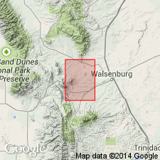
-
- Las Vegas-Raton basin
Summary:
Fort Hays limestone member of Niobrara formation. Described in La Veta area, Huerfano County, Colorado, where it crops out as prominent hogback on flanks of Greenhorn anticline. Consists of thick beds of light-gray chalky limestone alternating with thin interbeds of gray calcareous shale. Average thickness 60 feet. Underlies Smoky Hill marl member; overlies Codell sandstone member of Carlile shale. Age is Late Cretaceous.
Source: US geologic names lexicon (USGS Bull. 1200, p. 1394-1395).
- Usage in publication:
-
- Fort Hays member
- Modifications:
-
- Areal extent
- AAPG geologic province:
-
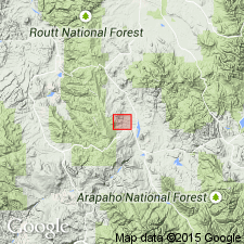
- North Park basin
Summary:
Pg. 53, pl. 1. Fort Hays member of Niobrara formation. Described in Red Dirt Creek area, Grand County, Colorado, where it is about 14 feet thick; underlies Smoky Hill member; overlies Codell sandstone here included in the Benton because Graneros, Greenhorn, and Carlile cannot be distinguished in this area. Believed that names Fort Hays and Smoky Hill have priority over terms Timpas and Apishapa; use of former terms would help standardize Niobrara terminology in west-central Colorado. Age is Late Cretaceous.
Source: US geologic names lexicon (USGS Bull. 1200, p. 1394-1395).
- Usage in publication:
-
- Fort Hays limestone member
- Modifications:
-
- Overview
Summary:
Shown on chart as Fort Hays limestone member of Niobrara chalk. Underlies Smoky Hill chalk member; overlies Codell sandstone. Age is Late Cretaceous.
Source: US geologic names lexicon (USGS Bull. 1200, p. 1394-1395).

- Usage in publication:
-
- Fort Hays limestone member*
- Modifications:
-
- Areal extent
- Dominant lithology:
-
- Limestone
- Shale
- AAPG geologic province:
-
- Denver basin
Summary:
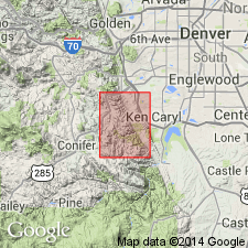
Is Upper Cretaceous member of Niobrara formation mapped in east-central Jefferson Co, CO (Denver basin). Outcrops in area of Deer Creek and south edge of quad. Is lower of two members of Niobrara. Consists of yellowish-gray dense hard thick massive limestone beds at base and softer thin, tabular limestone beds at top. Thin limy silty shale beds and bentonite beds separate limestone beds. Lowest bentonite bed is 11 ft above base. INOCERAMUS DEFORMIS Meek and OSTREA CONGESTA Conrad are abundant in upper 20 ft. Overlies Carlile shale (Upper Cretaceous); underlies Smoky Hill shale member of Niobrara. Measured section. Thickness averages 35 ft.
Source: GNU records (USGS DDS-6; Denver GNULEX).
- Usage in publication:
-
- Fort Hays Limestone Member*
- Modifications:
-
- Biostratigraphic dating
- AAPG geologic province:
-
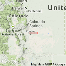
- Denver basin
Summary:
Name applied as the basal member of the Niobrara Formation to a 40 ft thick gray hard limestone above the Carlile Shale and beneath the Smoky Hill Shale Member of the Niobrara. Occurs in the Pueblo area, Pueblo Co, CO in the Denver basin as 40 layers of limestone, 1-26 inches thick, separated by gray calcareous shale. Weathers into irregular yellow-gray layers or flakes. Measured sections. Geologic map. Stratigraphic charts. Assigned to the late Turonian and early Coniacian, or Late Cretaceous. Fossils from Fort Hays include OSTREA CONGESTA Conrad, three species of INOCERAMUS, and rare fragments of ammonites. Replaces use of Timpas Limestone Member (abandoned in this report) of Niobrara Formation, or Timpas Limestone of Niobrara group of Gilbert (1896) whose Timpas included Fort Hays and the overlying shale and limestone, lower shale, and lower limestone of the Smoky Hill Member in this report.
Source: GNU records (USGS DDS-6; Denver GNULEX).
- Usage in publication:
-
- Fort Hays Limestone Member*
- Modifications:
-
- Revised
- AAPG geologic province:
-
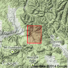
- Piceance basin
Summary:
Mancos Shale divided into three mapped parts. The lower member is a 230 ft thick unit of grayish-black, siliceous indurated shale, sandy shale, and thin beds of fine-grained quartzitic sandstone. The Fort Hays Limestone Member, newly recognized in this area as a member of the Mancos, is an 80 ft thick dark-gray, very thin to thick bedded, dense, fossiliferous limestone, shaly limestone, and limy shale. The upper member is a 4,300 ft thick dark-gray, laminated, silty marine shale. Transition zone of sandstone, limestone, and shale mapped with upper member of Mancos, though the zone represents a transition from Mancos to Mesaverde. Mancos mapped in northern part of quad, Gunnison Co, CO in the Piceance basin. [See also GQ-512, -932, -967.]
Source: GNU records (USGS DDS-6; Denver GNULEX).
- Usage in publication:
-
- Fort Hays*
- Modifications:
-
- Areal extent
- Dominant lithology:
-
- Limestone
- Shale
- AAPG geologic province:
-
- Denver basin
Summary:
Is lower of two members of Upper Cretaceous Niobrara Formation mapped in central Jefferson Co, CO (Denver basin). Outcrops in northeast part of quad on east side of Hogback. Unconformably overlies Carlile Shale (Upper Cretaceous); conformably underlies Smoky Hill Shale Member of Niobrara Map unit described as yellowish-gray hard thick-bedded fossiliferous limestone layers containing thin silty shale beds and bentonite layers near middle; lowest bentonite layer about 11 ft above base; about 35 ft thick.
Source: GNU records (USGS DDS-6; Denver GNULEX).
For more information, please contact Nancy Stamm, Geologic Names Committee Secretary.
Asterisk (*) indicates published by U.S. Geological Survey authors.
"No current usage" (†) implies that a name has been abandoned or has fallen into disuse. Former usage and, if known, replacement name given in parentheses ( ).
Slash (/) indicates name conflicts with nomenclatural guidelines (CSN, 1933; ACSN, 1961, 1970; NACSN, 1983, 2005, 2021). May be explained within brackets ([ ]).