The National Geologic Map Database is migrating to a new infrastructure. We apologize for any service disruptions during this process.
|
|---|


- Usage in publication:
-
- Flume Formation
- Modifications:
-
- Named
- Dominant lithology:
-
- Phyllite
- Slate
- AAPG geologic province:
-
- New England province
Summary:
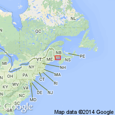
Rocks named the Canoose Formation of MacKenzie (1940), and the "Pale Argillite Division of the Charlotte Group" of MacKenzie and Alcock (1960), are here named the Flume Formation in Charlotte Co., New Brunswick, CAN, and westward into ME. It consists of gray-green phyllite, sandy phyllite, and slate. Interbedded with the underlying Waweig and Digdeguash Formations. Age is Late Silurian and Early Devonian based on fossils in the Waweig and pre-Mississippian deformation.
Source: GNU records (USGS DDS-6; Reston GNULEX).
- Usage in publication:
-
- Flume Ridge Formation
- Modifications:
-
- Revised
- AAPG geologic province:
-
- New England province
Summary:
The Flume Formation of Ruitenberg (1967), is here mapped as the Flume Ridge Formation.
Source: GNU records (USGS DDS-6; Reston GNULEX).
- Usage in publication:
-
- Flume Ridge Formation
- Modifications:
-
- Overview
- AAPG geologic province:
-
- New England province
Summary:
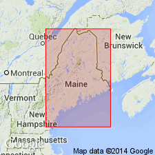
The bulk of the Fredericton trough in ME is composed of three formations: the Ordovician and Silurian Pocomoonshine Lake, the Silurian Digdeguash, and the Silurian and Devonian Flume Ridge. The Flume Ridge is the most extensive of the three, extending 20 mi across strike from its contact with the Digdeguash. Underlies a large part of the Big Lake quad and almost all of the Waite 15-min quad. Most of unit consists of variably calcareous quartzofeldspathic wackes interbedded with calcareous and non-calcareous siltstones and non-calcareous slates. Appearance changes drastically from chlorite zone to higher metamorphic grades. Thickness is estimated at 20,000 ft. Flume Ridge is equivalent to the Bucksport Formation of mid-coastal ME and the Hutchins Corner Formation. Intruded by the Pocomoonshine gabbro-diorite, the Bottle Lake pluton and the Pokiok pluton. Rocks of the Fredericton trough span the Late Ordovician through at least Middle Silurian time. Flume Ridge is mapped in fig. 3 as Silurian and Devonian.
Source: GNU records (USGS DDS-6; Reston GNULEX).

- Usage in publication:
-
- Flume Ridge Formation
- Modifications:
-
- Age modified
- AAPG geologic province:
-
- New England province
Summary:
Supposed plant fossils reported by Bailey and Matthews (1872), MacKenzie (1940), and Ruitenberg (1967) in the Flume Ridge Formation are now interpreted as inorganic. Therefore "* * * assignment of specific ages to the Digdeguash and Flume Ridge is unwarranted. It can only be surmised that this thick package of rocks is older than the unconformably overlying Carboniferous strata and is likely younger than the Ordovician Cookson Group, which apparently stratigraphically underlies it." A Late Ordovician to Silurian age is suggested for the Flume Ridge. The Ordovician-Silurian boundary occurs either near the base of the Flume Ridge or within the Digdeguash.
Source: GNU records (USGS DDS-6; Reston GNULEX).
- Usage in publication:
-
- Flume Ridge Formation
- Modifications:
-
- Age modified
- AAPG geologic province:
-
- New England province
Summary:
Pocomoonshine Gabbro-Diorite intrudes the Pocomoonshine Lake, Digdeguash, and Flume Ridge Formations in the Fredericton belt and cuts the Kendall Mountain and Woodland Formations of the Cookson Group in the St. Croix belt. The pluton was emplaced during two separate episodes during the Silurian Period. 40Ar/39Ar hornblende ages form the northern mafic portion indicate crystallization at 422.7+/-3.0 Ma. Muscovite plateau age of 414.2+/-3.2 Ma is minimum age for central and southern dioritic portions of the pluton. Therefore, deposition of the Pocomoonshine Lake, Digdeguash, and Flume Ridge Formations is constrained to late Caradocian (early Late Ordovician) through Early Silurian. The Cookson Group is interpreted as Late Cambrian(?) through Late Ordovician. According to authors, a major episode of folding and regional metamorphism must have taken place during the Silurian. Melding of the Fredericton, St. Croix, and Coastal Volcanic belts into a single block must have occurred by the Silurian. Accretion of this composite block to ancestral North America, then, was probably responsible for the Acadian Orogeny in northern New England.
Source: GNU records (USGS DDS-6; Reston GNULEX).
- Usage in publication:
-
- Flume Ridge Formation*
- Modifications:
-
- Age modified
- AAPG geologic province:
-
- New England province
Summary:
Age of Flume Ridge Formation changed to Silurian. Flume Ridge dated as Silurian by West and others (1992, Silurian age for the Pocomoonshine Gabbro-Diorite, southeastern Maine and its regional tectonic implications: American Journal of Science, v. 292, p. 253-273), Ludman (1991, Revised stratigraphy of the Cookson Group in eastern Maine and southwestern New Brunswick, an alternative view: Atlantic Geology, v. 27, no. 1, p. 49-55), and Fyffe (1992, Geology of the Flume Ridge-Kedron Stream areas, Charlotte County, New Brunswick, IN Abbott, S.A., ed., Project summaries for 1991, sixteenth annual review of activities: New Brunswick Department of Natural Resources and Energy, Information Circular 91-2, p 12-20; and 1992, Revised stratigraphy of early Paleozoic rocks in the Piskahegan Stream-Mount Pleasant area of southwestern New Brunswick [abs.]: Atlantic Geology, v. 28, no. 2, p. 197-198).
Source: GNU records (USGS DDS-6; Reston GNULEX).
For more information, please contact Nancy Stamm, Geologic Names Committee Secretary.
Asterisk (*) indicates published by U.S. Geological Survey authors.
"No current usage" (†) implies that a name has been abandoned or has fallen into disuse. Former usage and, if known, replacement name given in parentheses ( ).
Slash (/) indicates name conflicts with nomenclatural guidelines (CSN, 1933; ACSN, 1961, 1970; NACSN, 1983, 2005, 2021). May be explained within brackets ([ ]).