The National Geologic Map Database is migrating to a new infrastructure. We apologize for any service disruptions during this process.
|
|---|


- Usage in publication:
-
- Flathead quartzite*
- Modifications:
-
- Original reference
- Dominant lithology:
-
- Quartzite
- AAPG geologic province:
-
- Montana folded belt
Summary:
Flathead quartzite. Remarkably persistent quartzite or sandstone, which has long been recognized in Rocky Mountain region as lying in most cases at base of Paleozoic section. Is usually quartzitic. In some places there are interlaminated beds of reddish or reddish brown sandstones in which cementing material is partly an iron oxide. Thickness 125 feet. In places rests on Belt series and in places on Archean schists or gneisses. No fossils. Is overlain by Flathead shales from which it is in places separated by a layer of eruptive rock. The Flathead quartzite and Flathead shales comprise Flathead formation. [See also entries under †Flathead Shale (†Flathead Formation).]
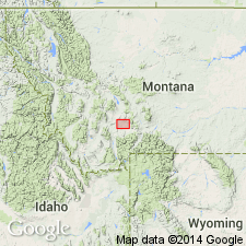
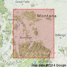
Named from exposures in Flathead Pass, northeastern corner Threeforks [Three Forks] quadrangle, MT.
Source: US geologic names lexicon (USGS Bull. 896, p. 738).
- Usage in publication:
-
- Flathead sandstone
- Modifications:
-
- Revised
- AAPG geologic province:
-
- Central Montana uplift
- Montana folded belt
- Sweetgrass arch
- Yellowstone province
Summary:
Pg. 1271-1272, 1288, 1289 (fig. 5), 1317 (fig. 9), 1326-1328. Flathead sandstone. Presentation of revision of type Cambrian formations and sections of Montana and Yellowstone National Park. Publications dealing with problem of Cambrian nomenclature in area are discussed. Peale's original Flathead and Gallatin formations are not valid because latter included both Middle and Upper Cambrian rocks. Although Weed and others used Peale's names, the Flathead and Gallatin formations, meanings of these names were never redefined and given official status. Because of error by Walcott, formational name Gallatin was dropped, but name Flathead was retained to include only strata equivalent to Flathead quartzite member of Peale's Flathead formation. In present report, names given by Weed (1900) for Little Belt Mountains are retained to designate type Cambrian formations of central and southern Montana and Yellowstone National Park. These names, Flathead, Wolsey, Meagher, Park, Pilgrim, and Dry Creek, are chosen for types because they were correctly used by Weed (1900); they have been widely used by later writers, and they are taken from carefully measured and located sections. These formational names were correctly taken from geographic features. However, the location of these geographic features were not and are not the type localities or sections of either the original or emended formations. This fact must be clearly understood by future workers. Weed's (1900) definition of Flathead sandstone quoted. Flathead sandstone (herein emended) is basal formation of Cambrian system and everywhere in Montana and Yellowstone Park rests upon Precambrian rocks. Underlies Wolsey shale (emended). Within region, maximum thickness of Flathead is 276 feet in Beaver Creek area; least thickness, 93 feet on Crowfoot Ridge; 243 feet at emended type section; thins northward to average of 90 feet in northwestern Montana. Consists of cross-bedded, thin- and thick-bedded sandstones, which have been indurated locally into quartzites. Most diagnostic characteristic is presence of tan and white pure quartz pebbles, which range from less than one-fourth inch to more than 3 inches in diameter, are well rounded, and are largely concentrated into thin lenses. Most exposures exhibit purple-maroon and buff banding, particularly in lower half of formation; upper half commonly thinner bedded, more sandy, and contains intercalated, micaceous, sandy, thin beds of shale. Oolitic hematite or hematitic sandstone, as much as 2 feet thick, commonly marks top of formation. Emended type section is on Belt Creek; formation is better exposed, more complete, and less metamorphosed on Crowfoot Ridge in Yellowstone National Park, Checkerboard Creek in Castle Mountains, and on Beaver Creek in northern part of Big Belt Mountains. Weed took name Flathead for his formation in Little Belt Mountains from Peale's (1893) Three Forks section. By using name Flathead, Weed created confusion in nomenclature, but not in the stratigraphy, because he neither stated nor implied that type section of Peale's Flathead quartzite member was type of Flathead sandstone (formation) in Little Belt Mountains. Weed gave his Belt Creek section as part of his definition of the formation and thereby indicated it as type of his Flathead sandstone. Comparison of the original and emended Belt Creek section shows a sill at top instead of near bottom of latter section and a thickness of 243 feet instead of 168 feet (sills excluded in both cases). In this section, Flathead sandstone is incompletely exposed, and contact with Wolsey shale is covered. It is however, the best known section of basal Cambrian formation in Little Belt Mountains. Because Weed indicated Belt Creek section as the type, the emended one is retained in that capacity for Flathead sandstone. Fossils (brachiopods). Age is Middle Cambrian.
Source: US geologic names lexicon (USGS Bull. 1200, p. 1364-1365); supplemental information from GNU records (USGS DDS-6; Denver GNULEX).

- Usage in publication:
-
- Flathead sandstone
- Flathead sandstone member
- Modifications:
-
- Revised
- Dominant lithology:
-
- Sandstone
- Quartzite
- AAPG geologic province:
-
- Bighorn basin
- Montana folded belt
- Wind River basin
Summary:
Pg. 1083, 1088-1089, 1098-1101 (fig. 3), 1103. Flathead sandstone, [Lewis and Clark Range area, Montana]; Flathead sandstone member of Depass formation, Wind River Canyon area, Wyoming. Deiss, 1933 (Montana Bur. Mines and Geol. Mem., no. 6) divided Cambrian rocks in northwestern Montana into 11 formations --Flathead quartzite at base overlain by Wolsey shale. Sequence is herein revised --Flathead sandstone is overlain by Gordon shale. In Wind River Canyon area, Wyoming, Flathead sandstone is considered a member of Depass formation. Underlies Gros Ventre member; overlies pre-Beltian granite. Thickness in type section of Depass 280 feet. [Age is Middle Cambrian (Albertan).]
Source: US geologic names lexicon (USGS Bull. 1200, p. 1365-1366).
- Usage in publication:
-
- Flathead Sandstone
- Modifications:
-
- Geochronologic dating
- AAPG geologic province:
-
- Montana folded belt
Summary:
Flathead Sandstone. Thick- to thin-bedded, well sorted, clean quartzose and glauconitic sandstones with thin interbedded red and green fissile shales occurring near the top of the formation. Seven samples of the interbedded shales have been dated by the Rb-Sr whole-rock method with an age of 555+/-18 Ma. A single Rb-Sr age on presumed authigenic glauconite yields an age of 542 Ma. Both the shale and glauconite ages are consistent with a Middle Cambrian age to which the Flathead Sandstone is assigned on geologic evidence.
Source: Publication.
For more information, please contact Nancy Stamm, Geologic Names Committee Secretary.
Asterisk (*) indicates published by U.S. Geological Survey authors.
"No current usage" (†) implies that a name has been abandoned or has fallen into disuse. Former usage and, if known, replacement name given in parentheses ( ).
Slash (/) indicates name conflicts with nomenclatural guidelines (CSN, 1933; ACSN, 1961, 1970; NACSN, 1983, 2005, 2021). May be explained within brackets ([ ]).