- Usage in publication:
-
- Flatbrookville Member*
- Modifications:
-
- Named
- Dominant lithology:
-
- Shale
- Limestone
- Chert
- AAPG geologic province:
-
- Appalachian basin
Summary:
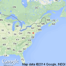
Pg. 2 (fig. 1), 31-33, 55-57, 63-65, pl. 1. Flatbrookville Member of New Scotland Formation of Helderberg Group. Consists of medium-dark-gray siliceous and calcareous fossiliferous shale that weathers medium-gray; beds and lenses of medium-gray, fine-grained, argillaceous, very fossiliferous limestone that weathers medium-light-gray; and nodules and lenses of dark-gray chert. The shale exhibits slaty cleavage; the limestone has weak fracture cleavage. Member present in New Jersey, New York, and Pennsylvania. Persists to the southwest end of Godfrey Ridge in Saylorsburg quadrangle. Generally poorly exposed; complete exposures unknown in New Jersey and northeastern Pennsylvania. Thickness at reference section is 33 feet; is about 20 feet thick in Lake Maskenozha quadrangle, New Jersey. Abruptly overlies Stormville Member of Coeymans Formation southwest of [Hainesville], New Jersey, and grades down into Kalkberg Limestone northeast of [Hainesville]. Underlies Maskenozha Member (new) of New Scotland Formation abruptly; upper contact placed at highest occurrence of abundant dark-gray chert and abundant pure limestone beds and below the dark-gray laminated shales of the Maskenozha. Has more diverse fauna than Maskenozha. MACROPLEURA MACROPLEURA, LAEPTAENA "RHOMBOIDALIS," and ISORTHIS PERELEGANS abundant. There are many other brachiopods, bryozoans, corals, crinoid columnals, trilobites, and ostracodes as well. Age is Early Devonian. Report includes measured sections. (Flatbrookville Member of New Scotland Formation of Helderberg Group adopted by the USGS.)
Type section: about 3.5 mi northeast of Flatbrookville, in woods and along northeast side of Flatbrookville-Wallpack Center Road, 3.2 mi (road distance) from intersection with Trans-Kittatinny Road joining it from the southeast, near southern edge of Lake Maskenozha 7.5-min quadrangle [approx. Lat. 41 deg. 7.7 min. N., Long. 74 deg. 54.86 min. W., Sussex Co., NJ (A.G. Harris, written commun., ca. 1995)]. Named from Flatbrookville, Sussex Co., NJ.
Reference section: on northeast bank of Brodhead Creek at Minisink Hills, in northeast corner of Stroudsburg quadrangle [approx. Lat. 40 deg. 59.67 min. N., Long. 75 deg. 9.00 min. W., Monroe, Co., PA (A.G. Harris, written commun., ca. 1995)].
[Misprint: US geologic names lexicon (USGS Bull. 1350, p. 260) states "Consists of medium-dark-gray siliceous and calcareous fossiliferous limestone that weathers medium-gray..." Should be ... shale that weathers medium-gray.]
Source: Publication; US geologic names lexicon (USGS Bull. 1350, p. 260-261);GNU records (USGS DDS-6; Reston GNULEX); Changes in stratigraphic nomenclature, 1967 (USGS Bull. 1274-A, p. A8).
For more information, please contact Nancy Stamm, Geologic Names Committee Secretary.
Asterisk (*) indicates published by U.S. Geological Survey authors.
"No current usage" (†) implies that a name has been abandoned or has fallen into disuse. Former usage and, if known, replacement name given in parentheses ( ).
Slash (/) indicates name conflicts with nomenclatural guidelines (CSN, 1933; ACSN, 1961, 1970; NACSN, 1983, 2005, 2021). May be explained within brackets ([ ]).

