

- Usage in publication:
-
- Flat Gap member
- Modifications:
-
- Named
- Dominant lithology:
-
- Limestone
- AAPG geologic province:
-
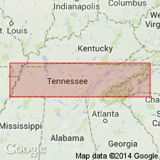
- Upper Mississippi embayment
Summary:
Flat Gap member described as a heavy-bedded coarsely crystalline or granular limestone of white or pinkish color, very sparingly fossiliferous. Thickness 0 to 53 ft. Top member of Olive Hill formation. Unconformably underlies Birdsong shale and overlies Bear Branch member of Olive Hill formation. [Type locality not stated.]
Source: GNU records (USGS DDS-6; Reston GNULEX).
- Usage in publication:
-
- Flat Gap formation
- Modifications:
-
- Revised
- AAPG geologic province:
-
- Upper Mississippi embayment
Summary:
Pg. 302-306, figs. 2, 88. Flat Gap formation. Rank raised to formation. Overlies various units of [/]Ross formation (new): [/]Ross limestone member, Bear Branch facies, Birdsong shale member. Unconformably underlies Harriman formation which truncates it northward. Maximum thickness 55 feet at type exposure herein stated. Age is Early Devonian.
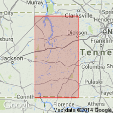
Type exposure: on Flat Gap Creek, northeast of Olivehill, Hardin Co., central southern TN.
[Name Ross preempted by Ross Limestone of Foerste (1903), which = Ross limestone member of author. The application of an identical geographic name to a stratigraphic unit and its parts (Ross limestone member of Ross formation) conflicts with nomenclature guidelines (CSN, 1933; ACSN, 1961, 1970; NACSN, 1983, 2005, 2021). Precise duplication of geographic names of sedimentary units shall not be allowed, except as a most urgent necessity because of scarcity of available names or other conditions, and then only if geographic and stratigraphic separation is such as to preclude any possible chance of confusion (CSN, 1933).]
Source: Modified from US geologic names lexicon (USGS Bull. 1200, p. 1364).
- Usage in publication:
-
- Flat Gap Limestone
- Modifications:
-
- Areal extent
- AAPG geologic province:
-
- Upper Mississippi embayment
Summary:
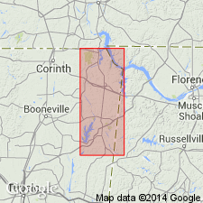
Present report assigns Flat Gap Limestone and Ross Formation to Linden Group. Ross is the only portion of Linden represented at surface in study area. Overlying Flat Gap occurs in isolated synclinal basins in subsurface of Tishomingo Co, northeastern MS. Age is Early Devonian (Helderbergian).
Source: GNU records (USGS DDS-6; Reston GNULEX).
- Usage in publication:
-
- Flat Gap Limestone*
- Modifications:
-
- Age modified
- AAPG geologic province:
-
- Cincinnati arch
Summary:
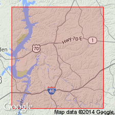
Flat Gap Limestone occurs in du Pont Geohydrological Survey well near Waverly, Humphreys Co., central TN. Assigned an Early Devonian (Lochkovian to Pragian) age.
Source: GNU records (USGS DDS-6; Reston GNULEX).
For more information, please contact Nancy Stamm, Geologic Names Committee Secretary.
Asterisk (*) indicates published by U.S. Geological Survey authors.
"No current usage" (†) implies that a name has been abandoned or has fallen into disuse. Former usage and, if known, replacement name given in parentheses ( ).
Slash (/) indicates name conflicts with nomenclatural guidelines (CSN, 1933; ACSN, 1961, 1970; NACSN, 1983, 2005, 2021). May be explained within brackets ([ ]).