

- Usage in publication:
-
- Flagstaff limestone member*
- Modifications:
-
- Original reference
- Dominant lithology:
-
- Limestone
- AAPG geologic province:
-
- Wasatch uplift
Summary:
Pg. 150-151, 448. Flagstaff limestone member of Wasatch formation. A remarkable member of fresh-water limestone, 200 to 1,000 feet thick, lying 1,000 feet below top of Wasatch formation and 1,200 to 2,000 feet above base of Wasatch in Wasatch Plateau, central eastern Utah. Age is Eocene. [Named for fact it is prominent in Flagstaff Peak.]
[GNC remark (ca. 1938, US geologic names lexicon, USGS Bull. 896, p. 737): These beds are now treated as a distinct formation, Flagstaff Limestone, by the USGS.]
Source: US geologic names lexicon (USGS Bull. 896, p. 737).
- Usage in publication:
-
- Flagstaff limestone*
- Modifications:
-
- Revised
- AAPG geologic province:
-
- Wasatch uplift
Summary:
Raised in stratigraphic rank from Flagstaff limestone member of Wasatch formation to Flagstaff limestone. Is more closely related to the Green River formation than to rocks associated with the Wasatch. Is present throughout the Wasatch Plateau, Sanpete Co, UT, Wasatch uplift. Has been eroded from the Colorado River basin. Extent north of Book Cliffs is unknown. Traced into Uinta basin. Forms extensive white or cream-colored cliffy outcrops, a contrast to the red and variegated outcrops of the underlying North Horn formation (new) and the overlying Colton formation (new). Ranges between 200 and 1500 ft thick, thicker to west and southwest. Southern extent unknown. Has the form of a tongue of the Green River formation, although this rank not assigned because of its thickness and extent. Represents the initiation of lacustrine conditions that continued into Green River time. Contains freshwater gastropods and pelecypods. Probably Paleocene age. Stratigraphic table.
Source: GNU records (USGS DDS-6; Denver GNULEX).
- Usage in publication:
-
- Flagstaff Formation
- Modifications:
-
- Not used
Summary:
Not used in Pavant Mountains of central UT, Sevier Co, [Wasatch uplift]. Rocks previously referred to as Flagstaff are assigned to newly named Cedar Breaks Formation. Rocks are more clastic than Flagstaff of Wasatch Plateau and contain less limestone and have an increase in red, tan, and pink colors.
Source: GNU records (USGS DDS-6; Denver GNULEX).
- Usage in publication:
-
- Flagstaff Limestone*
- Modifications:
-
- Age modified
- AAPG geologic province:
-
- Uinta basin
Summary:
Age changed from late Paleocene and early Eocene? to late Paleocene and early Eocene in the Uinta basin.
Source: GNU records (USGS DDS-6; Denver GNULEX).
- Usage in publication:
-
- Flagstaff Member
- Modifications:
-
- Revised
- AAPG geologic province:
-
- Uinta basin
Summary:
Reduced in stratigraphic rank in subsurface of western Uinta basin to basal member of Green River Formation. Name applied to lacustrine sequence of dominantly medium- to dark-gray carbonate, light-gray sandstone, light-gray to gray-green claystone which lie between the Upper Cretaceous and Paleocene North Horn Formation, and the upper Paleocene and lower Eocene Colton Formation on north and south parts of basin, and is continuous with the overlying main part of the Green River Formation in the central part of the basin. Term "Limestone" not used with member rank. Is a Paleocene unit.
Source: GNU records (USGS DDS-6; Denver GNULEX).
- Usage in publication:
-
- Flagstaff Limestone
- Modifications:
-
- Revised
- AAPG geologic province:
-
- Wasatch uplift
Summary:
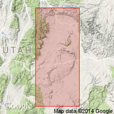
Overlies and intertongues with upper member of the newly named Red Narrows Conglomerate, a unit recognized in Red Narrows Canyon, and at least 10 mi south and at least 5 mi east of Billie's Mountain quad. A section 571 ft thick measured in sec 26, T9S, R4E, Utah Co, UT, Wasatch uplift. Described as mostly gray, very fine to medium crystalline limestone, with minor amount of pale orange calcareous shale, orange sandstone, and several conglomerate beds that have cobbles up to 2 inches. Some limestone beds are silty, some are shaly; uppermost limestone is oolitic. Flagstaff outcrop varies from rounded ledges, slopes, to cliffs. Ostracodes, gastropods, fish scales, bone fragments found. Is thickest near Red Narrows. Thins to west and north. Thickens to east and south. Deposited in a warm, shallow-water environment in Paleocene and Eocene time. Geologic map. Interfingers with overlying Colton Formation. Cross section.
Source: GNU records (USGS DDS-6; Denver GNULEX).

- Usage in publication:
-
- Flagstaff Limestone*
- Modifications:
-
- Overview
- AAPG geologic province:
-
- Uinta basin
- Wasatch uplift
Summary:
Is a member of the Green River Formation in the Uinta basin and a formation (Flagstaff Limestone) on the Wasatch Plateau. Intertongues with the upper part of the North Horn Formation and overlies the North Horn. Early Eocene palynomorphs found in Sanpete Valley area, San Pete Co, UT on the Wasatch uplift.
Source: GNU records (USGS DDS-6; Denver GNULEX).
- Usage in publication:
-
- Flagstaff Formation
- Modifications:
-
- Overview
- Redescribed
Summary:
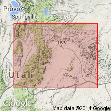
Mapped. Exposed in east-central part of quad, in southeast part where it outcrops as a narrow northwest striking band forming a narrow cliff along Salina Canyon, and northeast of town of Salina where it strikes northeast. Also occurs in southwest part of adjacent Aurora quad (UGMS Map 112). Flagstaff is mostly limestone in Wasatch Plateau to northeast, in Salina area and west of Sevier Valley it is primarily sandstone and conglomerate. Redescribed here as reddish-brown to pale gray calcareous sandstone, sandy limestone, micritic limestone and lenticular conglomerate beds. Overlies North Horn Formation; underlies Colton Formation. Up to 200 ft exposed in Salina quad; a few hundred feet exposed in Aurora quad, though may be as much as 1500 ft thick. Age is late Paleocene to early Eocene.
Source: GNU records (USGS DDS-6; Denver GNULEX).
- Usage in publication:
-
- Flagstaff Member*
- Modifications:
-
- Areal extent
- Overview
- AAPG geologic province:
-
- Uinta basin
Summary:
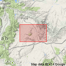
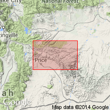
Designated a member of the Green River Formation in Price Canyon (secs 21 and 15, T12S, R9E), Carbon Co, UT in the Uinta basin. Is continuous with the Green River Formation in the subsurface. Boundary with underlying North Horn Formation placed at base of a series of resistant argillaceous and fossiliferous carbonate rocks intercalated with lesser amounts of claystone and sandstone. Thought to be late Paleocene on basis of nonmarine mollusks.
Source: GNU records (USGS DDS-6; Denver GNULEX).
- Usage in publication:
-
- Flagstaff Member*
- Modifications:
-
- Overview
- AAPG geologic province:
-
- Paradox basin
Summary:
Tertiary-Cretaceous boundary placed above a bleached zone, a distinctive, well-developed, easily recognized, and readily traceable zone of kaolinite-rich beds. Rocks west of Desolation Canyon above the bleached zone assigned to the Paleocene North Horn Formation and Flagstaff Member of Green River Formation undivided. This zone is recognized also in Piceance basin, CO, between the Upper Cretaceous Ohio Creek Member of Mesaverde Formation, or Ohio Creek Member of Hunter Canyon Formation of Mesaverde Group, and the overlying Paleocene and Eocene Wasatch Formation. Underlying Upper Cretaceous rocks belong to Price River Formation of Mesaverde Group. Flagstaff and Price River mapped in northeast corner of map area south of the Roan Cliffs, Emery Co, UT in Paradox basin. Rocks east of Desolation Canyon above the bleached zone assigned to Paleocene North Horn Formation and Flagstaff Member of Green River Formation. Underlying rocks assigned to Upper Cretaceous Tuscher Formation of Mesaverde Group. Tuscher mapped along east-central edge of map.
Source: GNU records (USGS DDS-6; Denver GNULEX).
- Usage in publication:
-
- Flagstaff Limestone*
- Modifications:
-
- Overview
- AAPG geologic province:
-
- Uinta basin
- Wasatch uplift
Summary:
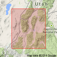
Mapped undivided with North Horn Formation as units intertongue. Mapped in southwest part of quad in area of Book and Roan Cliffs, Utah and Carbon Cos, UT, Wasatch uplift and Uinta basin. Flagstaff described as interbedded fresh-water limestone beds which are dark-gray to gray, dense, thin-bedded, and locally very fossiliferous with snails and bivalves dominant. Thickness ranges from 60-340 m (100-1100 ft); thickest in northwest part of outcrop area and thinnest near southern edge of quad. Many workers in area consider Flagstaff as member of Green River Formation. Cretaceous-Tertiary boundary is marked by "bleached zone." From Whitmore Canyon eastward to Desolation Canyon of Green River, undivided Flagstaff and North Horn are arbitrarily placed above bleached zone and both formations are considered Paleocene age. West of Whitmore Canyon, bleached zone appears to be missing and undivided Flagstaff and North Horn are considered Late Cretaceous and Paleocene age. Undivided unit overlies Price River Formation; underlies Colton Formation. East of Desolation Canyon, rocks equivalent to Colton, Flagstaff, and North Horn are mapped as Wasatch Formation. Correlation chart; generalized cross section.
Source: GNU records (USGS DDS-6; Denver GNULEX).
- Usage in publication:
-
- Flagstaff Limestone*
- Modifications:
-
- Revised
- AAPG geologic province:
-
- Wasatch uplift
Summary:
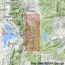
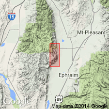
Ranges in age from late Paleocene to Eocene in the San Pitch Mountains on the Wasatch uplift. A carbonate and shale unit above the calcareous siltstone of the North Horn Formation and beneath the upper redbed unit of the North Horn thickens northward from Wales Canyon, eastern San Pitch Mountains, Sanpete Co. to merge with the Flagstaff. This carbonate and shale unit has been included and mapped with the North Horn; it is removed from the North Horn in this report, reassigned to the Flagstaff, and named Wales Tongue of the Flagstaff. The Wales is assigned a late Thanetian, Paleocene age. The Flagstaff above the upper redbed unit of the North Horn is assigned to the late Ypresian, or an early Eocene age. Basal contact is unconformable to conformable with the North Horn depending on locality. Geologic map
Source: GNU records (USGS DDS-6; Denver GNULEX).
For more information, please contact Nancy Stamm, Geologic Names Committee Secretary.
Asterisk (*) indicates published by U.S. Geological Survey authors.
"No current usage" (†) implies that a name has been abandoned or has fallen into disuse. Former usage and, if known, replacement name given in parentheses ( ).
Slash (/) indicates name conflicts with nomenclatural guidelines (CSN, 1933; ACSN, 1961, 1970; NACSN, 1983, 2005, 2021). May be explained within brackets ([ ]).