The National Geologic Map Database is migrating to a new infrastructure. We apologize for any service disruptions during this process.
|
|---|


- Usage in publication:
-
- Fisk formation
- Modifications:
-
- Original reference
- Dominant lithology:
-
- Limestone
- Shale
- Sandstone
Summary:
Pg. 66 (fig. 1), 95-96. Fisk formation. Proposed for the limestones and underlying shales and sandstones ("Indian Creek bed" of Drake, 1893 [Indian Creek shale member of Admiral formation]) that occur above the Hords Creek formation (redefined) and below the disconformity at the base of the newly defined Jim Ned shale. Report includes stratigraphic chart.
Named from village of Fisk, about 12 mi southwest of Coleman, Coleman Co., central TX. Fisk is located on upper part of formation.
Source: US geologic names lexicon (USGS Bull. 1200, p. 1356-1357).
- Usage in publication:
-
- Fisk formation
- Modifications:
-
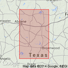
- Areal extent
- AAPG geologic province:
-
- Bend arch
Summary:
Pg. 15. Wildcat Creek shale and Overall limestone members of Admiral formation are names being introduced by R.C. Moore to replace "Indian Creek" shale and "Coleman" limestone of earlier reports. These 2 members are equivalent to Fisk formation.
Source: US geologic names lexicon (USGS Bull. 1200, p. 1356-1357).
For more information, please contact Nancy Stamm, Geologic Names Committee Secretary.
Asterisk (*) indicates published by U.S. Geological Survey authors.
"No current usage" (†) implies that a name has been abandoned or has fallen into disuse. Former usage and, if known, replacement name given in parentheses ( ).
Slash (/) indicates name conflicts with nomenclatural guidelines (CSN, 1933; ACSN, 1961, 1970; NACSN, 1983, 2005, 2021). May be explained within brackets ([ ]).