The National Geologic Map Database is migrating to a new infrastructure. We apologize for any service disruptions during this process.
|
|---|


- Usage in publication:
-
- Fisher Gully beds
- Modifications:
-
- Named
- Dominant lithology:
-
- Shale
- AAPG geologic province:
-
- Appalachian basin
Summary:
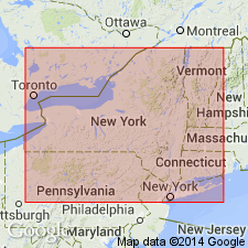
Windom Shale Member of Moscow Formation reaches a maximum thickness of 60 m in the eastern Finger Lakes area of NY. Here it consists of medium to dark gray fossiliferous mudstones and shales with thin concretionary limestone beds and can be divided into approximately 15 informal traceable units and a number of thin, localized shell-rich beds. Unit 11, here informally designated the Fisher Gully beds, extends throughout the central Finger Lakes and into the Genesee Valley. The 0.5 to 7.0 m interval occupies the middle portion of the Windom Member and consists of medium dark gray to nearly black, sublaminated to platy shale. It was divided by Cleland (1903) into the AMBOCOELIA PRAEUMBONA and modified LIEORHYNCHUS zones, but these two brachiopods appear to be intermixed. The Fisher Gully thins as the unconformably underlying Bear Swamp beds thicken. Base of unit is a thin, cryptic shell hash bed with a concentration of varied reworked fossils. The overlying 1 to 2 m of shale are typically quite dark gray and platy and range from nearly barren to highly fossiliferous. The upper boundary with the Fall Brook coral bed varies from gradational near Seneca and Cayuga Lakes and eastward to very sharply defined in the Canandaigua to Genesee Valley area. Occupies same stratigraphic position as Amsdell bed in the Buffalo region, which is believed to have been formerly coextensive with these lower dark shales of the Finger Lakes area. (See Windom entry for complete list of units.) Age is Middle Devonian (Givetian).
Source: GNU records (USGS DDS-6; Reston GNULEX).
For more information, please contact Nancy Stamm, Geologic Names Committee Secretary.
Asterisk (*) indicates published by U.S. Geological Survey authors.
"No current usage" (†) implies that a name has been abandoned or has fallen into disuse. Former usage and, if known, replacement name given in parentheses ( ).
Slash (/) indicates name conflicts with nomenclatural guidelines (CSN, 1933; ACSN, 1961, 1970; NACSN, 1983, 2005, 2021). May be explained within brackets ([ ]).