The National Geologic Map Database is migrating to a new infrastructure. We apologize for any service disruptions during this process.
|
|---|


- Usage in publication:
-
- Fish Springs Member
- Modifications:
-
- Named
- Reference
- Dominant lithology:
-
- Shale
- Limestone
- Conglomerate
- AAPG geologic province:
-
- Great Basin province
Summary:
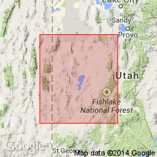
Named as upper member of Trippe Limestone after Fish Springs Range, western UT. Units 1-5 of Nolan's (1935) type Trippe constitute this member and are designated as type for Fish Springs. Reference is NE1/4, SW1/4 sec 33, T12S, R14W, Juab Co, UT, Great Basin province. Also occurs in northern and southern (not central) House, Wah Wah and Cricket Ranges. At reference, lowest 30 m forms talus slopes and consists of shale interbedded equally with thin-bedded limestone, one-third being flat-pebble intraformational limestone conglomerate; middle 7 m is thin-bedded mottled limestone that forms low ledges; uppermost 6 m is silty, thin-bedded limestone that forms slopes beneath overlying Lamb Dolomite. Thickness at reference is 43 m; 26 m thick in Cricket Range. Overlies lower member of Trippe; underlies Wah Wah Summit Formation (new) in Wah Wah, southern House and Cricket Ranges. Correlates (chart) with upper part of Marjum Formation and lower part of Weeks Limestone, central House Range; middle part of Cole Canyon Dolomite, East Tintic Mountains; and upper part of Fandangle Limestone (Staatz and Carr's units 1-4 IN USGS Prof Paper 469, 1964), Dugway Range, all in western UT; and part of Merriam's (1964, USGS Prof Paper 469) unit 9 of Highland Peak Formation, Pioche, NV. ELDORADIA PROSPECTENSIS suggests tidal-flat environment. Assigned to uppermost trilobite BOLASPIDELLA Zone (uppermost Middle Cambrian).
Source: GNU records (USGS DDS-6; Denver GNULEX).
- Usage in publication:
-
- Fish Springs Member*
- Modifications:
-
- Adopted
- AAPG geologic province:
-
- Great Basin province
Summary:
Fish Springs Member (Hintze and Robison, 1975) is adopted as the upper of two members of the Trippe Limestone. Conformably overlies unnamed lower member; conformably underlies the Dome Limestone. Age is Middle Cambrian.
Source: GNU records (USGS DDS-6; Menlo GNULEX).
For more information, please contact Nancy Stamm, Geologic Names Committee Secretary.
Asterisk (*) indicates published by U.S. Geological Survey authors.
"No current usage" (†) implies that a name has been abandoned or has fallen into disuse. Former usage and, if known, replacement name given in parentheses ( ).
Slash (/) indicates name conflicts with nomenclatural guidelines (CSN, 1933; ACSN, 1961, 1970; NACSN, 1983, 2005, 2021). May be explained within brackets ([ ]).