The National Geologic Map Database is migrating to a new infrastructure. We apologize for any service disruptions during this process.
|
|---|


- Usage in publication:
-
- Fir Crags gravel member (informal) [?]
- Fir Crags gravel [member] (informal?) [?]
- Modifications:
-
- Named
- Dominant lithology:
-
- Gravel
- AAPG geologic province:
-
- Sierra Nevada province
Summary:
zzzzz[Discrepancy: GNC records (US geologic names lexicon, USGS Bull. 1350) indicate author proposed name for an informal member of Lousetown Formation. GNU records (USGS DDS-6; Menlo GNULEX) indicate author's proposal is not clearly stated; Fir Crags is shown on sketch map as one of three informally? named [members] in the Lousetown. --unresolved.]
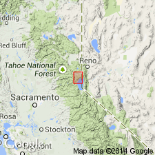
GNC records (US geologic names lexicon, USGS Bull. 1350): Pg. 61, fig. 2 (map). Fir Crags gravel member of Lousetown Formation. A gravel deposited by northeastward-flowing ancestral Ward Creek at a time when drainage of Upper Truckee Canyon was blocked by basalt flow cropping out along the canyon. Age is early Pleistocene. Crops out 2 or 3 miles downstream from Lake Tahoe outlet, Truckee area. Named for settlement of Fir Crags, northeastern CA.
GNU records (USGS DDS-6; Menlo GNULEX, December 16, 1988): Fir Crags gravel [member] of Lousetown Formation. [Named for Fir Crags, in sec. 3, T. 15 N., R. 16 E., Tahoe City 7.5-min quadrangle, Placer Co., CA. Type locality not designated]. Crops out 2 or 3 miles downstream from Lake Tahoe outlet, Truckee area. Shown on sketch map as one of three informally(?) named [members] of Lousetown Formation. Deposited by northeastward flowing ancestral Ward Creek at time when drainage of Upper Truckee Canyon was blocked by basalt. Age is Pleistocene. Also referred to as Fir Crags Gravel [Member] of Lousetown Formation in Menlo GNULEX.
Source: US geologic names lexicon (USGS Bull. 1350, p. 257); GNU records (USGS DDS-6; Menlo GNULEX).
- Usage in publication:
-
- Fir Crags gravel member (informal)
- Modifications:
-
- Age modified
- AAPG geologic province:
-
- Sierra Nevada province
Summary:
Pg. 1453-1464. Fir Crags gravel member of Lousetown Formation. An informal member of Lousetown Formation. Rests on andesite bedrock and underlies Tahoe City olivine latites (new). Unit consists mostly of weathered andesite gravels, some cobbles of which are up to 8 inches across, with minor amounts of sand. Maximum thickness about 240 feet. Appears to have been deposited by Ward Creek at time canyon was dammed by Big Chief basalt (new). Age is early Pleistocene.
Source: US geologic names lexicon (USGS Bull. 1350, p. 257).
For more information, please contact Nancy Stamm, Geologic Names Committee Secretary.
Asterisk (*) indicates published by U.S. Geological Survey authors.
"No current usage" (†) implies that a name has been abandoned or has fallen into disuse. Former usage and, if known, replacement name given in parentheses ( ).
Slash (/) indicates name conflicts with nomenclatural guidelines (CSN, 1933; ACSN, 1961, 1970; NACSN, 1983, 2005, 2021). May be explained within brackets ([ ]).