

- Usage in publication:
-
- Finger Bay volcanics*
- Modifications:
-
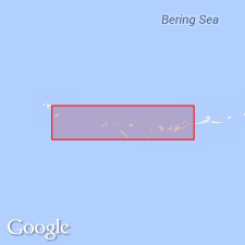
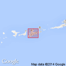
- Areal extent
- AAPG geologic province:
-
- Aleutian Islands province
- Alaska Southwestern region
Summary:
Geographically extended to eastern tip of Amchitka Island and (most of) Adreanof islands east of Adak Island. Consists of volcanic rocks (basaltic rocks cut by large gabbro and small rhyolite masses). Age is given as Mesozoic(?) based on regional stratigraphic correlations.
Source: GNU records (USGS DDS-6; Menlo GNULEX).
- Usage in publication:
-
- Finger Bay volcanics*
- Modifications:
-
- Named
- Dominant lithology:
-
- Volcaniclastics
- Volcanics
- AAPG geologic province:
-
- Aleutian Islands province
- Alaska Southwestern region
Summary:
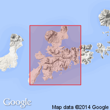
[Named for Finger Bay, Adak Island in east-central part of Adak 1:250,000 quad, southwest AK.] [no type designated] Occurs in southern part of northern Adak Island. Consists of basaltic tuff, basalt flows, tuff breccia, agglomerate and dikes with few small rhyolitic flows and dikes. Some rocks are conspicuously porphyritic. In general rocks are intensely altered and locally recrystallized. Thickness is at least 2,000 feet and possibly up to 15,000 feet. Intruded by Zeto Point basalt porphyry (new). Unconformably overlain by unaltered and undeformed Tertiary volcanic rocks. Age is regarded as Mesozoic(?) based on regional stratigraphic relations.
Source: GNU records (USGS DDS-6; Menlo GNULEX).
- Usage in publication:
-
- Finger Bay volcanics*
- Modifications:
-
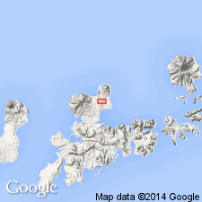
- Areal extent
- AAPG geologic province:
-
- Aleutian Islands province
- Alaska Southwestern region
Summary:
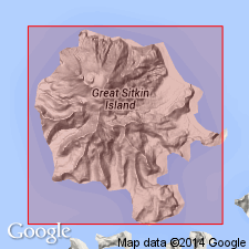
Geographically extended onto Great Sitka Island. Is oldest rock exposed on island. Consists predominantly of andesitic and basaltic greenstone, and includes coarse- to fine-grained porphyritic flows, amygdaloidal flows, coarse flow-breccia, pillow lava, and dense fine-grained rocks that are probably flows, and coarse- to fine-grained tuff. Unconformably underlies Sand Bay volcanics (new). Chain of islands between Great Sitkin and Adak seem to be composed largely, if not entirely, of Finger Bay volcanics. Source of volcanic rocks is not known. Age is not definitely known, but believed to be Mesozoic, possibly Triassic, based on correlation with similar rocks of probably Triassic age in Iliamna region and at Alinchak Bay on Alaska Peninsula.
Source: GNU records (USGS DDS-6; Menlo GNULEX).
- Usage in publication:
-
- Finger Bay volcanics*
- Modifications:
-
- Age modified
- Biostratigraphic dating
- AAPG geologic province:
-
- Aleutian Islands province
- Alaska Southwestern region
Summary:
Some of the rocks are conspicuously porphyritic. Leaf impressions (ANNULARIA STELLATA) (Schlotheim Wood) from sandstone interbeds in northernmost outcrops present. Considered oldest rocks in report area. Intruded by large mass of gabbro exposed south of Finger Bay. Type area is area "about Finger Bay and Sweeper Cove". Age stated as "not known with certainty" but regarded as "Paleozoic(?) in age" based on leaf fossils present. "Pennsylvanian(?) or Permian(?)" age is shown on plate 9.
Source: GNU records (USGS DDS-6; Menlo GNULEX).
- Usage in publication:
-
- Finger Bay volcanics*
- Modifications:
-
- Age modified
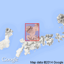
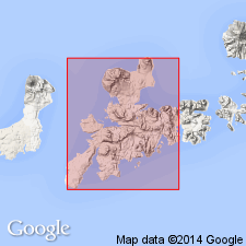
- Areal extent
- AAPG geologic province:
-
- Aleutian Islands province
- Alaska Southwestern region
Summary:
Geographically extended to southern part of Adak Island and Kagalaska Island. Coats (1955[6]) included body of fossiliferous yellow sandstone ... that crops out between Clam Lagoon and Andrew Lake in northern part of Adak Island in his Finger Bay volcanics which are Pennsylvanian or Permian age based on fossil leaf impressions. Relation of these rocks to Finger Bay Volcanics in southern part of Adak Island and on Kagalaska Island is uncertain. Volcanic sandstone beds of northern Adak Island are doubtless terrestrial, whereas Finger Bay rocks of this report are interpreted as marine deposits of Tertiary(?) age based on correlation with similar-appearing sequence of rocks on Kanaga Island (10 mi west of Adak Island) which contain Miocene(?) marine fossils. Authors believe Tertiary(?) age as more probable than Paleozoic(?) age as heretofore assigned to Finger Bay volcanics.
Source: GNU records (USGS DDS-6; Menlo GNULEX).
- Usage in publication:
-
- Finger Bay Volcanics*
- Modifications:
-
- Age modified
- Biostratigraphic dating
- Revised
- AAPG geologic province:
-
- Aleutian Islands province
- Alaska Southwestern region
Summary:
Finger Bay Volcanics of Coats (1947, 1956) stratigraphically restricted in area between Andrew Lake and Clam Lagoon in northern Adak Island and in southern Adak Island and Kagalaska Island. Uppermost rocks on northern Adak Island are here reassigned to Andrew Lake Formation (new). Finger Bay Volcanics consist of massive and intensively altered andesitic and basaltic flows and pyroclastic rocks --i.e., eruptive rocks only. Unconformably underlies Andrew Lake Formation. Age is considered early Tertiary based on presence of late Eocene foraminifers, pectens, and fish scales and middle to late Eocene dinoflagellates (from same strata as "Annularia"-bearing beds of Coats, 1956) identified from overlying Andrew Lake Formation.
Source: GNU records (USGS DDS-6; Menlo GNULEX).
- Usage in publication:
-
- Finger Bay Volcanics*
- Modifications:
-
- Age modified
- AAPG geologic province:
-
- Aleutian Islands province
- Alaska Southwestern region
Summary:
Age is Paleocene or early Eocene based on greater degrees of alteration and metamorphism than unconformably overlying (upper Eocene) Andrew Lake Formation. Unit consists of highly altered interbedded flows and pyroclastic rocks.
Source: GNU records (USGS DDS-6; Menlo GNULEX).
- Usage in publication:
-
- Finger Bay Volcanics*
- Modifications:
-
- Age modified
- AAPG geologic province:
-
- Aleutian Islands province
- Alaska Southwestern region
Summary:
Shown on correlation table. Age is Eocene or older.
Source: Modified from GNU records (USGS DDS-6; Menlo GNULEX).
- Usage in publication:
-
- Finger Bay Volcanics*
- Modifications:
-
- Age modified
- Geochronologic dating
- AAPG geologic province:
-
- Aleutian Islands province
- Alaska Southwestern region
Summary:
Age is Eocene based on K-Ar determination of about 50 Ma from flow rocks of Finger Bay Volcanics, and from stratigraphic relations.
Source: GNU records (USGS DDS-6; Menlo GNULEX).
For more information, please contact Nancy Stamm, Geologic Names Committee Secretary.
Asterisk (*) indicates published by U.S. Geological Survey authors.
"No current usage" (†) implies that a name has been abandoned or has fallen into disuse. Former usage and, if known, replacement name given in parentheses ( ).
Slash (/) indicates name conflicts with nomenclatural guidelines (CSN, 1933; ACSN, 1961, 1970; NACSN, 1983, 2005, 2021). May be explained within brackets ([ ]).