The National Geologic Map Database is migrating to a new infrastructure. We apologize for any service disruptions during this process.
|
|---|


- Usage in publication:
-
- Fife Lake Formation
- Modifications:
-
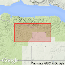
- Areal extent
- Overview
- AAPG geologic province:
-
- Williston basin
Summary:
Is one of eight formations of Interlake Group. Name extended in subsurface south from CN into the central Williston basin of ND where it is applied to a basal sequence of skeletal turbidites, a repetitive upward-fining lime packstone-mudstone with skeletal debris and angular to subround flat limestone pebbles. In these basal beds, gastropods and ostracodes are abundant; some pelecypod and crinoid fragments; the muddy beds are bioturbated; poor sorting and upward fining character indicate marine slope deposit; the coarse deposits within sequence probably derived from shelf. The debris flows are overlain gradationally by homogeneous microcrystalline dolomite in a lower cycle and a laminated unfossiliferous lime mudstone in an upper cycle. Lamination with finely disseminated pyrite well preserved in upper part. Anhydrite a few cm to 15 cm thick interbedded with laminites as contorted bands. Is 60 ft thick--between 12,770 and 12,830 ft--in core of Texaco Inc. #1 Missouri Breaks well. Overlies Strathclair Formation of Interlake; underlies Guernsey Formation of Interlake. History of nomenclature chart. Silurian age.
Source: GNU records (USGS DDS-6; Denver GNULEX).
For more information, please contact Nancy Stamm, Geologic Names Committee Secretary.
Asterisk (*) indicates published by U.S. Geological Survey authors.
"No current usage" (†) implies that a name has been abandoned or has fallen into disuse. Former usage and, if known, replacement name given in parentheses ( ).
Slash (/) indicates name conflicts with nomenclatural guidelines (CSN, 1933; ACSN, 1961, 1970; NACSN, 1983, 2005, 2021). May be explained within brackets ([ ]).