The National Geologic Map Database is migrating to a new infrastructure. We apologize for any service disruptions during this process.
|
|---|


- Usage in publication:
-
- Fayette beds
- Modifications:
-
- Original reference
- Dominant lithology:
-
- Clay
- Sand
- Lignite
- AAPG geologic province:
-
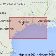
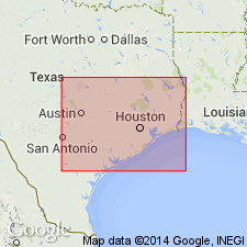
- Gulf Coast basin
Summary:
Pl. 3, p. xxxiii, 17, 47, 57, 58, 63. Fayette beds. Sands, sandstones, clays, and lignites, more or less calcareous, 300 to 400 feet thick, overlying uppermost fossiliferous stratum of Marine Tertiary (siliceous and glauconitic sands and white, brown, and black clays with lignite) and underlying Quaternary Coast clays, on Brazos, Colorado and Rio Grande [Rivers], Texas. [As thus defined includes at base, Yegua formation.]
Source: US geologic names lexicon (USGS Bull. 896, p. 723-724).
- Usage in publication:
-
- Fayette division
- Modifications:
-
- Revised
- AAPG geologic province:
-
- Gulf Coast basin
Summary:
(Brown coal and lignite of Texas, p. 124, 154). Fayette division. Gray sandstones interstratified with gray clays and gray sands, 20 to 200 feet thick. Unconformably underlies Lapara beds, and overlies Yegua division, originally included in Fayette.
Source: US geologic names lexicon (USGS Bull. 896, p. 723-724).
- Usage in publication:
-
- Fayette sands
- Modifications:
-
- Revised
- AAPG geologic province:
-
- Gulf Coast basin
Dumble, E.T., 1894, The Cenozoic deposits of Texas: Journal of Geology, v. 2, no. 6, p. 549-567.
Summary:
Pg. 549, 552. Fayette sands. Restricted to series of sands (coarse and angular) and sandstones with some clays, which contain large amount of opaline and chalcedonic materials, overlying Yegua clays and underlying Frio clays.
Source: US geologic names lexicon (USGS Bull. 896, p. 723-724).
- Usage in publication:
-
- Fayette sandstone
- Modifications:
-
- Revised
- AAPG geologic province:
-
- Gulf Coast basin
Summary:
Fayette sandstone, 800 feet thick, underlies Frio clay and overlies Yegua formation in coastal plain of Texas west of Brazos River.
Source: US geologic names lexicon (USGS Bull. 896, p. 723-724).
- Usage in publication:
-
- [Fayette sandstone]
- Modifications:
-
- Revised
- AAPG geologic province:
-
- Gulf Coast basin
Summary:
Pg. 424-436. Fayette of type section unconformably underlies Frio group and overlies Yegua formation. The upper 500+ feet is of Jackson age, and is here named Whitsett beds. The lower part, or true Fayette, is 150+/- feet, is unconformably overlain and overlapped by Whitsett beds. Their separation from the Jackson is made necessary by unconformity at their top.
Source: US geologic names lexicon (USGS Bull. 896, p. 723-724).
- Usage in publication:
-
- Fayette formation
- Modifications:
-
- Revised
- AAPG geologic province:
-
- Gulf Coast basin
Summary:
Fayette formation is 135+ feet thick in southwestern coastal plain of Texas. Is largely sandstones, but includes clay and shale. Conformably underlies Frio formation and overlies Yegua clay. Is basal formation of Jackson group.
Source: US geologic names lexicon (USGS Bull. 896, p. 723-724).
- Usage in publication:
-
- Fayette sandstone
- Modifications:
-
- Age modified
- AAPG geologic province:
-
- Gulf Coast basin
Summary:
Pg. 384. Age assigned to Fayette sandstone in literature has ranged from Lower Claiborne (Eocene) to Miocene. Work of Deussen, Matson, and Berry, and later work by Bailey (Univ. Tex. Bull., no. 2645, 1926), seems sufficient definitely to allocate the Fayette, or, to quote Deussen, "the Fayette sandstone lies above Jackson formation, is overlain by Catahoula." Bailey's Gueydan is approximately = Deussen's Catahoula. Miss Alva C. Ellisor has stated to writer that she has verified this position of Fayette on the surface, and the work of the writer has verified it in subsurface. It is in sense of Upper Jackson that Fayette is used in this note.
Source: US geologic names lexicon (USGS Bull. 896, p. 723-724).
- Usage in publication:
-
- [Fayette sandstone]
- Modifications:
-
- Not used
- AAPG geologic province:
-
- Gulf Coast basin
Summary:
Pg. 1302. Jackson group divided into (descending) Whitsett formation, McElroy formation, and Caddell formation, which are = Fayette of USGS.
Source: US geologic names lexicon (USGS Bull. 896, p. 723-724).

- Usage in publication:
-
- Fayette formation
- Modifications:
-
- Revised
- AAPG geologic province:
-
- Gulf Coast basin
Summary:
Pg. 681. Fayette is employed as a formation name for Texas strata between Yegua below and Catahoula or Frio above, and Jackson as a group name to designate all Eocene strata above the Claiborne. [In this publication Frio was referred to Oligocene, thus making Fayette and Jackson equivalent.] Whitsett is upper member of Fayette formation (Jackson, Eocene).
Source: US geologic names lexicon (USGS Bull. 896, p. 723-724).
- Usage in publication:
-
- [Fayette sandstone]†
- Modifications:
-
- Abandoned
- AAPG geologic province:
-
- Gulf Coast basin
Summary:
Pg. 501. Jackson group is here divided into (descending) Whitsett, McElroy, and Caddell, following 1933 classification of Miss Ellisor; and, also following Miss Ellisor, Fayette is abandoned and Whitsett is substituted.
Source: US geologic names lexicon (USGS Bull. 896, p. 723-724).
- Usage in publication:
-
- [Fayette sandstone]
- Modifications:
-
- Revised
- AAPG geologic province:
-
- Gulf Coast basin
Summary:
Pg. 1639. Fayette is divided into (descending): (1) Fayette (Whitsett); (2) McElroy; and (3) Caddell.
Source: US geologic names lexicon (USGS Bull. 896, p. 723-724).
- Usage in publication:
-
- [Fayette sandstone]†
- Modifications:
-
- Abandoned
- AAPG geologic province:
-
- Gulf Coast basin
Summary:
Pg. 540. Jackson group, following Miss Ellisor, is here divided into Whitsett formation (substituted for Fayette, which is abandoned), McElroy formation and Caddell formation. [Orange, Orange County, Texas]
Source: US geologic names lexicon (USGS Bull. 896, p. 723-724).
- Usage in publication:
-
- Fayette sandstone†
- Modifications:
-
- Abandoned
- AAPG geologic province:
-
- Gulf Coast basin
Summary:
Pg. 474. As USGS has used the name Fayette as synonymous with the name Jackson and is using Fayette to include all Jackson sediments, F.B. Plummer of Bur. Econ. Geol., Univ. Texas, suggested dropping the name Fayette for the upper, third formation of Jackson group. As the name is now applied as a group name it can not be delimited as a formation. The name Whitsett has been selected for former Fayette of the writer.
Source: US geologic names lexicon (USGS Bull. 896, p. 723-724).

- Usage in publication:
-
- Fayette sandstone
- Modifications:
-
- Overview
- AAPG geologic province:
-
- Gulf Coast basin
Summary:
The USGS present [ca. 1938] definition of Fayette sandstone (of Jackson age) includes in the formation all beds in eastern Texas below Frio clay and above Yegua formation.
Named for Fayette County, Texas, but F.B. Plummer states (Univ. Tex. Bull., no. 3232, 1933, p. 681): The section exposed at Lipan Hills, as described by Dumble in his final [1924] description of the Fayette is now regarded as the type section of the Fayette formation.
Source: US geologic names lexicon (USGS Bull. 896, p. 723-724).
- Usage in publication:
-
- Fayette formation
- Modifications:
-
- Revised
- AAPG geologic province:
-
- Gulf Coast basin
Summary:
Pg. 259 (fig. 2), 266-270. Fayette formation described in area between Laredo [Webb County] and Rio Grande City [Starr County], Texas. Classification followed is that of Kane and Gierhart (1935, AAPG Bull., v. 19, no. 9) in which names Fayette and Jackson are used synonymously; it is understood that Fayette has been restricted so that some of beds of lower Jackson are not now included in Fayette. Thickness in Starr County about 1,500 feet. Contains three prominent marine sandstone tongues separated by shaly beds of marginal to nonmarine facies. Named units include (ascending) Salineno sandstone tongue, Resendez shale member (new), Roma sandstone tongue. Gorgora shale member (new), Sanchez sandstone tongue, Agua Verde shale member (new), and Villa Nueva sandstone member. Overlies Yegua formation; underlies units termed uppermost Jackson.
Source: US geologic names lexicon (USGS Bull. 1200, p. 1330).
- Usage in publication:
-
- [Fayette sandstone]†
- Modifications:
-
- Abandoned
- AAPG geologic province:
-
- Gulf Coast basin
Summary:
Pg. 2625-2626. History of usage summarized. On the basis of recent fieldwork, it is believed that the Jackson of west Gulf Coastal Plain should be classified as a group and that name Fayette, of varied usage in the past, be abandoned.
Source: US geologic names lexicon (USGS Bull. 1200, p. 1330).
For more information, please contact Nancy Stamm, Geologic Names Committee Secretary.
Asterisk (*) indicates published by U.S. Geological Survey authors.
"No current usage" (†) implies that a name has been abandoned or has fallen into disuse. Former usage and, if known, replacement name given in parentheses ( ).
Slash (/) indicates name conflicts with nomenclatural guidelines (CSN, 1933; ACSN, 1961, 1970; NACSN, 1983, 2005, 2021). May be explained within brackets ([ ]).