

- Usage in publication:
-
- Fasken Formation*
- Modifications:
-
- First used
- Dominant lithology:
-
- Limestone
- Dolomite
- Mudstone
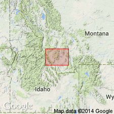
- AAPG geologic province:
-
- Permian basin
Summary:
Here first used as a formation in Silurian Wristen Group (revised). Described as complex platform-margin and inner-platform suites of shallow-water carbonates and as diverse shelf facies. Subdivided into (1) platform-margin skeletal wackestones to grainstones and boundstones and (2) inner-platform mudstones, pellet and skeletal wackestones and grainstones. Base of typical succession comprises dark-colored wackestones containing poorly sorted skeletal debris. Upward in section, comprised of an interval with more abundant and larger fossil plant fragments; followed by a relatively well-sorted interval displaying interparticle porosity; and finally capped by coral framestone, geopetal cavities filled with sediment, and, less commonly, cement. Inner-platform Fasken deposits show broad spectrum of facies successions, most of which are highly cyclic. Thickness ranges from <200 to 1400 feet. Overlies Ordovician and Silurian Fusselman Formation, or interfingers Silurian Wink and Frame Formations of Wristen Group, (see figs. 3, 4, and 11). Throughout most of the region, underlies Late Devonian Woodford Formation, except where the latter has been removed by late Paleozoic erosion (see p. 97). Also known to underlie Early Devonian Thirtyone Formation. Age is Silurian (Wenlockian through Pridolian). Although dating of the Fasken is imprecise, unit is probably a shallow-water equivalent of the Silurian (Ludlovian and Pridolian) Henryhouse of the Hunton Group. Report includes correlation chart, stratigraphy and facies charts, measured cores, and depositional history diagram.
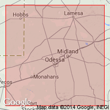
Type locality not designated, but unit is [well represented] in Standard Oil of Texas hydrocarbon core Fasken 5, No. 1 well, in Andrews Co. (near Lea Co., NM), west-central TX (see figs. 7, 8). Derivation of name not stated, but probably named from core.
Source: Modified from GNU records (USGS DDS-6; Denver GNULEX).
- Usage in publication:
-
- Fasken Formation
- Modifications:
-
- Named
- Reference
- AAPG geologic province:
-
- Permian basin
Summary:
Fasken Formation of Wristen Group, named in this report, originally referred to as the carbonate facies of the Wristen Formation by Hills and Hoenig (1979). Three reference sections designated: One cored well in eastern Andrews Co., and two cored wells in Fullerton field. Fasken constitutes the post-Fusselman Silurian in the north part of West TX and NM. Underlies the Woodford Formation throughout most of the region or where the Woodford is absent underlies Pennsylvanian and Permian clastics and carbonates. Unit reaches thicknesses of at least 1,400 ft in extreme western Andrews Co. and eastern NM and thins to less than 200 ft in Dawson Co. Though not precisely known, fossils indicate a Middle Silurian age. Fasken is shown on correlation chart as Wenlockian, Ludlovian, and Pridolian and equivalent to the Wink and Frame Formations of the Wristen Group in southern TX.
Source: GNU records (USGS DDS-6; Denver GNULEX).
For more information, please contact Nancy Stamm, Geologic Names Committee Secretary.
Asterisk (*) indicates published by U.S. Geological Survey authors.
"No current usage" (†) implies that a name has been abandoned or has fallen into disuse. Former usage and, if known, replacement name given in parentheses ( ).
Slash (/) indicates name conflicts with nomenclatural guidelines (CSN, 1933; ACSN, 1961, 1970; NACSN, 1983, 2005, 2021). May be explained within brackets ([ ]).