- Usage in publication:
-
- Farmdale loess
- Modifications:
-
- Principal reference
- AAPG geologic province:
-
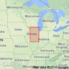
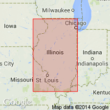
- Illinois basin
- Upper Mississippi embayment
Leighton, M.M., and Willman, H.B., 1950, Loess formations of the Mississippi Valley: Journal of Geology, v. 58, no. 6, p. 599-623.
Summary:
Pg. 602-603. [Farmdale loess.] Silt deposit which lies on weathered zone and erosional slopes of Illinoian drift and which has very youthful profile of weathering beneath Peorian loess was described by Leighton (Jour. Geol., v. 34, 1926) as late Sangamon loess. This is unit named Farmdale (Leighton, 1948, IN H.L. Wascher, R.P. Humbert, and J.C. Cady, Proc. Soil Sci. Soc. Amer., v. 12, p. 390). Farmdale substage and loess are pro-Wisconsin. Farmdale is older than Iowan. Loess has definite valley relationships to Illinois River valley (ancestral Mississippi), present Mississippi Valley below mouth of Illinois River and Wabash and lower Ohio Valleys. Such a relationship suggests a valley-train source. This, in turn, implies an extension of an ice sheet during Farmdale into drainage basin of ancestral Mississippi prior to Iowan substage but not yet recognized in series of drift sheets because it fell short of subsequent ice lobes. Age is Pleistocene (Wisconsinan).
[Named from exposure in Farm Creek section near Farmdale, Tazewell Co., IL.]
Source: US geologic names lexicon (USGS Bull. 1200, p. 1323-1325).

- Usage in publication:
-
- Farmdale Soil
- Modifications:
-
- Revised
- Dominant lithology:
-
- Soil
- AAPG geologic province:
-
- Illinois basin
Summary:
Authors here present Farmdale as a formal soil-stratigraphic unit. Farmdale Silt and Loess and Farmdalian Substage were described many years ago. They state that the Farmdale Soil is unique. At its type section (Farm Creek), it is an intrazonal, organic-rich soil, formed by the accumulation of organic debris and silt from sheetwash and eolian deposition. Resembles the accretion-gley soils in that it developed more slowly than other soils in a poorly drained locality, but it differs from them, in that it is composed largely of silt and organic debris rather than clay. Overlies Roxana Silt and underlies Morton Loess, Peoria Loess, or the Wedron Formation. Occurs widely in central and northern IL. Radiocarbon dates range from 21,000 yr B.P. to approximately 27,000 yr B.P.
Source: GNU records (USGS DDS-6; Reston GNULEX).

- Usage in publication:
-
- Farmdale Geosol
- Modifications:
-
- Revised
- AAPG geologic province:
-
- Illinois basin
Summary:
Authors quote the NACSN Code in stating that the "geosol is the fundamental unit of pedostratigraphy, defined as a mappable, stratiform body of material with soil characteristics formed on a previous land surface, with an upper surface that now constitutes both a material and stratigraphic boundary. A formalized geosol is defined at its type locality as a buried soil that contains catenal members." The organic-rich facies of the Farmdale is developed in the Robein Silt. The in situ facies are common in the top of the Roxana Silt.
Source: GNU records (USGS DDS-6; Reston GNULEX).
For more information, please contact Nancy Stamm, Geologic Names Committee Secretary.
Asterisk (*) indicates published by U.S. Geological Survey authors.
"No current usage" (†) implies that a name has been abandoned or has fallen into disuse. Former usage and, if known, replacement name given in parentheses ( ).
Slash (/) indicates name conflicts with nomenclatural guidelines (CSN, 1933; ACSN, 1961, 1970; NACSN, 1983, 2005, 2021). May be explained within brackets ([ ]).

