

- Usage in publication:
-
- Farley limestone bed
- Modifications:
-
- Original reference
- Dominant lithology:
-
- Limestone
- Shale
- AAPG geologic province:
-
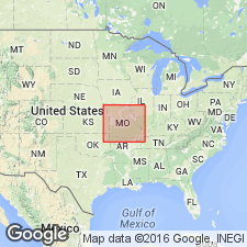
- Forest City basin
Summary:
Pg. 29, 155. Farley limestone bed of Lane shale member of Lansing formation. Ranges from a thin layer of calcareous shale to a bed of limestone 10 feet thick, seemingly disappearing to northeast. Divides Lane shale member of Lansing formation into two parts. The overlying beds being arenaceous and the underlying beds chiefly argillaceous. Is bed No. 100 of Broadhead's section. Age is Late Pennsylvanian (Missouri age).
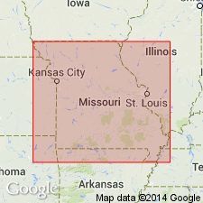
Named from exposures near Farley, Platte Co., northwestern MO.
Source: US geologic names lexicon (USGS Bull. 896, p. 721); GNC KS-NE Pennsylvanian Corr. Chart, sheet 1, Oct. 1936.
- Usage in publication:
-
- Farley limestone
- Modifications:
-
- Revised
Summary:
Correlation chart. Farley limestone of Lansing group. Named the shale overlying Farley limestone the Bonner Springs shale and the shale underlying it the Island Creek shale, and included all of them in [Lansing] group. Age is Late Pennsylvanian (Missouri age).
[Misprint (USGS Bull. 896, p. 721): In 1931 Moore included Bonner Springs, Farley, and Island Creek in Lansing group, not Kansas City group. See KS-NE Pennsylvanian corr. chart, sheet 1, Oct. 1936.]
Source: US geologic names lexicon (USGS Bull. 896, p. 721); GNC KS-NE Pennsylvanian Corr. Chart, sheet 1, Oct. 1936.

- Usage in publication:
-
- Farley limestone member
- Modifications:
-
- Revised
- AAPG geologic province:
-
- Forest City basin
Summary:
Farley limestone member of Wyandotte limestone of Lansing group. Underlies Bonner Springs shale of Lansing group and overlies Island Creek shale member of Wyandotte. Age is Late Pennsylvanian (Missouri age).
Source: GNC KS-NE Pennsylvanian Corr. Chart, sheet 2, Oct. 1936.

- Usage in publication:
-
- Farley limestone member
- Modifications:
-
- Overview
Summary:
Farley limestone member of Wyandotte limestone of Kansas City group. According to N.D. Newell, 1935 (Kansas Geol. Survey Bull., no. 21), the Lane shale of Hinds and Greene is younger than true Lane shale and corresponds to upper part of Wyandotte limestone and overlying Bonner Springs shale of Moore and Newell; and Farley limestone is upper member of their Wyandotte limestone. This classification is followed by R.C. Moore, 1936 (Kansas Geol. Survey Bull., no. 22, p. 45, 12, 122). Moore draws top of Kansas City group at top of Bonner Springs shale. These changed definitions have not yet [ca. 1938] been considered by the USGS for its publications.
Source: US geologic names lexicon (USGS Bull. 896, p. 721); GNC KS-NE Pennsylvanian Corr. Chart, sheet 2, Oct. 1936.
- Usage in publication:
-
- Farley limestone member
- Modifications:
-
- Overview
Summary:
Pl. 5. Farley limestone member of Lane shale. Shown on chart as member of Lane shale. Thickness 2 to 10 feet. Underlies Bonner Springs shale member; overlies Island Creek shale member. Age is Late Pennsylvanian (Missourian).
Source: US geologic names lexicon (USGS Bull. 1200, p. 1322-1323).
- Usage in publication:
-
- Farley limestone member
- Modifications:
-
- Overview
Summary:
Pg. 2031 (fig. 4), 2033; F.C. Greene, 1938, Missouri Geol. Survey Water Res. Rpt. Inv., no. 11, p. vi (fig. 2), 14. Farley limestone member of Wyandotte limestone. According to interstate agreement, Farley limestone is classified as uppermost member of Wyandotte limestone. Overlies Island Creek shale member; underlies Bonner Springs shale. Age is Late Pennsylvanian (Missourian).
Source: US geologic names lexicon (USGS Bull. 1200, p. 1322-1323).

- Usage in publication:
-
- Farley limestone member
- Modifications:
-
- Areal extent
- AAPG geologic province:
-
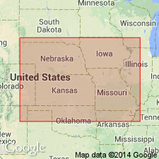
- Iowa shelf
- Forest City basin
Summary:
Pg. 25, fig. 5. Farley limestone member of Wyandotte limestone. Uppermost member of Wyandotte limestone. Comprises two or three gray argillaceous limestone beds separated by thin shales and varies considerably in thickness. Thickness about 2 feet in Madison County; more than 7 feet in Union County. Overlies Island Creek shale; underlies Bonner Springs shale. Age is Late Pennsylvanian (Missourian).
Source: US geologic names lexicon (USGS Bull. 1200, p. 1322-1323).
For more information, please contact Nancy Stamm, Geologic Names Committee Secretary.
Asterisk (*) indicates published by U.S. Geological Survey authors.
"No current usage" (†) implies that a name has been abandoned or has fallen into disuse. Former usage and, if known, replacement name given in parentheses ( ).
Slash (/) indicates name conflicts with nomenclatural guidelines (CSN, 1933; ACSN, 1961, 1970; NACSN, 1983, 2005, 2021). May be explained within brackets ([ ]).