

- Usage in publication:
-
- Falun Member
- Modifications:
-
- Original reference
- Dominant lithology:
-
- Clay
- AAPG geologic province:
-
- Wisconsin arch
Summary:
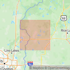
Pg. 63-67, geol. map. Falun Member of Trade River Formation. Calcareous, rhythmically laminated, rhythmically bedded, dark-grayish-brown to dark-brown massive clay, and dark-yellowish-brown to yellowish-brown silty clay. At reference section B includes silt and fine-grained sand at base. Thickness about 1 to 5 m. Extends into Pine County, Minnesota, where thickness exceeds 5 m. Unit is at or near surface; at type lies beneath tan to gray loose sand and mixed zone of sandy loam. Overlies red, ripple-bedded to lamininated, fine- to medium-grained sand of Copper Falls Formation; contact is sharp. Is similar to Sunrise Member of Copper Falls Formation, but is gray, more calcareous, thicker bedded, and occurs at higher stratigraphic position. Deposited in glacial Lake Grantsburg around 14,000 yr B.P. Many of rhythmic layers, interpreted to be varves, probably represent ice advance and retreat of Grantsburg Sublobe during Pine City Phase. Age is Pleistocene (late Wisconsinan).
Type section: btw. 280 and 283 m elevation, in excavation (June 1992) on south side of WI State Highway 70, about 1.9 mi (3 km) east of Grantsburg, in NE/4 NW/4 NE/4 sec. 19, T. 38 N., R. 18 W., [approx. Lat. 45 deg. 46 min. 20 sec. N., Long. 92 deg. 38 min. 15 sec. W.], Grantsburg 7.5-min quadrangle [1983 ed.], Burnett Co., northwestern WI. Named from community of Falun, Burnett Co., northwestern WI; name credited to Mark D. Johnson and Chris Hemstad.
Reference sections:
(1) section A, gravel pit on north side of M-Y Road, in NW/4 SW/4 SW/4 sec. 3, T. 37 N., R. 18 W., [approx. Lat. 45 deg. 43 min. 00 sec. N., Long. 92 deg. 35 min. 12 sec. W.], Trade Lake 7.5-min quadrangle, Burnett Co., northwestern WI; and
(2) section B, excavation (June 1992) on farm property, in NE/4 SE/4 NW/4 sec. 10, T. 39 N., R. 20 W., [approx. Lat. 45 deg. 53 min. 04 sec. N., Long. 92 deg. 49 min. 37 sec. W.], Cedar Lake 7.5-min quadrangle, Pine Co., eastern MN.
[Additional locality information from USGS historical topographic map collection TopoView, accessed on June 9, 2018.]
Source: Publication.
- Usage in publication:
-
- Falun Member
- Modifications:
-
- Overview
- AAPG geologic province:
-
- Wisconsin arch
Summary:
[Not synopsized to date. Lithology, thickness, distinguishing characteristics, contacts, sections, areal extent, age, correlations discussed.]
Pg. 4 (fig. 2), 7 (fig. 3), 8, 120-122. Falun Member of Trade River Formation.
Source: NA
For more information, please contact Nancy Stamm, Geologic Names Committee Secretary.
Asterisk (*) indicates published by U.S. Geological Survey authors.
"No current usage" (†) implies that a name has been abandoned or has fallen into disuse. Former usage and, if known, replacement name given in parentheses ( ).
Slash (/) indicates name conflicts with nomenclatural guidelines (CSN, 1933; ACSN, 1961, 1970; NACSN, 1983, 2005, 2021). May be explained within brackets ([ ]).