

- Usage in publication:
-
- Fairport chalky shale member*
- Modifications:
-
- Original reference
- Dominant lithology:
-
- Shale
- AAPG geologic province:
-
- Central Kansas uplift
Summary:
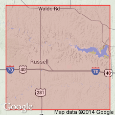
Pg. 16, 40. Fairport chalky shale member of Carlile shale. Chalky shale and thin beds of chalk, 85 feet thick, forming basal member of Carlile shale in Russell County, north-central Kansas. Replaces "Ostrea shales" of Logan. Underlies Blue Hill shale member of Carlile; beds below contact effervesce with acid and weather to light yellowish tints, those above the contact are free from lime and are dark bluish gray. Overlies Greenhorn limestone. Fossils (fish bones and scales, GLOBIGERINA, INOCERAMUS, OSTREA, etc.) are species found in lower part of Carlile of Colorado, Wyoming, and elsewhere. Age is Late Cretaceous.
Named from exposures a few mi south and west of Fairport, Russell Co., north-central KS.
Source: US geologic names lexicon (USGS Bull. 896, p. 716); supplemental information from GNU records (USGS DDS-6; Denver GNULEX).

- Usage in publication:
-
- Fairport chalky shale member*
- Modifications:
-
- Contact revised
- AAPG geologic province:
-
- Anadarko basin
- Central Kansas uplift
Summary:
Fairport chalky shale member of Carlile shale. In Ellis County, north-central Kansas, overlies Pfeifer shale member (new) of Greenhorn limestone. Nearly 150 miles to southwest, in Kearny and Hamilton Counties, overlies Bridge Creek limestone member (new) of Greenhorn [Pfeifer and underlying Jetmore are indistinguishable]. Age is Late Cretaceous.
Source: Modified from GNU records (USGS DDS-6; Denver GNULEX).

- Usage in publication:
-
- Fairport
- Modifications:
-
- Areal extent
- AAPG geologic province:
-
- Central Kansas uplift
- Anadarko basin
Summary:
Pg. 24. Fairport chalky shale member of Carlile shale of Colorado group. Shale, calcareous, and thin chalk beds, blue-gray to gray, weathers to light orange-tan; thin bentonite beds in base; chalky limestones more abundant near base. Thickness, 85 feet in Russell County to 147 feet in Hamilton County; average, 125 feet. Underlies Blue Hill shale member of Carlile and overlies Greenhorn limestone. Age is Late Cretaceous (Gulfian).
Source: Publication; US geologic names lexicon (USGS Bull. 1200, p. 1311).
- Usage in publication:
-
- Fairport chalky member*
- Modifications:
-
- Areal extent
- AAPG geologic province:
-
- Anadarko basin
Summary:
Pg. 121. Fairport chalky member of Carlile shale. In Baca County, Colorado, consists of alternating beds of chalky limestone and tan platy to fissile chalky shale. Age is Late Cretaceous.
Source: Publication; US geologic names lexicon (USGS Bull. 1200, p. 1311).

- Usage in publication:
-
- Fairport chalky shale member*
- Modifications:
-
- Areal extent
- AAPG geologic province:
-
- Denver basin
Summary:
Carlile shale mapped as a narrow band on southwest part of map in Jefferson Co, CO in the Denver basin, where it is in contact with the older Greenhorn limestone and with the younger Niobrara formation. Divisible into (ascending): Fairport chalky shale member about 25 ft thick, Blue Hill? shale member about 15 ft thick, and Codell sandstone member 2 ft thick. Ammonites identified in the Fairport and Codell. Of Late Cretaceous age. Geologic map.
Source: GNU records (USGS DDS-6; Denver GNULEX).
- Usage in publication:
-
- Fairport Member*
- Modifications:
-
- Areal extent
- AAPG geologic province:
-
- Las Vegas-Raton basin
Summary:
Fairport Member, basal member of Carlile Formation, areally extended to Gold Creek exposure in sec 4, T31N, R17E, Colfax Co, NM in the Las Vegas-Raton basin. Is 32 ft thick in measured section where it overlies Bridge Creek Limestone Member of Greenhorn Formation and underlies the lower unit of Blue Hill Shale Member of Carlile. Is composed of medium-gray, very calcareous to limy shale. Petroliferous, bioclastic limestone 2-4 in thick at top composed of INOCERAMUS prisms and GLOBOGERINA forams. Of Cretaceous age.
Source: GNU records (USGS DDS-6; Denver GNULEX).
- Usage in publication:
-
- Fairport Member*
- Modifications:
-
- Areal extent
- AAPG geologic province:
-
- Sioux uplift
Summary:
Is present as the basal member--one of four members--of the Carlile Shale at Lake Traverse, Traverse Co, MN on the Sioux uplift. Overlies Greenhorn Formation. Underlies Blue Hill Member of Carlile. Is 2.3 m thick. Late Cretaceous age. Of shallow water marine origin.
Source: GNU records (USGS DDS-6; Denver GNULEX).
- Usage in publication:
-
- Fairport Member*
- Modifications:
-
- Biostratigraphic dating
- AAPG geologic province:
-
- Chadron arch
Summary:
Is member of Carlile Shale. Biostratigraphic dating on basis of ammonites. Collections of ammonites from top of Fairport Member at USGS Mesozoic locality D9128 in NE1/4 SW1/4 sec 28, T35N, R47W, Dawes Co, NE on Chadron arch indicates PRIONOCYCLUS PERCARINATUS zone of middle Turonian (Late Cretaceous) age.
Source: GNU records (USGS DDS-6; Denver GNULEX).
For more information, please contact Nancy Stamm, Geologic Names Committee Secretary.
Asterisk (*) indicates published by U.S. Geological Survey authors.
"No current usage" (†) implies that a name has been abandoned or has fallen into disuse. Former usage and, if known, replacement name given in parentheses ( ).
Slash (/) indicates name conflicts with nomenclatural guidelines (CSN, 1933; ACSN, 1961, 1970; NACSN, 1983, 2005, 2021). May be explained within brackets ([ ]).