The National Geologic Map Database is migrating to a new infrastructure. We apologize for any service disruptions during this process.
|
|---|


- Usage in publication:
-
- Everona limestone
- Modifications:
-
- Named
- Dominant lithology:
-
- Limestone
- AAPG geologic province:
-
- Piedmont-Blue Ridge province
Summary:
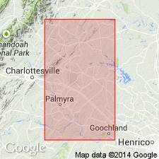
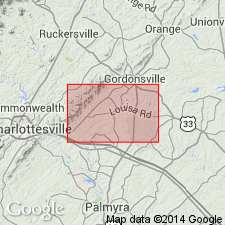
Everona limestone (new name) occurs as a narrow belt of blue slaty limestone exposed from Mitchells Ford, on Rapidan River, to southwest of Rivanna River near Charlottesville, VA. The limestone is blue, crystalline, with slaty partings, closely crumpled, with breaks cemented by secondary white calcite, and is interbedded with thin, blue, only slightly calcareous slates, which form a considerable part of the formation. Probably of same age as Frederick limestone of MD, which Bassler concludes is probably Chazy. Is believed to be in fault contact with Wissahickon schist.
Source: GNU records (USGS DDS-6; Reston GNULEX).
- Usage in publication:
-
- Everona Limestone
- Modifications:
-
- Overview
- Age modified
- AAPG geologic province:
-
- Piedmont-Blue Ridge province
Summary:
Everona Limestone described as blue gray, thin bedded, and fine grained. Beds are separated by thin, opaque, stylolitic seams, composed partly of pyrite and graphite(?). Unit can be traced along a linear depression diagonally across southeastern Keswick and northwestern Boswells Tavern quads. Eight outcrops are present within the map area, most in abandoned quarries. Upper and lower contacts not exposed. Rock is polydeformed by movement along the Mountain Run fault zone. Everona was included in Pavlides' (1989) formation at True Blue. It is here considered to be Cambrian.
Source: GNU records (USGS DDS-6; Reston GNULEX).
- Usage in publication:
-
- Everona Limestone Member*
- Modifications:
-
- Revised
- Age modified
- AAPG geologic province:
-
- Piedmont-Blue Ridge province
Summary:
Rank reduced to member of True Blue Formation (new). Jonas (1927) originally described the Everona Limestone as occurring in a 2-mi-wide belt extending from Mitchells Ford on Rapidan River to southwest of Rivanna River near Charlottesville, VA, in a valley northwest of Wissahickon Schist of her usage. Mack (1965), however, mapped Everona Formation as a limestone unit 200 m thick extending from Rockfish Creek in Albemarle Co. to Potomac River. He describes the unit as containing 5 lithologic variations, including banded limestone, massive limestone, slaty limestone, ferruginous limestone, and black slate. This differs from definition of Jonas (1927). Pavlides (1988) stated that Everona was deposited as lenses instead of as a contiguous formation of regional extent, as would be argued by Mack (1965). For this reason, it is assigned member status. As used herein, it is a gray-blue, fine-grained, thin-bedded and finely laminated, silty to nearly pure metalimestone with outcrop widths of about 160 m. Jonas (1927) had assigned Ordovician age to Everona based on lithologic similarity to Frederick Limestone of MD. Since then, Reinhardt (1974) subdivided Frederick into 3 members and assigned a Late Cambrian age to them and an Early Ordovician age to overlying Grove Formation. Reinhardt's descriptions, and comparisons in the field of the MD units with Everona do not indicate similarity. Age is changed from Ordovician of Jonas (1927) to provisional Cambrian(?) and (or) Ordovician(?) due to lack of paleontologic data.
Source: GNU records (USGS DDS-6; Reston GNULEX).
For more information, please contact Nancy Stamm, Geologic Names Committee Secretary.
Asterisk (*) indicates published by U.S. Geological Survey authors.
"No current usage" (†) implies that a name has been abandoned or has fallen into disuse. Former usage and, if known, replacement name given in parentheses ( ).
Slash (/) indicates name conflicts with nomenclatural guidelines (CSN, 1933; ACSN, 1961, 1970; NACSN, 1983, 2005, 2021). May be explained within brackets ([ ]).