

- Usage in publication:
-
- Ervay tongue
- Modifications:
-
- Original reference
- Dominant lithology:
-
- Limestone
- AAPG geologic province:
-
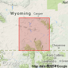
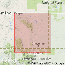
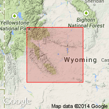
- Wind River basin
Summary:
Pg. 1664, 1666. Ervay tongue of Phosphoria formation. The uppermost limestones of Phosphoria formation, which extend east and south from Wind River and Owl Creek Mountains as a fairly widespread tongue. Crops out a few hundred feet west of Ervay, a post office in Natrona County, Wyoming, near northern end of Rattlesnake Hills, Natrona County, and also at such scattered localities as Ferris Mountains, Green Mountains, and Alcova. Thickness 9 to 16 feet. The tongue is not as well exposed near Ervay as on the head of Casper Creek near Garfield Peak, about 15 miles south of Ervay, where it forms the dip-slope of a prominent hogback. Type section is on Casper Creek. [Fossils of the tongue are listed.] Underlies Dinwoody formation and grades laterally into Freezeout tongue of Chugwater formation. Age is Permian.
Source: US geologic names lexicon (USGS Bull. 896, p. 697).
- Usage in publication:
-
- Ervay carbonate rock member*
- Modifications:
-
- Revised
- AAPG geologic province:
-
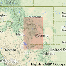
- Green River basin
- Wind River basin
- Yellowstone province
Summary:
Pg. 3 (fig. 1), 19-20, pls. 2, 3; see also V.E. McKelvey and others, 1956, AAPG Bull., v. 40, no. 12, p. 2832 (fig. 3), 2844. Ervay carbonate rock member of Park City formation. In this report, beds that Thomas (1934) called Phosphoria in Wind River Mountains are designated Park City formation; hence, Ervay is considered member of Park City. Extends to northern Wind River Mountains where it is 30 to 40 feet thick; north and west of this, grades into upper member of Shedhorn sandstone; west of Big Piney, grades into Tosi chert member of Phosphoria. Mostly limestone in its western area and dolomite in its eastern area. Underlies Dinwoody formation. Fossils (see section by J.S. Williams, p. 37-38). Age is Late Permian. [Members of Phosphoria, Park City, and Shedhorn formations are referred to as tongues in areas where they occur singly or are subordinate parts of the interval.]
Source: US geologic names lexicon (USGS Bull. 1200, p. 1276-1277).
- Usage in publication:
-
- Ervay Member*
- Modifications:
-
- Revised
- AAPG geologic province:
-
- Green River basin
Summary:
Reassigned as one of eight members of the Goose Egg Formation in Albany and Carbon Cos, WY in the Greater Green River basin. Overlies the newly named Difficulty Shale Member of the Goose Egg. Underlies the Freezeout Shale Member (restricted), newly assigned to the Goose Egg. Ervay as used in this report includes not only the 6 ft included at the type, but also an additional 98 ft of the underlying interbedded gypsum, carbonate rock, and shale. Changes lithology in WY from limestone and dolomitic limestone in the west part of the state to dolomite in the middle part to gypsum in the east part. Anhydrite and thin reddish claystone or mudstone are interbedded with gypsum in the eastern facies. Is 5 to 10 ft thick in southern WY. Correlation chart; cross section. Of Late Permian age.
Source: GNU records (USGS DDS-6; Denver GNULEX).
- Usage in publication:
-
- Ervay Limestone Member*
- Modifications:
-
- Redescribed
- Dominant lithology:
-
- Limestone
- Dolomite
- AAPG geologic province:
-
- Wind River basin
Summary:
Name redescribed as Ervay Limestone Member in Wind River Canyon, Fremont Co, WY in Wind River basin. Is composed of light- to yellowish-gray dolomitic limestone and shale. Contains oolitic limestone and algal stromalolitic beds in upper part. Was probably deposited in an intertidal and supratidal environment.
Source: GNU records (USGS DDS-6; Denver GNULEX).
For more information, please contact Nancy Stamm, Geologic Names Committee Secretary.
Asterisk (*) indicates published by U.S. Geological Survey authors.
"No current usage" (†) implies that a name has been abandoned or has fallen into disuse. Former usage and, if known, replacement name given in parentheses ( ).
Slash (/) indicates name conflicts with nomenclatural guidelines (CSN, 1933; ACSN, 1961, 1970; NACSN, 1983, 2005, 2021). May be explained within brackets ([ ]).