The National Geologic Map Database is migrating to a new infrastructure. We apologize for any service disruptions during this process.
|
|---|


- Usage in publication:
-
- Ernst Member
- Modifications:
-
- First used
- AAPG geologic province:
-
- Permian basin
Summary:
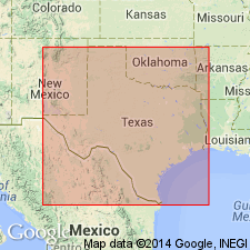
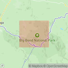
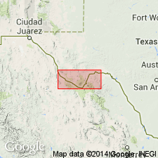
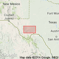
Pg. 12-33, pI. 1. Ernst Member, basal member of Boquillas Formation of Terlingua Group (revised). Present in San Vicente-Hot Springs area, Brewster County, southwestern Texas. Gray, buff, and yellowish-brown flaggy limestone interbedded with gray and buff marl. Thickness about 475 feet. Includes Udden's (1907) Boquillas Flags. Considered correlative in part with Eagle Ford Formation of Val Verde County, Texas. Overlies Buda Limestone. Underlies San Vicente Member (new) of Boquillas. Members are separated by an erosion surface, but beds below and above the diastem are so nearly alike that it is difficult to distinguish between them unless the rocks are fossiliferous. Fossils: Ammonite ALLOCRIOCERAS HAZZARDI identified from 3-foot-thick brown siliceous limestone ledge about 330 feet above base; COILOPOCERAS sp. zone at top. Age is Late Cretaceous (Gulfian).
Source: US geologic names lexicon (USGS Bull. 1350, p. 245); supplemental information from GNU records (USGS DDS-6; Denver GNULEX).
- Usage in publication:
-
- Ernst Member
- Modifications:
-
- Named
- Dominant lithology:
-
- Limestone
- Siltstone
- Clay
- AAPG geologic province:
-
- Permian basin
Summary:
Pg. 55-64, pI. Ernst Member, lower member of Boquillas Formation (redefined) of Terlingua Group (revised). Formal proposal of name. Consists of silty limestone flags, siltstone, and calcareous clay. Flagstones usually 2 to 5 inches thick with some as thick as 10 to 18 inches. Clay partings not prominent on fresh surfaces, but in vertical weathered surfaces they disintegrate like mortar in an old brick wall, leaving harder flagstones well exposed. Flagstone and clay are bluish gray; weather light yellowish-gray or buff. Thickness 450 feet in Big Bend National Park. Fossil ammonites, pelecypods, echinoids, and foraminifers identified. Ammonites establish at least a partial correlation with the Eagle Ford elsewhere in Texas. Correlates (pl. VIII) with lower part of Sawmill Mountain Member of Boquillas Formation in Agua Fria area, northwest of the Park. Approximately equivalent to Udden's (1907) Boquillas Flags. Underlies San Vicente Member of Boquillas. Overlies Buda Limestone. Age is Late Cretaceous (Gulfian; Turonian and Coniacian).
Named from Ernst Tinaja about 2 mi east-northeast of old Boquillas Post Office, Brewster Co., southwestern TX. Three sections (measured by planetable) in San Vicente-Hot Springs area, Brewster Co., southwestern TX; complete section about 1.5 mi north of Rio Grande (pl. VIII, no. 21), 469 ft thick. [According to GNU records (USGS DDS-6; Denver GNULEX, March 17, 1989), type locality not designated.]
Source: US geologic names lexicon (USGS Bull. 1350, p. 245); supplemental information from GNU records (USGS DDS-6; Denver GNULEX).
- Usage in publication:
-
- Ernst Member
- Modifications:
-
- Mapped 1:250k
- Dominant lithology:
-
- Limestone
- Siltstone
- Clay
- AAPG geologic province:
-
- Permian basin
Summary:
Ernst Member of Boquillas Formation. Not separately mapped (Boquillas Formation, undivided, mapped in Presidio and Brewster Counties, Texas). Consists of limestone, siltstone, and clay. Limestone, silty ranging to siltstone, flaggy, beds mostly 2 to 5 inches, some up to 15 inches; clay mostly as partings; bluish-gray, weathers light yellowish-gray to light brownish-yellow, blocky from joints; marine megafossils and microfossils common. Thickness 277 feet in Black Gap area, 450 feet in Big Bend National Park, 600+ feet in Tascotal Mesa quadrangle, and 1,000 feet in Terlingua area. Equivalent to Boquillas Flags, mapped in eastern part of sheet. Overlies Buda Limestone (Lower Cretaceous). Underlies San Vicente Member, upper member of Boquillas Formation. Age is Late Cretaceous.
Source: Publication; supplemental information from GNU records (USGS DDS-6; Denver GNULEX).
- Usage in publication:
-
- Ernst Member
- Modifications:
-
- Mapped 1:250k
- Dominant lithology:
-
- Limestone
- Siltstone
- Clay
- AAPG geologic province:
-
- Permian basin
Summary:
Is lower member of two in Boquillas Formation as mapped south of Del Norte Mountains in Brewster Co, TX (southern part of Permian basin). Ernst Member not separately mapped. Overlies Buda Limestone. Overlain by San Vicente Member of Boquillas. Consists of limestone, siltstone, and clay; limestone, silty, ranging to siltstone, flaggy; clay mostly as partings, bluish gray, weathers light yellowish gray to light brownish gray, blocky from joints; marine megafossils and microfossils common. Is not recognized in southeastern part of map area (southern Terrell Co, TX). Age is Late Cretaceous.
Source: GNU records (USGS DDS-6; Denver GNULEX).
For more information, please contact Nancy Stamm, Geologic Names Committee Secretary.
Asterisk (*) indicates published by U.S. Geological Survey authors.
"No current usage" (†) implies that a name has been abandoned or has fallen into disuse. Former usage and, if known, replacement name given in parentheses ( ).
Slash (/) indicates name conflicts with nomenclatural guidelines (CSN, 1933; ACSN, 1961, 1970; NACSN, 1983, 2005, 2021). May be explained within brackets ([ ]).