

- Usage in publication:
-
- Englewood limestone*
- Modifications:
-
- Named
- Dominant lithology:
-
- Limestone
- AAPG geologic province:
-
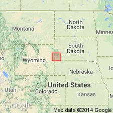
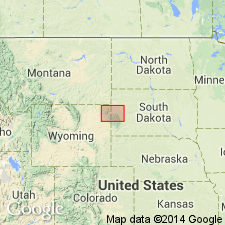
- Chadron arch
- Williston basin
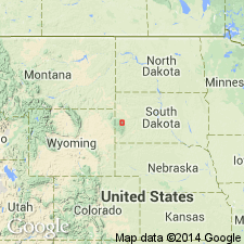
Summary:
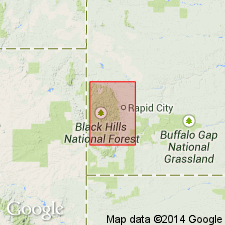
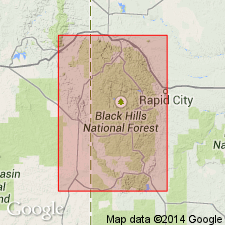
Named as a formation in the Black Hills, SD. No type locality designated, no measured sections. Name ascribed to T. A. Jagger, Jr., from a locality (not identified) in the northern Black Hills. Consists of pale, pinkish-buff limestones averaging 20-30 ft in thickness. Merges rapidly into the overlying [Pahasapa] limestone (new), occasionally with a few ft of impure buff limestone intervening. Is usually sharply separated from the underlying Deadwood formation (new), but only by a sudden change in materials. In the northern Black Hills, Englewood and Deadwood are separated by a mass of buff limestone and some shales, the age of which has not been determined. Is fossiliferous, containing numerous corals and occasional shells. Carboniferous in age, correlated with Chouteau, or Kinderhook of the Mississippi Valley.
Source: GNU records (USGS DDS-6; Denver GNULEX).
- Usage in publication:
-
- Englewood limestone*
- Modifications:
-
- Revised
- Overview
- AAPG geologic province:
-
- Williston basin
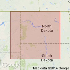
Summary:
In northern Black Hills, SD, Williston basin, Mississippian Englewood limestone is underlain by Ordovician Whitewood limestone, a new unit. Extends throughout the Black Hills area. No discordance with underlying unit. Fossils (brachiopods, ectoproct, nautiloids, mollusks, crinoids) reported. Correlated with Kinderhook [Early Mississippian] rocks.
Source: GNU records (USGS DDS-6; Denver GNULEX).
- Usage in publication:
-
- Englewood limestone*
- Modifications:
-
- Overview
- Dominant lithology:
-
- Limestone
- Shale
- AAPG geologic province:
-
- Williston basin
Summary:
Designates type locality near Englewood, Lawrence Co, SD in Williston basin. Previously called Eocarboniferous limestone in northern Black Hills (Jagger, 1901, U.S. Geological Survey 21st Annual Rpt, Pt. 3, p. 181). Describes section (in vicinity of type locality) along the Burlington and Missouri River RR, 2 mi southwest of Englewood, sec 30 or 31, T4N, R3E, Lawrence Co, SD. Here formation consists of (descending): purplish limestones, 50 ft; greenish-gray shales (in railroad cut), 14 ft. Overlain by Pahasapa limestone; underlain by Cambrian rocks (Deadwood formation) below a covered interval [at type section]. Carboniferous (Chouteau or Kinderhook) in age.
Source: GNU records (USGS DDS-6; Denver GNULEX).
- Usage in publication:
-
- Englewood limestone*
- Modifications:
-
- Overview
- AAPG geologic province:
-
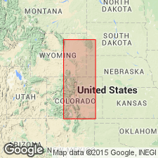
- Powder River basin
- Williston basin
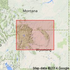
Summary:
Describes formation in the northern Black Hills, SD and WY, in Williston and Powder River basins. Measured section in Whitewood Gulch, below town of Deadwood (sec 13, T5N, R3E, Lawrence Co, SD in Williston basin) consists of (descending): purple, shaly limestone, stained bright yellow, merging up into gray, massive limestone streaked with dark-red hematite, many calcite druses, soft; gray, slaty shale, 7 ft; yellow shale (lies on Whitewood limestone), 8 ft. Not distinctly recognizable in the Bear Lodge uplift (Crook Co, WY in the Powder River basin), but possibly is represented there by sandy beds at base of Pahasapa limestone. Lists fossils identified by G. H. Girty. Fauna represents an early stage of the Mississippian or Lower Carboniferous, and may be correlated with Chouteau limestone of MO.
Source: GNU records (USGS DDS-6; Denver GNULEX).
- Usage in publication:
-
- Englewood limestone*
- Modifications:
-
- Revised
- Overview
- AAPG geologic province:
-
- Williston basin
- Chadron arch
Summary:
Revises lower boundary upward in the vicinity of the type locality. States that on Whitewood Creek above Englewood station, Lawrence Co, SD in Williston basin, the [Englewood] limestone has a deep, purplish tint. Its upper part is thin bedded, but is more massive below. In this region, Englewood lies on a greenish-gray shale at top of Deadwood. [Shale of this description was included by Jagger (1904) in Englewood limestone in a section 2 mi south of Englewood.] In the region north of Deadwood, in Lawrence Co, the limestone grades into 15 ft of gray and yellow shale regarded as a lower member. Correlated provisionally with the Kinderhook group of the Mississippian of the Mississippi Valley. Describes formation at various places in the Black Hills uplift, SD in Williston basin and on Chadron arch.
Source: GNU records (USGS DDS-6; Denver GNULEX).
- Usage in publication:
-
- Englewood formation
- Modifications:
-
- Areal extent
- AAPG geologic province:
-
- Williston basin
Summary:
Name extended to central ND, Williston basin, for black, carbonaceous shale top and base, separated by gray, silty, dolomitic limestone, gray shale, and calcareous siltstone in middle part, at depths of 6,360 to 6,390 ft in the Carter Oil Co., Emma L. Semling No. 1 well, SE1/4 SE1/4 sec 18, T141N, R81W, Oliver Co, ND. Overlain by Lodgepole formation; underlain by Amaranth formation. Mississippian in age.
Source: GNU records (USGS DDS-6; Denver GNULEX).
- Usage in publication:
-
- Englewood limestone
- Modifications:
-
- Overview
- AAPG geologic province:
-
- Chadron arch
- Williston basin
Summary:
Name used in Black Hills, SD, in Williston basin and on the Chadron arch. Is of later Kinderhook age. Shale constitutes the base of the formation at some outcrops and may correspond to black, Kinderhook shale in other regions.
Source: GNU records (USGS DDS-6; Denver GNULEX).
- Usage in publication:
-
- Englewood limestone
- Modifications:
-
- Overview
- AAPG geologic province:
-
- Williston basin
- Chadron arch
- Powder River basin
Summary:
Describes characteristics of formation in Black Hills, SD and WY, in Williston and Powder River basins and on Chadron arch. Changes from a brick-red, calcareous shale at base to nearly pure, light-pink limestone at top. Insoluble residues show a steady decrease in red clay residue at top of section. Residue drops suddenly to a trace near Pahasapa-Englewood contact; no evident unconformity at contact. Pink color may disappear at same point, or several ft higher or lower in section. Break in residues may be a better dividing point than the more obvious disappearance of pink coloration. Gray shale underlies the typical limestone in an exposure above junkyard in lower Deadwood, and chert occurs in layers 1/2 to 1 in thick, and makes up an estimated 10 percent of upper part of formation west of head where Icebox Canyon enters Spearfish Canyon. Both localities are in Lawrence Co, SD. Both gray shale and chert are characteristic of Paine member of Lodgepole formation of Madison series, with which Englewood is tentatively correlated. Fossils (corals, brachiopods, and sharks' teeth) indicate correlation with Kinderhook of Mississippi Valley.
Source: GNU records (USGS DDS-6; Denver GNULEX).
- Usage in publication:
-
- Englewood formation
- Modifications:
-
- Areal extent
- AAPG geologic province:
-
- Williston basin
Summary:
Uses term Englewood formation for rocks assigned to Bakken formation by Nordquist (1952) in Amerada Petroleum Corp., H. O. Bakken no. 1 well, Williams Co, ND in Williston basin. Overlain by Lodgepole limestone; underlain by Lyleton formation. Contacts are conformable. Mississippian in age.
Source: GNU records (USGS DDS-6; Denver GNULEX).
- Usage in publication:
-
- Englewood formation
- Modifications:
-
- Overview
- AAPG geologic province:
-
- Williston basin
- Powder River basin
- Chadron arch
Summary:
Is a formation in Madison group in Black Hills area, SD and WY, in Williston and Powder River basins and on the Chadron arch. Together with the lower part of overlying Pahasapa formation, comprises the lowest of three depositional sequences in Madison group in WY, southern MT, and adjacent parts of ND, SD, and NE. Mississippian in age.
Source: GNU records (USGS DDS-6; Denver GNULEX).
- Usage in publication:
-
- Englewood formation
- Modifications:
-
- Overview
- AAPG geologic province:
-
- Williston basin
Summary:
In Little Elk, Spearfish, and Whitewood Canyons, Lawrence Co, SD, in Williston basin, formation averages 50 ft thick, lies disconformably between underlying Whitewood and overlying Pahasapa formations, and comprises two members. One (at base) is varicolored shale and subordinate limestone, 30-40 ft thick; the other (at top) is buff dolomite, 5-20 ft thick. Early Mississippian in age.
Source: GNU records (USGS DDS-6; Denver GNULEX).
- Usage in publication:
-
- Englewood limestone
- Modifications:
-
- Revised
- AAPG geologic province:
-
- Williston basin
- Chadron arch
Summary:
Assigned to Madison group together with overlying Pahasapa limestone, where they outcrop in the Black Hills, SD, in Williston basin and on Chadron arch.
Source: GNU records (USGS DDS-6; Denver GNULEX).
- Usage in publication:
-
- Englewood Formation
- Modifications:
-
- Age modified
- Biostratigraphic dating
- AAPG geologic province:
-
- Williston basin
Summary:
Conodonts indicate that Englewood Formation of Black Hills is in part upper Devonian and in part Lower Mississippian. Previously only Lower Mississippian. The conodont fauna that occurs in the middle part (between 10-34 ft from top) of Englewood Formation in Boxelder Canyon, Meade Co, SD, in Williston basin, are of late Late Devonian age. Is correlated with a previously described Upper Devonian fauna from Bighorn and Wind River Mountains. Fauna from the top 10 ft of Englewood in Box Elder Co, and from the top 2 ft in Whitewood Canyon (Lawrence Co) are of the Early Mississippian. Age of Englewood therefore modified from Late Devonian to Late Devonian and Early Mississippian at these localities. The upper few ft of Englewood and basal part of Pahasapa Formation at Boxelder Canyon and at Whitewood Canyon, Lawrence Co, SD, in Williston basin, contain diagnostic Lower Mississippian conodonts. Detailed descriptions of the formation showing faunal collections are given at Boxelder Canyon, sec 7, T2N, R6E, Meade Co, SD, and at Whitewood Canyon, sec 13, T5N, R3E, Lawrence Co, SD. Mississippian-Devonian boundary placed 10 ft below top of formation at Boxelder Canyon, and 13 ft below top of formation at Whitewood Canyon.
Source: GNU records (USGS DDS-6; Denver GNULEX).
- Usage in publication:
-
- Englewood Formation
- Modifications:
-
- Overview
- Reference
- Dominant lithology:
-
- Limestone
- Shale
- AAPG geologic province:
-
- Williston basin
Summary:
Gives measured section at type locality in a railroad cut of Chicago, Burlington, and Quincy RR, NW1/4 NW1/4 sec 31, T4N, R3E, Lawrence Co, SD in Williston basin [approximately same locality as section described by Jagger, 1904]. Consists of grayish-red-purple argillaceous limestone, thin- to medium-bedded, occasional shale partings, 24 ft 2 in; overlain by yellowish-gray dolomitic limestone, 1 ft 9 in. Total thickness about 26 ft. Overlain transitionally by Pahasapa Limestone; overlies unconformably Roughlock Member of Winnipeg Formation. Designates a reference section at Deadwood junkyard, east side of Whitewood Creek north of U.S. Hwy 14 near its junction with U.S. Hwy 85, in NE1/4 SE1/4 sec 13, T5N, R3E, Lawrence Co, SD. Consists of (ascending): dark-gray, greenish-black, and medium-gray shale about 27 ft thick; grayish-red-purple argillaceous and partly shaly limestone, about 25 ft thick; yellowish-gray dolomitic limestone, about 5 ft thick. Total thickness 57 ft 7 in. Transitional contact with underlying Whitewood Dolomite. Equivalent in ND to Bakken Formation and lower part of Lodgepole Limestone. Early Mississippian (Kinderhook) in age.
Source: GNU records (USGS DDS-6; Denver GNULEX).
- Usage in publication:
-
- Englewood Formation*
- Modifications:
-
- Age modified
- Overview
- Biostratigraphic dating
- AAPG geologic province:
-
- Williston basin
- Powder River basin
- Chadron arch
Summary:
Underlies Pahasapa Limestone (Mississippian) which is equivalent to a large part of Madison Limestone, and is separated from Pahasapa at some localities in northern Black Hills, in Williston and Powder River basins, by an angular unconformity. Truncates progressively older beds southward. These range from Three Forks Formation of Late Devonian age in subsurface northeast of Black Hills, to Deadwood Formation of Late Cambrian age at south end of Black Hills. Thickness ranges from 18-54 ft at 6 sections measured by author in various parts of Black Hills. Contains conodont faunas equated to both Upper Devonian (toV) and Lower Carboniferous of Europe (Klapper, Furnish, 1962). On basis of their age determinations in Black Hills, and author's stratigraphic correlation between Englewood Formation at Coldbrook Canyon, (Fall River Co, SD, on Chadron arch, in south end of Black Hills), and equivalent rocks at Sand Canyon (Hartville area), from which Love and others (1953) reported a Late Devonian brachiopod fauna, age of Englewood Formation is here recognized as Late Devonian and Early Mississippian rather than only Early Mississippian as thought in most of the earlier reports.
Source: GNU records (USGS DDS-6; Denver GNULEX).
- Usage in publication:
-
- Englewood Formation*
- Modifications:
-
- Overview
- AAPG geologic province:
-
- Williston basin
- Powder River basin
- Denver basin
- Chadron arch
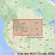
Summary:
Map shows distribution and thickness in SD, ND, northwestern NE, eastern WY, and southeastern MT, Williston, Powder River, and Denver basins, and on Chadron arch. As much as 90 ft thick in subsurface, northeastern SD, Williston basin and 18-54 ft thick in outcrops in Black Hills uplift, SD and WY, in Williston and Powder River basins and on Chadron arch. Is equivalent to Cottonwood Canyon Member [of Madison Limestone in WY, or Lodgepole Limestone in MT]. The lithologic character, stratigraphic relations, and age of these two units is very similar and their depositional areas may once have coalesced. The uppermost parts of Englewood and Bakken Formations of northern MT and ND also coalesced locally, and a vestigial connection is preserved in central ND. Conformable contact with overlying Pahasapa Limestone. Possible intraformational unconformity at about the Mississippian-Devonian contact. Unconformable contact with underlying Three Forks Formation or older rocks. Uppermost Mississippian and lowermost Devonian in age.
Source: GNU records (USGS DDS-6; Denver GNULEX).
- Usage in publication:
-
- Englewood Formation*
- Modifications:
-
- Areal extent
- Overview
- Contact revised
- AAPG geologic province:
-
- Wind River basin
- Powder River basin
- Denver basin
Summary:
Overlies the newly named Fremont Canyon Sandstone and underlies Madison Limestone in southeast WY from Fremont Canyon, Natrona Co, in the Wind River basin to northern Laramie Range, Converse Co, in the Powder River basin to Hartville Canyon, Platte Co, in the Denver basin. Replaces use of Guernsey Formation (part) in report area. Basal contact placed at base of lowest red siltstone above the quartz sandstone of the Fremont Canyon. Upper contact placed at base of lowest cherty, non-sandy dolomicrite of the Big Goose Member of Madison. Was deposited in a peritidal environment during late Famennian (Late Devonian) and Kinderhookian (Early Mississippian) time. The system boundary is a disconformity. Contains conodonts, forams, and corals. Is equivalent to the Cottonwood Canyon Member of the Madison of north-central WY.
Source: GNU records (USGS DDS-6; Denver GNULEX).
- Usage in publication:
-
- Englewood Formation*
- Modifications:
-
- Overview
- Age modified
- AAPG geologic province:
-
- Powder River basin
- Williston basin
Summary:
Assigned to base of author's stratigraphic sequence 4 (Kinderhookian to lower Meramecian). Occurs within Powder River and Williston basins of study area. Is at least partially equivalent to unnamed basal clastic unit which is time transgressive throughout its areal extent and which is also at least partially equivalent to Cottonwood Canyon Member of Madison or Lodgepole Limestones, Bakken Formation, Paine Member of Lodgepole Limestone, Exshaw Formation, Leatham Formation, Sappington Member of Three Forks Formation, lower part of Guernsey Formation, and others. Englewood and equivalents are disconformable above equivalents of Upper Devonian part of Three Forks Formation in northwest part of study area and above older rocks throughout remainder of area. Basal deposits of sequence 4 were laid down during an early stage of the Ancestral Front Range and Pathfinder uplifts and are overlain conformably (fig. 35) by carbonate rocks deposited during Kinderhookian transgression onto the Wyoming shelf. Maughan (1963, USGS Prof. Paper 475-C) assigned basal clastic unit in Laramie Range to the Mississippian and reported that contact with overlying limestone is gradational and intertonguing. Follows Kinderhookian age assignment of some previous workers.
Source: GNU records (USGS DDS-6; Denver GNULEX).
For more information, please contact Nancy Stamm, Geologic Names Committee Secretary.
Asterisk (*) indicates published by U.S. Geological Survey authors.
"No current usage" (†) implies that a name has been abandoned or has fallen into disuse. Former usage and, if known, replacement name given in parentheses ( ).
Slash (/) indicates name conflicts with nomenclatural guidelines (CSN, 1933; ACSN, 1961, 1970; NACSN, 1983, 2005, 2021). May be explained within brackets ([ ]).