The National Geologic Map Database is migrating to a new infrastructure. We apologize for any service disruptions during this process.
|
|---|


- Usage in publication:
-
- Endicott Group*
- Modifications:
-
- Named
- Biostratigraphic dating
- Dominant lithology:
-
- Shale
- Sandstone
- Conglomerate
- AAPG geologic province:
-
- Alaska Northern region
Summary:
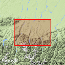
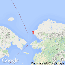
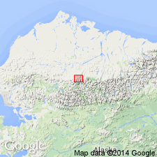
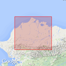
Named for exposures at type area in Endicott Mountains, central Brooks Range, northern AK. Occurs in DeLong and Baird Mountains at western end of Brooks Range, Shainin Lake area of Endicott Mountains, and Romanzof and Philip Smith Mountains of eastern Brooks Range. Composed of shale, sandstone and conglomerate deposited in paralic environment. Consists of (ascending): Hunt Fork Shale (1000 to 1500 m thick) and Noatak Sandstone (200 to 1000 m thick) in southern DeLong Mountains; Hunt Fork Shale, Kanayut Conglomerate (500 to 1500 m thick), and Kayak Shale (less than 300 m thick) in Shainin Lake area of Endicott Mountains; and Kekiktuk Conglomerate (0 to 100 m thick) and Kayak(?) Shale in Romanzof Mountains. Total thickness for group ranges 2000 to 4400 m. Overlies Skajit Limestone (Baird Group), or a locally intervening unnamed limestone, siltstone, conglomerate, and graywacke unit. Underlies Lisburne Group. Considered to be a relatively autochthonous unit that has been superposed by the allochthonous Baird Group and then folded. Age is Late Devonian and Early and Late Mississippian based on corals, brachiopods and plants. CYRTOSPIRIFERER sp is most common fossil.
Source: GNU records (USGS DDS-6; Menlo GNULEX).
- Usage in publication:
-
- Endicott Group
- Modifications:
-
- Revised
- AAPG geologic province:
-
- Alaska Northern region
Summary:
Itkilyariak Formation (new) assigned to Endicott Group as uppermost formation in Sadlerochit Mountains of northeast Brooks Range area. Overlies Kayak-Kekiktuk Formations undivided.
Source: GNU records (USGS DDS-6; Menlo GNULEX).

- Usage in publication:
-
- Endicott Group*
- Modifications:
-
- Revised
- AAPG geologic province:
-
- Alaska Northern region
Summary:
Itkilyariak Formation of Mull and Mangus (1972) adopted as uppermost formation in Endicott Group in eastern Sadlerochit Mountains, northeastern Brooks Range.
Source: GNU records (USGS DDS-6; Menlo GNULEX).
- Usage in publication:
-
- Endicott Group*
- Modifications:
-
- Areal extent
- AAPG geologic province:
-
- Alaska Northern region
Summary:
Endicott Group extended into area between Cape Thompson and Cape Dyer of the Lisburne Peninsula, at expense of previously unnamed rocks. Consists of (ascending) Mississippian informal Kapaloak sequence (marine and fluvial) and unnamed Upper Mississippian (marine) shale.
Source: GNU records (USGS DDS-6; Menlo GNULEX).
- Usage in publication:
-
- Endicott Group
- Modifications:
-
- Revised
- AAPG geologic province:
-
- Alaska Northern region
Summary:
Kurupa Sandstone (new) assigned to Endicott Group, in area near Kurupa Hills, Killik River quad, north central Alaska. Overlies Hunt Fork Shale(?). Underlies Kayak Shale.
Source: GNU records (USGS DDS-6; Menlo GNULEX).
- Usage in publication:
-
- Endicott Group*
- Modifications:
-
- Age modified
- AAPG geologic province:
-
- Alaska Northern region
Summary:
Overall unit age revised. Age is Late Devonian to Early Permian(?) based on biostratigraphic dating of Early to Middle Pennsylvanian foraminifers and Kamaenid algae present in undivided part of unit (in subsurface) at J.W. Dalton no. 1 well (on northeast part of Naval Petroleum Reserve of Alaska). Shown on bedrock geologic map of NPRA.
Source: GNU records (USGS DDS-6; Menlo GNULEX).
- Usage in publication:
-
- Endicott Group*
- Modifications:
-
- Revised
- AAPG geologic province:
-
- Alaska Northern region
Summary:
Unit revised to adopt and include Kurupa Sandstone of Mull and others (1987) who named Kupura Sandstone as middle member of Endicott Group in Picnic Creek allochthon in Killik River-Kurupa Hills area. [Kurupa Sandstone overlies Hunt Fork Shale(?) and underlies Kayak Shale (both of Endicott Group). Age of Endicott Group remains Late Devonian to Early Permian(?).]
Source: GNU records (USGS DDS-6; Menlo GNULEX).
For more information, please contact Nancy Stamm, Geologic Names Committee Secretary.
Asterisk (*) indicates published by U.S. Geological Survey authors.
"No current usage" (†) implies that a name has been abandoned or has fallen into disuse. Former usage and, if known, replacement name given in parentheses ( ).
Slash (/) indicates name conflicts with nomenclatural guidelines (CSN, 1933; ACSN, 1961, 1970; NACSN, 1983, 2005, 2021). May be explained within brackets ([ ]).