

- Usage in publication:
-
- Encinal Member*
- Modifications:
-
- Named
- Dominant lithology:
-
- Siltstone
- Mudstone
- AAPG geologic province:
-
- Transverse Ranges province
Summary:
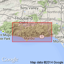
Type locality: exposures on Encinal Canyon Road, secs.21 and 28, T1S R19W, lower Encinal Canyon, Santa Monica Mountains, Point Dume quad, Los Angeles Co, CA. Recognized west of Trancas Canyon in west Point Dume and Triunfo Pass 7.5' quads. Is member of Topanga Canyon Formation. Consists of dark-gray siltstone or silty mudstone with dolomitic concretions. Texture is platy to shaly. Conformably overlies San Nicholas Member (new) (Vaqueros Formation); unconformably underlies Conejo Volcanics (Topanga Group). Is middle Miocene age.
Source: GNU records (USGS DDS-6; Menlo GNULEX).
For more information, please contact Nancy Stamm, Geologic Names Committee Secretary.
Asterisk (*) indicates published by U.S. Geological Survey authors.
"No current usage" (†) implies that a name has been abandoned or has fallen into disuse. Former usage and, if known, replacement name given in parentheses ( ).
Slash (/) indicates name conflicts with nomenclatural guidelines (CSN, 1933; ACSN, 1961, 1970; NACSN, 1983, 2005, 2021). May be explained within brackets ([ ]).