The National Geologic Map Database is migrating to a new infrastructure. We apologize for any service disruptions during this process.
|
|---|


- Usage in publication:
-
- El Rayo Volcanics*
- Modifications:
-
- Revised
- Adopted
- AAPG geologic province:
-
- Caribbean region
Summary:
The name Mayaguez Group is abandoned because it is no longer valid in the sense in which it was originally defined by Mattson (1960). His Mayaguez contained 7 lithofacies: the Parguera Limestone, here revised; the Brujo Limestone, here abandoned because it is identical to the Cotui Limestone; Melones Limestone, revised; the Yauco Mudstone, revised; the Sabana Grande Andesite, revised; El Rayo Volcanics, revised; and Maricao Basalt, not discussed. The El Rayo Volcanics are not within the Mayaguez but overlie rocks assigned by Mattson to the San German Formation, which does not overlie the Mayaguez, but is equivalent to part of the Mayaguez.
Source: GNU records (USGS DDS-6; Reston GNULEX).
- Usage in publication:
-
- El Rayo Formation*
- Modifications:
-
- Revised
- AAPG geologic province:
-
- Caribbean region
Summary:
The Jicara Formation is here revised and accepted for USGS usage. Disconformably overlies the El Rayo Formation. A lens of bioclastic limestone below the thin-bedded volcanic siltstone and mudstone formerly considered to be a basal unit of the Jicara is here moved to the El Rayo because it contains rudist fragments characteristic of the El Rayo and has identical lithology. Age of the Jicara is early Eocene based on Foraminifera.
Source: GNU records (USGS DDS-6; Reston GNULEX).

- Usage in publication:
-
- El Rayo Formation*
- Modifications:
-
- Overview
- AAPG geologic province:
-
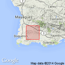
- Caribbean region
Summary:
The El Rayo Formation occurs in southwestern Puerto Rico and consists of massive, dark grayish-purple andesitic and basaltic lava with interbedded limestone. Thickness unknown. The El Rayo is of Late Cretaceous age.
Source: GNU records (USGS DDS-6; Reston GNULEX).
For more information, please contact Nancy Stamm, Geologic Names Committee Secretary.
Asterisk (*) indicates published by U.S. Geological Survey authors.
"No current usage" (†) implies that a name has been abandoned or has fallen into disuse. Former usage and, if known, replacement name given in parentheses ( ).
Slash (/) indicates name conflicts with nomenclatural guidelines (CSN, 1933; ACSN, 1961, 1970; NACSN, 1983, 2005, 2021). May be explained within brackets ([ ]).