The National Geologic Map Database is migrating to a new infrastructure. We apologize for any service disruptions during this process.
|
|---|


- Usage in publication:
-
- Eastland shale lentil*
- Modifications:
-
- Original reference
- Dominant lithology:
-
- Shale
- AAPG geologic province:
-
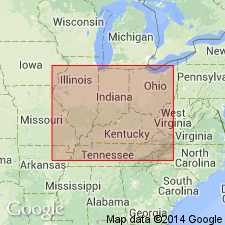
- Appalachian basin
Summary:
Pg. 9-12, pl. 4. Eastland shale lentil of Bonair sandstone. Mostly greenish clay shale, with some thin sandstone layers. The Clifty coal beds occur in lower 20 to 30 feet at Clifty. Best exposed, and apparently thickest (120 feet), on Pilot Knob. Wedges out in some and probably all directions from Clifty. Lies in midst of Bonair sandstone. In some places there is distinct angular unconformity between this shale and overlying sandstone member of the Bonair. Age is Pennsylvanian.
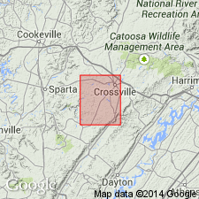
Mining town of Eastland, 1 mi west of Clifty, White Co., central TN, is built on this shale.
Source: US geologic names lexicon (USGS Bull. 896, p. 654).
- Usage in publication:
-
- Eastland member
- Modifications:
-
- Revised
- AAPG geologic province:
-
- Appalachian basin
Summary:
p. 1941. Listed as Eastland member of Lee formation.
Source: US geologic names lexicon (USGS Bull. 1200, p. 1204).

- Usage in publication:
-
- Eastland formation
- Modifications:
-
- Revised
- AAPG geologic province:
-
- Appalachian basin
Summary:
Chart no. 6 (column 17, southern Tennessee, collated by H.R. Wanless). Pennsylvanian correlation chart shows Eastland formation underlying Newton sandstone and overlying Herbert sandstone. Age is [Early Pennsylvanian]; Lee [Morrowan]; Westphalian A.
Source: Publication; US geologic names lexicon (USGS Bull. 1200, p. 1204).

- Usage in publication:
-
- Eastland shale lentil[†]
- Modifications:
-
- [Abandoned]
- AAPG geologic province:
-
- Appalachian basin
Summary:
Pg. 4. Eastland shale lentil of Bon Air sandstone. Conglomeratic phase of Newton sandstone in southern Cumberland and northern Bledsoe Counties was type "Herbert conglomerate" erroneously considered by Nelson (1925) to be older than Newton. The shale thought to be between the sandstones and named "Eastland shale" by Nelson is actually Whitwell shale. Names "Herbert" and "Eastland" are here discarded [abandoned].
Source: US geologic names lexicon (USGS Bull. 1200, p. 1204).
For more information, please contact Nancy Stamm, Geologic Names Committee Secretary.
Asterisk (*) indicates published by U.S. Geological Survey authors.
"No current usage" (†) implies that a name has been abandoned or has fallen into disuse. Former usage and, if known, replacement name given in parentheses ( ).
Slash (/) indicates name conflicts with nomenclatural guidelines (CSN, 1933; ACSN, 1961, 1970; NACSN, 1983, 2005, 2021). May be explained within brackets ([ ]).