The National Geologic Map Database is migrating to a new infrastructure. We apologize for any service disruptions during this process.
|
|---|


- Usage in publication:
-
- Dutchtown Formation
- Modifications:
-
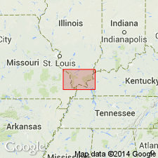
- Areal extent
- AAPG geologic province:
-
- Illinois basin
- Ozark uplift
- Upper Mississippi embayment
Summary:
Ordovician (Champlainian) Dutchtown Formation is relatively thin and combined with overlying Joachim Dolomite on geologic map. Crops out immediately east of St. Peter Sandstone, along a faulted strip that runs south-southeast through Perry and Cape Girardeau Cos., MO. Consists of medium- to very dark-gray and brownish-gray, very fine- to fine-grained, silty to sandy carbonate rock, most of which is dolomite; limestone becomes important constituent to the south. Fossils include pelecypods, gastropods, brachiopods, ostracods, and conodonts. Cryptozoan reefs occur near middle of Dutchtown in Thebes and Scott City 7.5-min quads. Also includes thin beds of brown, fine-grained, dolomitic sandstone and greenish-gray shale. Thins northward from 185 ft in southern Cape Girardeau Co to 20 ft or less in northern Cape Girardeau and Perry Cos. Contact with underlying St. Peter is disconformable according to quad mappers in MO; Templeton and Willman (1963) report contact to be gradational north of Cape Girardeau.
Source: GNU records (USGS DDS-6; Reston GNULEX).
- Usage in publication:
-
- Dutchtown Formation
- Modifications:
-
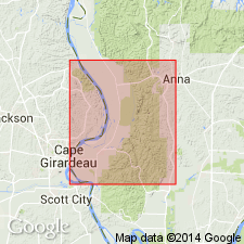
- Areal extent
- AAPG geologic province:
-
- Illinois basin
- Ozark uplift
Summary:
Ordovician (Mohawkian) Dutchtown Formation is about 200 ft thick in Ohio Oil Co. No. 1 Cross well, NW1/4NW1/4NE1/4 sec. 21, T13S, R2W, Jonesboro 7.5-min quad and 361 ft thick in Humble Oil Co. No. 1 Pickel well, NW1/4SE1/4NW1/4 sec. 21, T13S, R2W, Mill Creek 7.5-min quad. Thins northward to 185 ft in Cape Girardeau Co., MO, and pinches out in Perry Co., MO. Consists of dark-colored micritic to finely crystalline limestone, in addition to argillaceous and partly sandy dolomite.
Source: GNU records (USGS DDS-6; Reston GNULEX).

- Usage in publication:
-
- Dutchtown Formation*
- Modifications:
-
- Areal extent
- AAPG geologic province:
-
- Ozark uplift
Summary:
Ordovician (Mohawkian) Dutchtown Formation thins northward from Cape Girardeau Co. to Perry Co., MO.
Source: GNU records (USGS DDS-6; Reston GNULEX).

- Usage in publication:
-
- Dutchtown Formation*
- Modifications:
-
- Areal extent
- AAPG geologic province:
-
- Illinois basin
- Upper Mississippi embayment
Summary:
Middle Ordovician (Mohawkian) Dutchtown Formation is mapped undivided with Joachim Dolomite in subsurface of Upper Mississippi embayment in MO and Illinois basin in IL.
Source: GNU records (USGS DDS-6; Reston GNULEX).
For more information, please contact Nancy Stamm, Geologic Names Committee Secretary.
Asterisk (*) indicates published by U.S. Geological Survey authors.
"No current usage" (†) implies that a name has been abandoned or has fallen into disuse. Former usage and, if known, replacement name given in parentheses ( ).
Slash (/) indicates name conflicts with nomenclatural guidelines (CSN, 1933; ACSN, 1961, 1970; NACSN, 1983, 2005, 2021). May be explained within brackets ([ ]).