The National Geologic Map Database is migrating to a new infrastructure. We apologize for any service disruptions during this process.
|
|---|


- Usage in publication:
-
- Duncan sandstone
- Modifications:
-
- Original reference
- Dominant lithology:
-
- Sandstone
- Shale
- AAPG geologic province:
-
- Anadarko basin
- Chautauqua platform
- Palo Duro basin
- South Oklahoma folded belt
Summary:
Pg. 324-341, map. Duncan sandstone. Consists of two, sometimes three, ledges of white or buff sandstone, sometimes dolomitic, separated by shales. Thickness 75 to 250 feet. To north of its maximum development it is difficult to trace. Underlies Chickasha formation and overlies Lower Enid. The Chickasha and Duncan correspond to Upper Enid. The presence or absence of a coninuous unconformity at its top and base is still a mooted question. Forms an escarpment just north of Duncan, Stephens County, central southern Oklahoma. [This is approved definition of Duncan sandstone to Gould's Duncan sandstone and overlying Chickasha formation.] Age is Permian.
[Recognized in Caddo, Comanche, Garvin, Grady, Greer, Jackson, Kiowa, McClain, and Stephens Cos., central southern and southwestern OK.]
Source: US geologic names lexicon (USGS Bull. 896, p. 641); supplemental information from GNU records (USGS DDS-6; Denver GNULEX).

- Usage in publication:
-
- Duncan sandstone
- Modifications:
-
- Overview
- AAPG geologic province:
-
- Anadarko basin
- Chautauqua platform
- Palo Duro basin
- South Oklahoma folded belt
Summary:
Duncan sandstone. This sandstone (which has been mapped on 1926 Oklahoma geologic map from its type locality, in Stephens County, central southern Oklahoma, to Red River) is now known to be same as San Angelo sandstone of Texas, which has many years priority and has been traced from its type locality (in Tom Green County, central Texas) to Duncan, Oklahoma. (See 1926 entry under San Angelo sandstone.) On 1932 prelim. ed. of Texas geol. map San Angelo sandstone has been mapped up to Red River.
Source: US geologic names lexicon (USGS Bull. 896, p. 641).
- Usage in publication:
-
- Duncan sandstone*
- Modifications:
-
- Revised
- AAPG geologic province:
-
- Anadarko basin
- Chautauqua platform
- Palo Duro basin
- South Oklahoma folded belt
Summary:
Pg. 1553 (fig. 9). Duncan sandstone. Included in El Reno group. Overlies Hennessey formation; underlies Chickasha formation. [Age is Permian.]
Source: US geologic names lexicon (USGS Bull. 1200, p. 1174).
- Usage in publication:
-
- Duncan sandstone*
- Modifications:
-
- Areal extent
- AAPG geologic province:
-
- Anadarko basin
Summary:
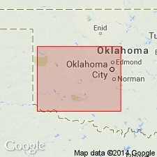
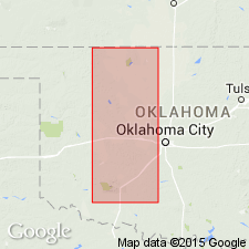
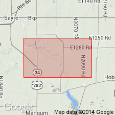
Pg. 13-14, pl. 1. Duncan sandstone of El Reno group. Described in Carter area [Beckham County], Oklahoma, where it is base of El Reno group. Underlies Flowerpot [Flower-pot] shale; overlies Hennessey shale. Thickness about 40 feet. Maximum thickness about 250 feet to southeast in Stephens County. Age is Middle Permian (Guadalupe). Note on type locality.
Type locality: Duncan, county seat of Stephens Co., central southern OK.
Source: Publication; US geologic names lexicon (USGS Bull. 1200, p. 1174).

- Usage in publication:
-
- Duncan Member
- Modifications:
-
- Areal extent
- AAPG geologic province:
-
- Palo Duro basin
- Permian basin
Summary:
Duncan Member of San Angelo Formation of Pease River Group (not separately mapped). Mostly sandstone, reddish-brown and tan, very fine-grained to fine-grained with silica, calcite, and gypsum cement; cross-bedded, planar-bedded, and cross-laminated; ripple marks and flaser bedding also common; conglomerate with clasts of dolomite, mudstone, and metamorphic rocks common at base of channel-fill bodies that locally cut into top of Clear Fork Group; zones of copper mineralization near base. Mudstone and siltstone, sandy, brownish-red and gray-green, medium- to thick-bedded with gypsum veins and nodules. Forms moderately prominent escarpment locally obscured by Quaternary deposits. Thickness 45 to 70 feet. Age is Guadalupian.
Source: Publication.
For more information, please contact Nancy Stamm, Geologic Names Committee Secretary.
Asterisk (*) indicates published by U.S. Geological Survey authors.
"No current usage" (†) implies that a name has been abandoned or has fallen into disuse. Former usage and, if known, replacement name given in parentheses ( ).
Slash (/) indicates name conflicts with nomenclatural guidelines (CSN, 1933; ACSN, 1961, 1970; NACSN, 1983, 2005, 2021). May be explained within brackets ([ ]).