

- Usage in publication:
-
- Dunbar Creek formation*
- Modifications:
-
- Named
- Dominant lithology:
-
- Limestone
- Gravel
- Siltstone
- Sandstone
- AAPG geologic province:
-
- Montana folded belt
Summary:
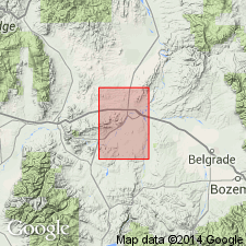
Named as a formation of Bozeman group (raised in rank) for Dunbar Creek, Gallatin Co, MT in the Montana folded belt province. Type area chosen in E1/2 sec 7, T1S, R2E where a partial section of formation measured. Is exposed over a 6 sq mi area and is thinly mantled by Quaternary rocks over another 20 sq mi. Is mostly (80 percent) thick-bedded, white to gray-yellow tuffaceous siltstone and sandstone. Also has white tuffaceous limestone, tongues of poorly sorted, poorly rounded, carbonate-rich gravel, and a few thin lenses of slightly bentonitic gray clay. Gradationally overlies Climbing Arrow formation (new) of Bozeman. Top is nowhere exposed. Overlain by Quaternary rocks. Ranges from 250+ ft to 1,000+ ft thick. Is of Oligocene age. Has brontothere, oreodont, and gastropod fossils. Is partly fluviatile, partly eolian, and partly lacustrine in origin. Geologic map.
Source: GNU records (USGS DDS-6; Denver GNULEX).
- Usage in publication:
-
- Dunbar Creek Formation*
- Modifications:
-
- Revised
- AAPG geologic province:
-
- Montana folded belt
Summary:
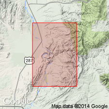
Sixmile Creek Formation named as uppermost formation of Bozeman Group in Big Belt Mountains area, Broadwater and Gallatin Cos, MT, Montana folded belt province. Here, Bozeman consists of (ascending): Climbing Arrow, Dunbar Creek, and Sixmile Creek Formations. Climbing Arrow or Dunbar Creek are disconformably overlain by Sixmile Creek Formation. Cross section. Oligocene age.
Source: GNU records (USGS DDS-6; Denver GNULEX).
- Usage in publication:
-
- Dunbar Creek Member
- Modifications:
-
- Revised
- Areal extent
- Overview
- AAPG geologic province:
-
- Montana folded belt
Summary:
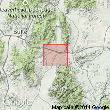
Extended into Jefferson basin area, southern Jefferson and northern Madison Cos, MT, Montana folded belt province. Rank reduced to member of Renova Formation (new) of Bozeman Group. Crops out sporadically over a 3-sq-mi area along western margin of basin north of Big Pipestone Creek and north of Northern Pacific RR tracks, where unconformably overlies Upper Cretaceous Elkhorn Mountains Volcanics and unconformably underlies Sixmile Creek Formation of Bozeman Group. Consists predominantly of grayish-orange vitric siltstone and locally of lenticular arkose and conglomerate lenses. Estimated thickness ranges from 600 to 1,000 ft. Geologic map, cross sections, correlation chart, fossil list. Middle Oligocene (Orellan) age based on vertebrate fossils.
Source: GNU records (USGS DDS-6; Denver GNULEX).
- Usage in publication:
-
- Dunbar Creek Formation*
- Modifications:
-
- Not used
Summary:
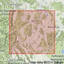
Historical use of formal stratigraphic nomenclature applied to Bozeman Group in southwest MT, Montana folded belt province described. Charts. Bozeman and its formations --Sphinx Conglomerate (oldest), Milligan Creek, Climbing Arrow, Dunbar Creek, Sixmile Creek of the Toston-Clarkson Valley areas, and the Renova (oldest) and Sixmile Creek Formations of the Jefferson-Beaverhead Valley areas not used. These Tertiary rocks considered to be basin-fill deposits separable on basis of sequence stratigraphic concepts, rather than on lithostratigraphic principles. Lithologic distinctions within the group are not distinctive due to abrupt lateral facies changes. These rocks are separable into 5 sequences, numbered 1 to 5, no. 1 is the oldest; no. 5 is post-Bozeman alluvium. Each sequence is separated by an unconformity. Term unconformity applied in this paper to surfaces of non-deposition or erosion; these surfaces have soils developed on them. Sequence 1 consists of calc-alkalic flows, flow tuffs, tuff, matrix-supported conglomerate, some massive sandstone about 157 m thick, and is of Eocene age. Sequence 2 is mostly fluvial channel conglomerate, sandstone, mudstone, siltstone, and minor tuff, lapilli tuff about 400 m thick, and is of Eocene and Oligocene age. Sequence 3 is fluvial sheet sandstone, some mudstone, siltstone, sandstone, lenses of conglomerate of flood plain origin about 214 m thick and is of Oligocene and Miocene age. Sequence 4 is mudstone, siltstone, sandstone, lenses of conglomerate mostly of flood plain origin 1,000 m thick, and is of Miocene and Pliocene age. Sequence 5 unconformably overlies rocks that were assigned to the Bozeman. Map shows distribution of the 5 sequences. The unconformities can be traced into the subsurface seismically.
Source: GNU records (USGS DDS-6; Denver GNULEX).
- Usage in publication:
-
- Dunbar Creek Member*
- Modifications:
-
- Mapped 1:24k (Bear Trap Creek quad, Madison Co, MT)
- Dominant lithology:
-
- Siltstone
- Sandstone
- Conglomerate
- AAPG geologic province:
-
- Montana folded belt
Summary:
Mapped as member of Renova Formation in northern Madison Co, MT, Montana folded belt province (after Kuenzi and Fields, 1971) in east-central part of quad. Consists of white, yellowish-white, and light-gray, moderately indurated to well indurated siltstone, sandstone, and matrix-supported conglomerate; most beds are tuffaceous and some sandstones are composed entirely of water-lain ash. Contains twig debris in some ash beds and bone fragments in some pebbly beds. Thickness is greater than 120 m. Overlies Milligan Creek Formation; underlies Tertiary diamicton. Oligocene age.
Source: GNU records (USGS DDS-6; Denver GNULEX).
For more information, please contact Nancy Stamm, Geologic Names Committee Secretary.
Asterisk (*) indicates published by U.S. Geological Survey authors.
"No current usage" (†) implies that a name has been abandoned or has fallen into disuse. Former usage and, if known, replacement name given in parentheses ( ).
Slash (/) indicates name conflicts with nomenclatural guidelines (CSN, 1933; ACSN, 1961, 1970; NACSN, 1983, 2005, 2021). May be explained within brackets ([ ]).