

- Usage in publication:
-
- Duck Creek chalk
- Modifications:
-
- Original reference
- Dominant lithology:
-
- Limestone
- Marl
- AAPG geologic province:
-
- South Oklahoma folded belt
Summary:
Pg. 504, 516. Duck Creek chalk in Washita division [group]. Crumbling white chalky limestone alternating with chalky marls. Contains unique fossil fauna. Thickness 100 feet. Overlies Kiamitia [Kiamichi] clays (new) and underlies Fort Worth limestone in Indian Territory [present-day southern Oklahoma] and Grayson and Cooke Counties, northeastern Texas. Age is Early Cretaceous (Comanche).
[Named from Duck Creek, Grayson Co., northeastern TX. Notable exposure on southern slope of Duck Creek, north of Denison.]
Source: US geologic names lexicon (USGS Bull. 896, p. 637-638).
- Usage in publication:
-
- Duck Creek formation
- Modifications:
-
- Revised
Summary:
Divided Duck Creek formation into several members and proposed a restriction of name to basal 2 members. (See 1919 entry under Fort Worth limestone.)
Source: US geologic names lexicon (USGS Bull. 896, p. 637-638).

- Usage in publication:
-
- Duck Creek formation*
- Modifications:
-
- Overview
- AAPG geologic province:
-
- South Oklahoma folded belt
Summary:
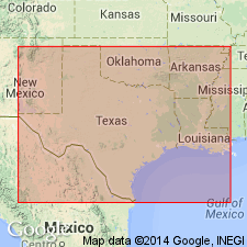
Duck Creek formation of Washita group. The USGS still uses the original definition of this name. Present in northeastern Texas and central southern Oklahoma. Age is Early Cretaceous (Comanche).
Named from Duck Creek, Grayson Co., northeastern TX.
Source: US geologic names lexicon (USGS Bull. 896, p. 637-638).

- Usage in publication:
-
- Duck Creek Formation
- Modifications:
-
- Mapped 1:250k
- Dominant lithology:
-
- Limestone
- AAPG geologic province:
-
- Fort Worth syncline
- Ouachita folded belt
- Strawn basin
Summary:
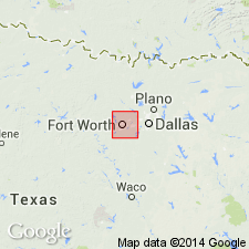
Duck Creek Formation. Limestone, aphanitic to biosparite, burrowed, beds 0.2 to 2 feet becoming thicker and more massive southward, light to medium gray; weathers yellowish brown; marine megafossils are PECTEN, oysters, echinoids, and ammonites. Clay, calcareous, in units 0.1 to 5 feet thick, medium gray to yellowish brown; weathers yellowish brown, forms low rolling hills. Thickness 25 to 35 feet. Lies above Kiamichi Formation and below Fort Worth Limestone. Age is Early Cretaceous.
[Mapped in Parker and Tarrant Cos., eastern TX.]
Source: Publication.

- Usage in publication:
-
- Duck Creek Formation
- Modifications:
-
- Mapped 1:250k
- Dominant lithology:
-
- Marl
- Limestone
- Clay
- AAPG geologic province:
-
- Fort Worth syncline
- South Oklahoma folded belt
Summary:
Pamphlet [p. 6]. Duck Creek Formation. In Texas, upper part mostly marl interbedded with thin beds of marly limestone; lower part comprises 6- to 12-inch-thick limestone beds intercalated with gray to greenish-gray marly clay. Thickness approximately 100 feet. Lies above Kiamichi Formation and below Fort Worth Limestone. Age is Early Cretaceous. [Mapped along Red River and southward to Lake Ray Roberts (btw. Sanger and Pilot Point); in Cooke, Denton, and Grayson Cos., northeastern TX; in northern and central part of map sheet. Fort Worth and Duck Creek mapped undifferentiated from Lake Ray Roberts area to southern edge of map sheet.]
In Oklahoma, finely laminated blue-gray shale and gray, silty, shaly limestone containing abundant large cephalopods, [rocks included in lower part of Caddo Formation; see entry under Caddo].
Source: Publication.

- Usage in publication:
-
- Duck Creek Shale
- Modifications:
-
- Areal extent
- Dominant lithology:
-
- Shale
- Limestone
- AAPG geologic province:
-
- Permian basin
Summary:
Duck Creek Shale. Interbedded shale and limestone. Shale, sandy, thin-bedded, light-gray, grayish-yellow, light-brown. Limestone argillaceous, nodular, grayish-yellow to light-brown. Marine megafossils. Exposed thickness 13 feet. Overlies Kiamichi Shale. Underlies Ogallala and younger deposits. Age is Early Cretaceous.
Not separately mapped. (Mapped with Kiamichi Shale around Twin and Double Lakes, Lynn Co., TX, southwestern edge of sheet.)
Source: Publication.
For more information, please contact Nancy Stamm, Geologic Names Committee Secretary.
Asterisk (*) indicates published by U.S. Geological Survey authors.
"No current usage" (†) implies that a name has been abandoned or has fallen into disuse. Former usage and, if known, replacement name given in parentheses ( ).
Slash (/) indicates name conflicts with nomenclatural guidelines (CSN, 1933; ACSN, 1961, 1970; NACSN, 1983, 2005, 2021). May be explained within brackets ([ ]).