


- Usage in publication:
-
- Drummond Mine Limestone
- Modifications:
-
- Named
- Dominant lithology:
-
- Limestone
- Argillite
- Siltstone
- Sandstone
- AAPG geologic province:
-
- Idaho Mountains province
- Snake River basin
Summary:
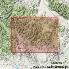
Named as one (of 6) formations of Copper Basin Group (rank raised) for Drummond Mine workings. Type section designated and measured along Star Hope Canyon in NW1/4 NE1/4 SE1/4 sec 10 and NE1/4 sec 15, and S1/2 sec 14 to SE1/4 SE1/4 sec 14, T4N, R21E, Custer Co (Idaho Mountains province) and Blaine Co (Snake River basin), ID. Overlies Milligen Formation, basal formation of the group. Underlies Scorpion Mountain Formation (new) of the group. Both contacts gradational; top and base placed where limestone is no longer dominant lithology. The upper Milligen is gray argillite. The lower Scorpion Mountain is gray argillite. Is 2,620 ft thick at type; has estimated minimum thickness of 900 ft. Consists predominantly of dark-gray (weathers light-gray), olive- to yellow-gray, yellow-brown, micritic, fossiliferous (cephalopod, ostracod, endothyrid) limestone. Limestone beds may be argillaceous, silty, sandy, and they contain pyrite locally. The interbedded argillite is dark-gray to black, commonly silty and may contain up to 40 percent angular to subangular quartz and chert. The interbedded siltstone and fine-grained sandstone are gray to brown, poorly sorted, angular to subangular, and have a composition of 40-60 percent quartz, 5-35 percent chert, and have 0-20 percent argillaceous cement and 5-50 percent calcareous cement. Considered to be a west-thinning tongue of White Knob Limestone. Late Mississippian "Chesteran" age. Nomenclature chart.
Source: GNU records (USGS DDS-6; Denver GNULEX).
- Usage in publication:
-
- Drummond Mine Limestone
- Modifications:
-
- Age modified
- Contact revised
- AAPG geologic province:
-
- Idaho Mountains province
Summary:
Is one of six formations of the Copper Basin Group. Lower contact revised in that the 1,120+ ft thick sequence of dark-gray argillite and quartzite, conglomerate, and limestone lenses beneath the Drummond Mine formerly assigned to the Milligen Formation of the Copper Basin Group, are reassigned to the newly named Little Copper Formation. Little Copper is the basal formation of the Copper Basin Group. Upper contact is with Scorpion Mountain of Copper Basin. Assigned an Early Mississippian age. [Reason for age change not stated.] Correlation chart.
Source: GNU records (USGS DDS-6; Denver GNULEX).
- Usage in publication:
-
- Drummond Mine Limestone Member*
- Modifications:
-
- Revised
- AAPG geologic province:
-
- Idaho Mountains province
- Snake River basin
Summary:
Revised in stratigraphic rank from Drummond Mine Limestone of Copper Basin Group to middle member of Copper Basin Formation. Used in Copper Basin plate along Star Hope and Iron Bog Creeks, Custer Co, Idaho Mountains province, and along Muldoon Creek, Custer and Blaine Cos, Idaho Mountains province and Snake River basin. Overlies Little Copper Member (adopted) of Copper Basin. Underlies upper clastic unit of Copper Basin. Assigned an early to late Kinderhookian age (conodonts, forams, ammonoids).
Source: GNU records (USGS DDS-6; Denver GNULEX).
For more information, please contact Nancy Stamm, Geologic Names Committee Secretary.
Asterisk (*) indicates published by U.S. Geological Survey authors.
"No current usage" (†) implies that a name has been abandoned or has fallen into disuse. Former usage and, if known, replacement name given in parentheses ( ).
Slash (/) indicates name conflicts with nomenclatural guidelines (CSN, 1933; ACSN, 1961, 1970; NACSN, 1983, 2005, 2021). May be explained within brackets ([ ]).