The National Geologic Map Database is migrating to a new infrastructure. We apologize for any service disruptions during this process.
|
|---|


- Usage in publication:
-
- Dripping Spring quartzite*
- Modifications:
-
- Original reference
- Dominant lithology:
-
- Quartzite
- AAPG geologic province:
-
- Southwestern Basin-and-Range region
Summary:
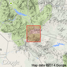
Dripping Spring quartzite. 400 feeet thick, is top formation of Apache group in Globe copper district, central Arizona. It overlies Barnes conglomerate and is overlain by Globe limestone. Lower 175 feet consists of massive beds of streaked buff and pink quartzite. Upper part consists of thinner-bedded, hard, laminated, rusty-colored quartzite. [Age is Precambrian.]
[Named from Dripping Spring Mountains, Globe quadrangle, which owe their boldly scarped outlines to these quartzites and the underlying Barnes conglomerate.]
Source: US geologic names lexicon (USGS Bull. 896, p. 633).
- Usage in publication:
-
- Dripping Spring quartzite*
- Modifications:
-
- Revised
- AAPG geologic province:
-
- Basin-and-Range province
Summary:
Is restricted to lower part of original. Upper part of original divided into Mescal limestone and overlying Troy quartzite.
Source: GNU records (USGS DDS-6; Denver GNULEX).
- Usage in publication:
-
- Dripping Spring quartzite*
- Modifications:
-
- Areal extent
- AAPG geologic province:
-
- Basin-and-Range province
Summary:
Extended to Sierra Ancha and Salt River Canyon, AZ. Of Cambrian? age.
Source: GNU records (USGS DDS-6; Denver GNULEX).
- Usage in publication:
-
- Dripping Spring quartzite*
- Modifications:
-
- Areal extent
- AAPG geologic province:
-
- Black Mesa basin
- Southwestern Basin-and-Range region
Summary:
Extended to Canyon Creek, Navajo Co, AZ. Precambrian [in Southwestern Basin-and-Range region] or Cambrian? [in Black Mesa basin].
Source: GNU records (USGS DDS-6; Denver GNULEX).
- Usage in publication:
-
- Dripping Spring quartzite*
- Modifications:
-
- Age modified
- AAPG geologic province:
-
- Southwestern Basin-and-Range region
Summary:
Assigned an Algonkian age on basis of similarities to pre-Cambrian rocks of the Grand Canyon.
Source: GNU records (USGS DDS-6; Denver GNULEX).
- Usage in publication:
-
- Dripping Spring quartzite
- Modifications:
-
- Areal extent
- AAPG geologic province:
-
- Southwestern Basin-and-Range region
Summary:
Extended to Santa Catalina Mountains, Pima Co, AZ in Southwestern Basin-and-Range region. Of pre-Cambrian age.
Source: GNU records (USGS DDS-6; Denver GNULEX).
- Usage in publication:
-
- Dripping Spring quartzite*
- Modifications:
-
- Areal extent
- AAPG geologic province:
-
- Southwestern Basin-and-Range region
Summary:
Extended to Little Dragoon Mountains, Cochise Co, AZ in Southwestern Basin-and-Range region. Is Precambrian.
Source: GNU records (USGS DDS-6; Denver GNULEX).
- Usage in publication:
-
- Dripping Spring quartzite*
- Modifications:
-
- Areal extent
- AAPG geologic province:
-
- Southwestern Basin-and-Range region
Summary:
Extended to Slate and Vekol Mountains, AZ in Southwestern Basin-and-Range region. Is formation of Apache group. Is of Late Precambrian age.
Source: GNU records (USGS DDS-6; Denver GNULEX).

- Usage in publication:
-
- Dripping Spring quartzite*
- Modifications:
-
- Overview
- AAPG geologic province:
-
- Southwestern Basin-and-Range region
Summary:
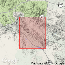
Mapped as part of Apache group in quad, Cochise Co, AZ in Southwestern Basin-and-Range region, with Barnes conglomerate. Measured sections described--in NE1/4 NW1/4 sec 21, T15S, R22E, 193 ft thick; and in NW1/4 sec 26, T15S, R22E, 304 ft thick--where it overlies Barnes conglomerate and underlies Bolsa quartzite. Assigned a Late Precambrian age. Geologic map.
Source: GNU records (USGS DDS-6; Denver GNULEX).
- Usage in publication:
-
- Dripping Spring Quartzite*
- Modifications:
-
- Revised
- Overview
- Reference
- AAPG geologic province:
-
- Southwestern Basin-and-Range region
Summary:
Term quartzite applied as part of name due to prior use though rocks are too poorly cemented and too feldspathic to be called quartzite. Divided into Barnes Conglomerate Member (reduced in rank, included as basal member of Dripping Spring), middle member (called lower member in earlier reports), and upper member. Bounded at base by erosional disconformity with Pioneer Formation and at top by erosional disconformity with Mescal Limestone. Detailed lithologic descriptions, twenty measured sections, and areal distribution map included. A representative reference section is designated in Deep Spring Canyon, 3,500 ft north of its confluence with Bull Canyon, Gila Co, AZ in Southwestern Basin-and-Range region. Deposited in a northeastward extending embayment from a sea to the southwest. Formation characterized by fluctuating shoreline, transgressive deposition, and in streams and seas whose beds remained very near base level. Assigned as one of four named formations of Apache Group. Is of Late Precambrian age.
Source: GNU records (USGS DDS-6; Denver GNULEX).
- Usage in publication:
-
- Dripping Spring Quartzite*
- Modifications:
-
- Areal extent
- AAPG geologic province:
-
- Southwestern Basin-and-Range region
Summary:
Extended to south-central AZ in the Southwestern Basin-and-Range region. Measured sections in the Vekol and Slate Mountains contain (in ascending order) the Barnes Conglomerate Member, middle member, and upper member. Is intruded by diabase sills. Absent in Waterman Mountains. Is part of Apache Group of younger Precambrian age.
Source: GNU records (USGS DDS-6; Denver GNULEX).
- Usage in publication:
-
- Dripping Spring Quartzite*
- Modifications:
-
- Overview
- Reference
- AAPG geologic province:
-
- Southwestern Basin-and-Range region
Summary:
Is described throughout its area of occurrence, in the Southwestern Basin-and-Range region. Depositional history discussed. Is part of Apache Group. Contains Barnes Conglomerate Member at base. A reference section measured in SW1/4 SW1/4 sec 18 T5N, R15E, Gila Co, AZ where a section 632 ft thick can be separated into Barnes Conglomerate Member (at base), arkose member, and siltstone member. Considered of younger Precambrian age.
Source: GNU records (USGS DDS-6; Denver GNULEX).
- Usage in publication:
-
- Dripping Spring Formation*
- Modifications:
-
- Redescribed
- Age modified
- Dominant lithology:
-
- Arkose
- Siltstone
- Quartzite
- AAPG geologic province:
-
- Southwestern Basin-and-Range region
Summary:
Is upper formation of Apache Group in Happy Valley quad, Cochise Co, AZ in the Southwestern Basin-and-Range region. Age changed from Precambrian to Precambrian Y age. Redescribed--name changed from Dripping Spring Quartzite to Dripping Spring Formation. Formation consists of banded light-colored and reddish-brown arkose, siltstone, and quartzite. Includes Barnes Conglomerate Member at base. Estimated 400-500 ft thick.
Source: GNU records (USGS DDS-6; Denver GNULEX).
For more information, please contact Nancy Stamm, Geologic Names Committee Secretary.
Asterisk (*) indicates published by U.S. Geological Survey authors.
"No current usage" (†) implies that a name has been abandoned or has fallen into disuse. Former usage and, if known, replacement name given in parentheses ( ).
Slash (/) indicates name conflicts with nomenclatural guidelines (CSN, 1933; ACSN, 1961, 1970; NACSN, 1983, 2005, 2021). May be explained within brackets ([ ]).