

- Usage in publication:
-
- Dox sandstone*
- Modifications:
-
- Original reference
- Dominant lithology:
-
- Sandstone
- AAPG geologic province:
-
- Southern Rocky Mountain region
Summary:
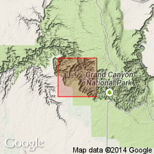
Dox sandstone of Unkar group of Grand Canyon series. Micaceous shaly sandstone; greenish gray in lower part, red-brown and vermilion above. Characterized by ripple marks and cross bedding. Cut by thin sills of intrusive diabase. Thickness 2,297 feet plus unknown thickness removed by pre-Cambrian erosion. Top formation of Unkar group (Algonkian). Unconformably overlain by Tapeats sandstone, of Tonto group, and conformably underlain by Shinumo quartzite. Of shallow-water origin. Report includes geologic map.
Named from Dox Castle, in Shinumo quadrangle, underneath which a typical section is found beneath Tonto group, which makes the castle, Grand Canyon, northern AZ.
Measured section 2,297 ft on west side of Shinumo Canyon.
Source: US geologic names lexicon (USGS Bull. 896, p. 629); supplemental information from GNU records (USGS DDS-6; Denver GNULEX).
- Usage in publication:
-
- Dox Sandstone*
- Modifications:
-
- Age modified
- AAPG geologic province:
-
- Southern Rocky Mountain region
Summary:
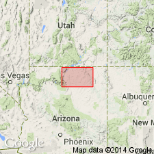
Shown as Precambrian Y age, rather than Algonkian, late Precambrian, or Precambrian as assigned earlier. Is present in southwest part of map area in the Grand Canyon of the Colorado River, Coconino Co, AZ in the Southern Rocky Mountain region.
Source: GNU records (USGS DDS-6; Denver GNULEX).
- Usage in publication:
-
- Dox Formation
- Modifications:
-
- Revised
- Redescribed
- Dominant lithology:
-
- Sandstone
- Siltstone
- Shale
- AAPG geologic province:
-
- Southern Rocky Mountain region
Summary:
Is the uppermost formation of Unkar Group [of Grand Canyon Supergroup] and is exposed only in central and eastern Grand Canyon, AZ in the Southern Rocky Mountain region. Overlies Shinumo Quartzite of Unkar. Underlies Cardenas Lavas of Unkar. Is about 1,525 m thick. Redescribed--name changed from Dox Sandstone to Dox Formation because it is only 50 percent sandstone, and the remaining part is siltstone, shale, and a minor amount of dolomite and conglomerate. Divided into the newly-named (ascending): Escalante Creek, Solomon Temple, Comanche Point, and Ochoa Point Members. Thought to be correlative of upper Apache Group and Troy Quartzite of southern AZ. Is a marginal marine sequence in the northwestern part of the Apache Basin. Late Precambrian age based on position above 1.65 b.y. age rocks, the 800 to 1.09 +/-0.07 b.y. age of the diabase dikes and sills that cut it and of the Cardenas Lavas above. Geologic map.
Source: GNU records (USGS DDS-6; Denver GNULEX).
- Usage in publication:
-
- Dox Sandstone*
- Modifications:
-
- Age modified
- Paleomagnetics
- AAPG geologic province:
-
- Southern Rocky Mountain region
Summary:
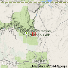
Is one of five formations of Unkar Group of Grand Canyon Supergroup. Overlies Shinumo Quartzite of Unkar. Underlies Cardenas Basalt. Term "Sandstone" rather than "Formation" applied because Dox is predominately sandstone; argillite and mudstone are subordinate and carbonate is rare. Ranges from 884 to 915 m thick. Divisible into lower, middle, and upper members. Deposited in marine, tidal flat, and continental environments. Age designation changed from Precambrian Y to Middle Proterozoic, the age term applied to rocks older than 900 Ma and younger than 1,600 Ma. Present in northern AZ, Southern Rocky Mountain region. Estimated age in upper part, middle member is 1,130 Ma. Estimated age in upper member is 1,110 Ma. Paleomagnetic dating suggests Dox correlates with middle and upper parts of the Keweenawan Supergroup of the Lake Superior region. A pole from the middle member of the Dox correlates with the argillite member of the Mescal Limestone. Columnar section.
Source: GNU records (USGS DDS-6; Denver GNULEX).
- Usage in publication:
-
- Dox Sandstone*
- Modifications:
-
- Paleomagnetics
- AAPG geologic province:
-
- Southern Rocky Mountain region
Summary:
Comparison made of paleomagnetic poles and polar paths of Middle Proterozoic rocks of Hazel Formation of Van Horn area, TX (Southwestern Basin-and-Range region) with Middle Proterozoic rocks elsewhere in North America. Changes in direction of apparent polar wander are interpreted to reflect plate interactions and collisions responsible for episodes of deformation on the craton. Folding phases in Van Horn and Adirondack Mountain regions are relatable to 5 direction changes of polar wander between about 1,200 and about 1,000 Ma. Hazel accumulated during an episode of south-to-north thrust faulting that has been identified as belonging to Grenville Orogeny. Hazel is a 1,500 ft thick, moderately to little deformed, purple-red, fine- to coarse-grained sandstone above Allamoore Formation and beneath Carrizo Mountain Group; is similar to Dox Sandstone, Unkar Group, Grand Canyon Supergroup of AZ (Southern Rocky Mountain region) in lithology and in lack of metamorphism. The lower, lower middle, upper parts of Hazel have normal polarity directions. Three poles from Hazel describe a short, north-south trending trace that appears to have rotated about 30 deg clockwise with respect to apex and upper part of descending leg of Unkar loop. A 30 deg counterclockwise vertical-axis rotation brings Hazel into general coincidence with upper part, middle member of Dox, and with middle and early late Keweenawan poles from Lake Superior region.
Source: GNU records (USGS DDS-6; Denver GNULEX).
For more information, please contact Nancy Stamm, Geologic Names Committee Secretary.
Asterisk (*) indicates published by U.S. Geological Survey authors.
"No current usage" (†) implies that a name has been abandoned or has fallen into disuse. Former usage and, if known, replacement name given in parentheses ( ).
Slash (/) indicates name conflicts with nomenclatural guidelines (CSN, 1933; ACSN, 1961, 1970; NACSN, 1983, 2005, 2021). May be explained within brackets ([ ]).