

- Usage in publication:
-
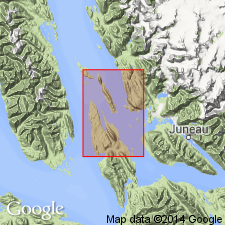
- Douglas Island volcanic group*
- Modifications:
-
- Named
- Dominant lithology:
-
- Tuff
- Volcanics
- AAPG geologic province:
-
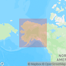
- Alaska Southeastern region
Martin, G.C., 1926, Mesozoic stratigraphy of Alaska: U.S. Geological Survey Bulletin, 776, 493 p.
Summary:
[Named after Douglas Island, Juneau region, southeastern AK (Eakin, unpub. report)]. Also occurs on Treadwell Island and seemingly on Admiralty Island, Consists of melaphyre flows, tuff, and agglomerate having thickness of possibly 15,000 ft. Apparently conformably overlies Treadwell slate (new). Tentatively assigned to Late Jurassic(?) age but may be either pre-Cretaceous or post-Cretaceous based on stratigraphic relations.
Source: GNU records (USGS DDS-6; Menlo GNULEX).
- Usage in publication:
-
- Douglas Island volcanic group*
- Modifications:
-
- Areal extent
- Age modified
- AAPG geologic province:
-
- Alaska Southeastern region
Summary:
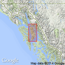
Unit is almost continuously exposed along coast and at adjacent islands from Auke Bay to Amalga Harbor. Total thickness cannot be measured; it is estimated to be at least 5000 ft and probably 10,000 ft. Is in gradational contact with overlying Symonds formation (new). Considered Jurassic(?) to Early Cretaceous(?) in age on basis of stratigraphic relations.
Source: GNU records (USGS DDS-6; Menlo GNULEX).
- Usage in publication:
-
- Douglas Island Volcanics*
- Modifications:
-
- Revised
- Age modified
- AAPG geologic province:
-
- Alaska Southeastern region
Summary:
Douglas Island Volcanic Group (Martin, 1926) revised as Douglas Island Volcanics and assigned to Stephens Passage Group (new). Forms main ridges of Douglas Island. Consists principally of augite-bearing volcanic flow breccia and some tuff, graywacke, and slate. Forms major part of Stephens Passage Group in eastern part of outcrop belt. Shown on geologic sketch map. Conformably overlies part of Seymour Canal Formation (Stephens Passage Group). Age is Late Jurassic and Early Cretaceous based on stratigraphic relations with Seymour Canal Formation.
Source: GNU records (USGS DDS-6; Menlo GNULEX).
For more information, please contact Nancy Stamm, Geologic Names Committee Secretary.
Asterisk (*) indicates published by U.S. Geological Survey authors.
"No current usage" (†) implies that a name has been abandoned or has fallen into disuse. Former usage and, if known, replacement name given in parentheses ( ).
Slash (/) indicates name conflicts with nomenclatural guidelines (CSN, 1933; ACSN, 1961, 1970; NACSN, 1983, 2005, 2021). May be explained within brackets ([ ]).