

- Usage in publication:
-
- Dome formation*
- Modifications:
-
- Original reference
- Dominant lithology:
-
- Limestone
- AAPG geologic province:
-
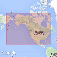
- Great Basin province
Summary:
Pg. 9. 11. Dome formation. Massive-bedded gray siliceous limestone, 355 feet thick, underlying Swasey formation and overlying Howell formation. Age is Middle Cambrian.
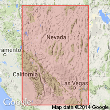
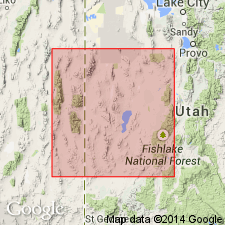
Type locality: at head of Dome Canyon, [in T. 17 N., R. 13 W., Marjum Pass 7.5-min quadrangle, Millard Co.], House Range, western UT.
[†Dome formation abandoned. Same as Dome Canyon limestone.]
Source: US geologic names lexicons (USGS Bull. 896, p. 619; USGS Bull. 1200, p. 1134).
- Usage in publication:
-
- Dome Canyon Limestone
- Modifications:
-
- Original reference
- AAPG geologic province:
-
- Great Basin province
Walcott, C.D., 1912, Cambrian Brachiopoda: U.S. Geological Survey Monograph, 51, pt. 1, 872 p.
Summary:
Pg. 157. Dome Canyon Limestone. Massive-bedded cliff-forming, gray, siliceous limestone with small specks of calcite. Layers of brownish-yellow arenaceous limestone, 15 inches to 2 feet thick, occur 100 feet below top and for 50 feet below. Thickness 355 feet. Underlies Swasey formation and overlies Howell formation in House Range, western Utah. Age is Middle Cambrian.
See Walcott, 1908 (Smithsonian Misc. Coll., v. 53, no. 1804, p. 11) [where he called the beds Dome formation.]
[GNC remark (ca. 1960, US geologic names lexicon, USGS Bull. 1200, p. 1134): The USGS has abandoned the term Dome Canyon limestone in favor of Dome limestone, the more widely used term.]
Source: US geologic names lexicon (USGS Bull. 896, p. 620).

- Usage in publication:
-
- Dome limestone
- Modifications:
-
- Revised
- Dominant lithology:
-
- Limestone
- AAPG geologic province:
-
- Great Basin province
Summary:
Pg. 1134-1135, 1141 (fig. 5), 1145. Dome limestone. At emended section formation is 310 feet thick and consists of black and dark-gray thick- and thin-bedded fine-grained limestone which contains drab-tan and maroon clay flakes, laminae, and nodules in lower two-thirds and dull-gray argillaceous pure limestone in upper third. Conformably overlies Howell limestone (emended); underlies Swasey limestone (emended). Forms part of continuous emended Cambrian section for region. [Age is Middle Cambrian (Albertan).]
Type locality (emended): section measured on north side Marjum Canyon, [in T. 18 S., R. 14 W., Notch Peak 15-min quadrangle (1965 ed.), Millard Co.], House Range, western UT.
Source: US geologic names lexicon (USGS Bull. 1200, p. 1133-1134).
- Usage in publication:
-
- Dome limestone
- Modifications:
-
- Areal extent
- AAPG geologic province:
-
- Great Basin province
Summary:
Pg. 38-39, fig. 5. Dome limestone. Geographically extended into Groom district, southern Groom Range, Lincoln County, southeastern Nevada, where it is same as units D-E of Highland Peak limestone as described by Wheeler and Lemmon (1939). Thickness 850 feet. Unconformably overlies Burnt Canyon limestone (new); unconformably underlies Condor member (new) of Swasey limestone. Age is Middle Cambrian, based on stratigraphic position.
Source: US geologic names lexicon (USGS Bull. 1200, p. 1133-1134); supplemental information from GNU records (USGS DDS-6; Menlo GNULEX).
- Usage in publication:
-
- Dome limestone
- Modifications:
-
- Revised
- AAPG geologic province:
-
- Great Basin province
Summary:
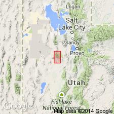
Pg. 35, 45-46, pl. 1, measured sections. Dome limestone of Ophir group. Included in Ophir group in Sheeprock Mountains, Tooele and Juab Counties, Wasatch National Forest, western Utah, where it overlies Burnt Canyon limestone and underlies Condor formation. Thickness 37 to 81 feet. [Age is Middle Cambrian.]
Source: US geologic names lexicon (USGS Bull. 1200, p. 1133-1134).
- Usage in publication:
-
- Dome formation
- Modifications:
-
- Areal extent
- Dominant lithology:
-
- Limestone
- AAPG geologic province:
-
- Great Basin province
Summary:
Pg. 49, 50 (fig. 4), 51. Dome formation. Wheeler's terminology in House Range revised. Term Burnt Canyon replaced with Chisholm formation, and Condor member of Swasey limestone replaced with Whirlwind formation (new). Hence, Dome overlies the Chisholm and underlies the Whirlwind. In Wah Wah Range, the Dome lies between the Chisholm and the Whirlwind. Age is Middle Cambrian (BATHYURISCUS-ELRATHINA trilobite assemblage zone).
Source: Publication; US geologic names lexicon (USGS Bull. 1200, p. 1133-1134).
- Usage in publication:
-
- Dome Limestone
- Modifications:
-
- Biostratigraphic dating
- AAPG geologic province:
-
- Great Basin province
Summary:
Dome Limestone is easily mapped in the House Range and adjoining ranges because it is a cliff-forming massive limestone between two slope-forming shaly limestone formations. Original designation as "siliceous limestone" is misleading, as insoluble residue makes up between 0.6 and 5.0 percent of the rock. Fresh surfaces are medium to dark gray and medium- to fine-grained. Oolites and small-scale cross-bedding are common in the middle of the unit, suggesting deposition in shallow water. Thickness is 320 ft. Conformably overlies the Chisholm Formation; conformably underlies the Swasey Limestone. Age is Middle Cambrian, based on fossils [trilobites].
Source: GNU records (USGS DDS-6; Menlo GNULEX).
For more information, please contact Nancy Stamm, Geologic Names Committee Secretary.
Asterisk (*) indicates published by U.S. Geological Survey authors.
"No current usage" (†) implies that a name has been abandoned or has fallen into disuse. Former usage and, if known, replacement name given in parentheses ( ).
Slash (/) indicates name conflicts with nomenclatural guidelines (CSN, 1933; ACSN, 1961, 1970; NACSN, 1983, 2005, 2021). May be explained within brackets ([ ]).