

- Usage in publication:
-
- Dolores formation*
- Modifications:
-
- Original reference
- Dominant lithology:
-
- Sandstone
- Grit
- Conglomerate
- AAPG geologic province:
-
- Paradox basin
- San Juan Mountains province
Summary:
[Credited to Whitman Cross.] Dolores formation. Reddish quartzose sandstones, grits, and conglomerates, latter usually containing granitic debris and fragments of Algonkian schists and quartzites; several thin limestone conglomerates with small pebbles characterize upper part and contain a few Triassic fossils [listed]. Below the fossiliferous horizons occurs a series of reddish grits, sandstones, or conglomerates in which no fossils have been found. In Rico quadrangle, adjoining on southwest, an invertebrate fauna has been found in lower 200 to 300 feet of "Red Beds," which is assigned by G.H. Girty to Permo-Carboniferous. The complex of strata characterized by this fauna will be described as Rico formation. In absence of fossil evidence the red strata between Rico Permo-Carboniferous and the beds containing Triassic fossils are grouped with latter in Dolores formation. The upper, finer-grained portion of Dolores formation is usually bright red, and includes limestone conglomerate called "Saurian conglomerate," 10 to 30 feet thick, usually of pinkish color, which occurs 30 to 500 feet below top of formation. Thickness 1,550 to 2,000 feet. Rests unconformably on Algonkian quartzite and is unconformably overlain by La Plata sandstone.
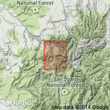
Named from typical exposures of the fossil-bearing strata in valley of Dolores River, at present best known in Rico quadrangle, southwestern CO.
Source: US geologic names lexicon (USGS Bull. 896, p. 619).
- Usage in publication:
-
- Dolores Formation*
- Modifications:
-
- Overview
- AAPG geologic province:
-
- Paradox basin
- San Juan basin
- San Juan Mountains province
Summary:
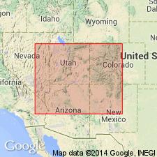
Is a correlative of the Chinle Formation and an Upper Triassic unit-name used only in southwest CO in the Paradox and San Juan basins, and the San Juan Mountain province. Unconformably overlies Permian Cutler Formation and unconformably underlies Jurassic Entrada Sandstone. Block diagram. Nomenclature chart. Divisible into three members in south part of San Juan Mountains. Lower member is a ledge-forming sandstone equivalent to part of Moss Back Member of Chinle. Middle member is composed of slope-forming gray, red micaceous siltstone, sandy siltstone, and very fine grained sandstone beds that vary from ripple to horizontally laminated. Middle member also includes limestone pebble conglomerate lenses, carbonaceous material and bone fragments. Upper member is mostly horizontally stratified brown siltstone and sandstone that form steep slopes. In northern San Juans, Dolores has a basal coarse to very coarse grained sandstone that locally has conglomerate lenses. Conglomerate has granules, pebbles, cobbles of limestone chert, quartz, feldspar, granite, gneiss, schist, slate, greenstone, metavolcanic rocks. The overlying part is brown and red siltstone and sandstone. Measured sections; ranges from 127+ to 857+ ft thick. Fossils: freshwater pelecypods, amphibians, reptiles, plants.
Source: GNU records (USGS DDS-6; Denver GNULEX).
- Usage in publication:
-
- Dolores Formation*
- Modifications:
-
- Overview
- AAPG geologic province:
-
- San Juan basin
- Paradox basin
Summary:
Divided on correlation chart into: 1) a lower member shown as correlative with the Poleo Sandstone Lentil, Sonsela Sandstone Bed, and Moss Back Member of Chinle; 2) a middle member correlative with the lower part of the upper part of the Petrified Forest Member of Chinle; and 3) an upper member correlative with the upper part of the upper part of the Petrified Forest and the overlying Owl Rock Member of the Chinle. Dolores in report area occurs in the Paradox and San Juan basins. Formation assigned to the Late Triassic; it overlies Cutler Formation and underlies Entrada Sandstone.
Source: GNU records (USGS DDS-6; Denver GNULEX).
- Usage in publication:
-
- Dolores Formation
- Modifications:
-
- Overview
- AAPG geologic province:
-
- Paradox basin
- San Juan Mountains province
Summary:
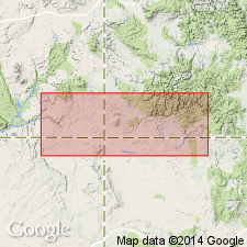
Was deposited in fluvial channel, floodplain, lacustrine, and sand sheet environments on southwest slope of the Uncompahgre highlands in Late Triassic time. Rests disconformably (Durango area) to unconformably (Ouray) on Lower Permian Cutler Formation. Facies relationships between Sawpit (west) and Ouray-Telluride area (east) suggest progressive onlap of younger Dolores beds to northeast onto basal unconformity. Correlated with Moss Back (upper part), Owl Rock, and Church Rock Members of Chinle Formation and with lower part of Wingate Sandstone of southeast UT and northern AZ. Correlated with (correlation chart) Petrified Forest (upper part) and Owl Rock Members of Chinle, and Rock Point and Lukachukai (lower part) Members of Wingate Sandstone of eastern AZ and western NM. Closest outcrop of Lukachukai is near Stoner and in Dry Creek valley 54 km west-northwest of Stoner. Presence of chert and well-rounded quartz grains in Dolores suggests that Dolores may be partly coeval with Lukachukai [see age assignments of Lukachukai]. The fluvial systems flowed southwest from the Uncompahgre in Dolores time. The rivers drained in front of and possibly through an eolian sand sea that was advancing from the northwest. Sand is interbedded with floodplain and lacustrine deposits near Stoner. Report area extends from Montezuma, Dolores, and San Miguel Cos, Paradox basin, into Ouray Co, San Juan Mountain province.
Source: GNU records (USGS DDS-6; Denver GNULEX).
- Usage in publication:
-
- Dolores Formation
- Modifications:
-
- Overview
- AAPG geologic province:
-
- Paradox basin
- San Juan Mountains province
Summary:
Sand sheets of the Dolores, which occurs in southwest CO in the Paradox basin and San Juan Mountain province, are considered to be of eolian origin and coeval with the upper part of the Wingate Sandstone, also of eolian origin. The sheets are thought to occupy the area between the dune field (Wingate) and the fluvial system (Dolores) emanating from adjacent [Uncompahgre] highlands. The sheets range from less than 1 m to more than 10 m thick. Where the outcrop is weathered, wind-ripple laminae are apparent. Mudstone drapes abundant in some horizons. Root structures, paleosol horizons, caliche nodules, and stacked caliche tubes formed around roots characterize the sand sheets. Some horizons have abundant SCOYENIA-like burrows about 1 cm in diameter, produced probably by nonmarine arthropods.
Source: GNU records (USGS DDS-6; Denver GNULEX).
For more information, please contact Nancy Stamm, Geologic Names Committee Secretary.
Asterisk (*) indicates published by U.S. Geological Survey authors.
"No current usage" (†) implies that a name has been abandoned or has fallen into disuse. Former usage and, if known, replacement name given in parentheses ( ).
Slash (/) indicates name conflicts with nomenclatural guidelines (CSN, 1933; ACSN, 1961, 1970; NACSN, 1983, 2005, 2021). May be explained within brackets ([ ]).