

- Usage in publication:
-
- Doerun formation
- Modifications:
-
- Principal reference
- Dominant lithology:
-
- Dolomite
- AAPG geologic province:
-
- Ozark uplift
Summary:
Pg. 15, 47. Doerun formation. Chiefly argillaceous dolomite alternating with finely crystalline dense dolomite and soft porous dolomite. Thickness 50 to 90 feet. Overlies Derby formation and unconformably(?) underlies cherty Potosi formation, which is characterized by coarse drusy cavities. Fossils (brachiopod FINKELNBURGIA OSCEOLA identified by C.D. Walcott). Age is Late Cambrian.
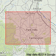
Most typical and best exposure in SE/4 SE/4 sec. 12, T. 36 N., R. 4 E., [just north of Elvins, Bonne Terre 15-min quadrangle], St. Francois Co., eastern MO. Named from Doe Run Lead Company, which owns the land upon which occurs the type section.
Source: Publication; US geologic names lexicon, USGS Bull. 896, p. 617.

- Usage in publication:
-
- Derby-Doe Run Member
- Modifications:
-
- Overview
- AAPG geologic province:
-
- Illinois basin
Summary:
Used as [/]Derby-Doe Run Member of Franconia Formation in IL. Name is hyphenated because the two units were named separately, in MO, but have similar lithology and conformable relationship. In north-central IL, Derby-Doe Run is silty, argillaceous dolomite. Farther south it becomes quite pure, except for a thin zone at the top that is slightly sandy, argillaceous, and glauconitic. Member is about 20 ft thick in the north and thickness to probably more than 500 ft to the southeast. Age is Late Cambrian (Franconian).
[The use of a hyphen between undifferentiated [members] is not considered proper notation (CSN, 1933).]
Source: GNU records (USGS DDS-6; Reston GNULEX).

- Usage in publication:
-
- Doe Run Formation*
- Modifications:
-
- Revised
- AAPG geologic province:
-
- Illinois basin
- Ozark uplift
Summary:
In subsurface of MO and IL, used as Doe Run Formation and included in Derby and Doe Run Formations, undivided. Age is Late Cambrian (Croixan).
Source: GNU records (USGS DDS-6; Reston GNULEX).
- Usage in publication:
-
- Doe Run Formation*
- Modifications:
-
- Areal extent
- AAPG geologic province:
-
- Ozark uplift
Summary:
Cambrian (Croixan) Doe Run Formation occurs on Ozark dome in MO. Correlates with Franconia Formation of Knox Group in IL. Difficult to differentiate between Doe Run and underlying Derby Formation, or overlying Potosi Dolomite or Eminence Formation in subsurface.
Source: GNU records (USGS DDS-6; Reston GNULEX).
For more information, please contact Nancy Stamm, Geologic Names Committee Secretary.
Asterisk (*) indicates published by U.S. Geological Survey authors.
"No current usage" (†) implies that a name has been abandoned or has fallen into disuse. Former usage and, if known, replacement name given in parentheses ( ).
Slash (/) indicates name conflicts with nomenclatural guidelines (CSN, 1933; ACSN, 1961, 1970; NACSN, 1983, 2005, 2021). May be explained within brackets ([ ]).